
Live

 12:28:16
 10.6°C / 51.1°F
 Overcast Clouds
 86%
86% 15 km/h / 9 mph
 07:53
07:53 18:55
18:55Loading forecast…


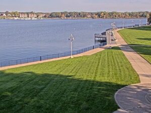
Kollen Park, Lake Macatawa, Holland, Michigan, USA
16.9°C / 62.4°F
12:28
Canada Creek Ranch, Montmorency County, Michigan, USA
11.5°C / 52.7°F
12:28

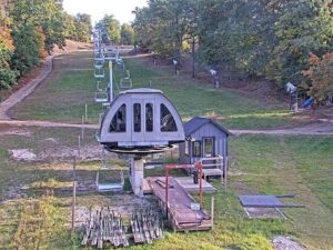
Caberfae Peaks, Caberfae Lane, Cadillac, MI, USA
12.1°C / 53.8°F
12:28




Michigan Technological University, Houghton, Michigan, USA
8.7°C / 47.7°F
12:28The Mackinac Bridge Webcam looks northwest from the Riviera Motel in Mackinaw City, across the Straits of Mackinac to the bridge that joins Michigan’s Lower and Upper Peninsulas. The green approach spans enter from the left edge of the frame and run out to the two cream-colored towers of the main span, with the low shore of the Upper Peninsula on the horizon behind them. A sand and pebble beach fills the foreground, and open water stretches away to the right toward Lake Huron. Boats can cross in front of the towers on calm days, and the early morning sun lights the steel and the beach from the side. In mid-October the beach grass in the foreground turns gold and the shrubs along the shore go deep red.
The bridge opened on November 1, 1957, and carries four lanes of Interstate 75 across the Straits of Mackinac, the channel that connects Lake Michigan with Lake Huron. Its total length is 8,038 meters (26,372 feet), just under 5 miles, and it is the longest suspension bridge between anchorages in the Western Hemisphere. The main span between the two towers measures 1,158 meters (3,800 feet). Both towers rise 168 meters (552 feet) above the water, and ships passing under the center of the main span have 47 meters (155 feet) of clearance.
The camera sees the bridge at an angle from its Mackinaw City end, which is why the near approach spans on the left look so much larger than the distant towers. At the center, the road deck sits about 61 meters (200 feet) above the water. According to the Mackinac Bridge Authority, the deck at center span can move as much as 10.7 meters (35 feet) east or west in severe wind. It does not swing back and forth; it shifts slowly in one direction under the pressure of the wind. The bridge is lit after dark, so its outline can still be picked out across the water at night.
The camera belongs to the Riviera Motel at 520 North Huron Avenue, on the Lake Huron side of the village and a short walk from the Shepler’s Ferry dock and the downtown shops. Mackinaw City had 846 residents at the 2020 census, and the village is split between two counties, Cheboygan and Emmet. It sits 182 meters (597 feet) above sea level at the northern end of the Lower Peninsula, where the bridge begins its crossing to St. Ignace.
Spring comes late to the Straits. April in Mackinaw City averages a high of 13 C (55 F) and a low of -3 C (27 F), so nights still dip below freezing. Summer is mild, with July averaging 27 C (81 F) by day and 11 C (52 F) at night, and long, light evenings on the water. Autumn cools quickly. October averages 14 C (58 F) by day and 0 C (32 F) at night, and the beach plants in the foreground of this camera turn red and gold.
Winter is long and cold, with January averaging a high of -3 C (27 F) and a low of -15 C (5 F). In a hard winter, ice can spread across the Straits, and the view turns into a white plain running out to the bridge piers. Wind is the weather that matters most on the bridge itself. When it blows hard, the Mackinac Bridge Authority escorts high-profile vehicles such as campers, boat trailers and rental trucks across at 32 km/h (20 mph), and in the worst storms it can close the bridge to traffic altogether.
Mackinac Island is the trip most visitors make from here. Shepler’s Ferry and Star Line Ferry both sail to the island from Mackinaw City, and the Shepler’s dock is a few minutes on foot from the motel that hosts this camera. In the village itself are Fort Michilimackinac State Park and Old Mackinac Point Light, a lighthouse that began operating in 1889.
McGulpin Point Light, an older lighthouse near the village, was in service from 1869 to 1906. About 8 kilometers (5 miles) southeast of the village is the site of Dousman’s Mill. Driving north over the bridge takes you to St. Ignace and the Upper Peninsula, and every Labor Day the bridge itself becomes the outing, when thousands of people cross it on foot in the annual Mackinac Bridge Walk.
For more Great Lakes water and another long bridge over a strait, try these cameras.
The camera looks northwest from Mackinaw City across the Straits of Mackinac. The bridge runs in from the left edge of the frame, its green approach spans leading out to the two towers of the main span, and the Upper Peninsula shore lies low on the horizon behind it. A sand and pebble beach and shoreline plants fill the foreground, with open water to the right toward Lake Huron.
The bridge crosses the Straits of Mackinac in northern Michigan, linking Mackinaw City at the top of the Lower Peninsula with St. Ignace on the Upper Peninsula. This camera is in Mackinaw City, on the Lake Huron side of the bridge.
No. The camera faces out over the water toward the bridge, so the downtown shops, the marina and the Mackinac Island ferry docks are behind it and out of frame. Mackinac Island is not in the shot either.
The bridge is 8,038 meters (26,372 feet) long in total, just under 5 miles. Its main span measures 1,158 meters (3,800 feet), the towers stand 168 meters (552 feet) above the water, and the center of the main span leaves 47 meters (155 feet) of clearance for passing ships.
Not reliably. The camera shows the conditions over the Straits, from whitecaps to winter ice, but the bridge is too far away to judge traffic on the deck. Wind escorts and closures are announced by the Mackinac Bridge Authority, which escorts high-profile vehicles across at 32 km/h (20 mph) when the wind is strong.
Mackinaw City has mild summers and long, cold winters. July averages 27 C (81 F) by day and 11 C (52 F) at night, while January averages -3 C (27 F) by day and -15 C (5 F) at night. April and October are cool, with average highs of 13 C (55 F) and 14 C (58 F).
The Mackinac Bridge Walk is held every year on Labor Day, the first Monday in September, when thousands of people cross the bridge on foot. The bridge stays in the camera’s view all day, but from this distance individual walkers are too small to make out.
Source: Riviera Motel of Mackinaw City
The best new live webcams and site features, once a week.
By subscribing you agree to receive our weekly email. Unsubscribe any time.
 16°C / 60.8°F