
Live
Mackinac Bridge Webcam, Michigan
Mackinac Bridge, Mackinac Bridge, Mackinaw City, MI, USA
 21.8°C / 71.2°F
 18:38
18:38 18:38:43
 21.3°C / 70.3°F
 Overcast Clouds
 43%
43% 19 km/h / 12 mph
 07:37
07:37 18:56
18:56Loading forecast…
Mackinac Bridge, Mackinac Bridge, Mackinaw City, MI, USA
21.8°C / 71.2°F
18:38
Kollen Park, Kollen Park Drive, Holland, Michigan, USA
25.5°C / 77.9°F
18:38


Michigan Technological University, Houghton, Michigan, USA
29.4°C / 84.9°F
18:38



Canada Creek Ranch, Montmorency County, Michigan, USA
26°C / 78.8°F
18:38
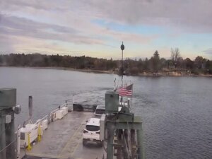
Ironton Ferry, Ferry Road, Charlevoix, MI, USA
26.8°C / 80.2°F
18:38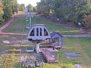
Caberfae Peaks, Caberfae Lane, Cadillac, MI, USA
25.1°C / 77.2°F
18:38
The St. Clair Webcam watches the St. Clair River from the roof of the Voyageur Restaurant on the riverfront in St. Clair, Michigan, where Great Lakes freighters pass between Lake Huron and Lake St. Clair. BoatNerd, a nonprofit that follows Great Lakes shipping, runs the camera with help from the restaurant and the City of St. Clair. The camera does not sit still. It scans the river for the next big boat, so one minute it looks straight across to the wooded Ontario shore and the next it turns downstream, where a high-voltage line crosses the water on tall lattice towers and power station smokestacks rise on the Michigan bank. The edge of the flat roof, sometimes with a globe lamp on a post, often sits in the foreground.
St. Clair is a city of 5,464 people (2020 census) in St. Clair County, set on the Michigan bank of the river at an elevation of 178 meters (584 feet). The river is the international border here, and the shore across the water belongs to St. Clair Township in Ontario, Canada. Its story starts with Fort Sinclair, built by the British officer Patrick Sinclair in 1764 and used for about twenty years as a trading post and sawmill center. Settlers arrived in 1818, Thomas Palmer platted the town under the name Palmer in 1828, and it became a village in 1850 and a city in 1858. Salt followed in 1887, when the Diamond Crystal Salt Company began tapping the deposits under the town, and the salt works still run under new ownership.
The Voyageur is a waterfront fine dining restaurant with a sports bar and a bowling alley on the street side of the building. Its patio looks out on the river and on pleasure boats turning into the Pine River for the municipal marina, and its rooftop camera, in the restaurant’s own words, scans the river looking for the next big boat. BoatNerd, a 501(c)(3) nonprofit, streams the feed on YouTube.
The St. Clair River runs 65.2 kilometers (40.5 miles) from Lake Huron to Lake St. Clair, dropping only about 1.5 meters (5 feet) on the way. The tall towers in the downstream view appear to carry the power links between the two countries: a 345 kV line and a 230 kV line run from ITC’s St. Clair substation, beside the St. Clair Power Plant in East China Township, to the Lambton Transformer Station at Courtright, Ontario. DTE’s plant, about 6 kilometers (4 miles) south of the camera, opened in August 1953 and was retired in May 2022.
Daily averages for 2015 to 2024 from the Open-Meteo archive show four clearly separate seasons. January highs hover around 0 C (32 F) with lows near minus 7 C (20 F), and February is barely warmer. April highs average 13 C (55 F) with nights around 3 C (37 F). July is the warmest month, with highs of about 27 C (81 F) and lows near 18 C (64 F), and August runs only a degree behind.
Autumn cools quickly, from September highs of 23 C (74 F) to 16 C (61 F) in October and 9 C (47 F) in November. Precipitation is spread through the year, about 950 millimeters (37 inches) in total, with June and August the wettest months at roughly 100 millimeters (4 inches) each. On the camera, a warm afternoon can fade the far end of the river into gray haze, and in early October the trees on the Ontario shore were already turning yellow and red.
The riverfront boardwalk in Palmer Park is billed by the local visitors bureau as the longest freshwater boardwalk in the world. Along it runs the Freighter Walk, about 320 meters (a fifth of a mile) of brass markers for 22 Great Lakes ships, each giving the vessel’s name, length and year built. It starts below the Waving Lady statue and heads south past markers such as the 222-meter (729-foot) Edmund Fitzgerald, lost in a storm in November 1975. The last marker, 309 meters (1,013 feet) from the start, belongs to the Paul R. Tregurtha, the longest Great Lakes vessel ever built. Looking back from it shows just how long the ships on the camera are.
The St. Clair Historical Museum covers the town’s past, and the St. Clair Art Association runs the Alice W. Moore Center for the Arts. The historic St. Clair Inn looks over the river, boaters tie up at the St. Clair Boat Harbor and Rivers Bend Marina, and Greig Park, home of the Imagination Station, has a nature trail. Golfers have Pine Shores Golf Course, Rattle Run Golf Club and Michigan Meadows Golf Course nearby. Farther downriver, the river ends in the St. Clair Flats, the largest delta in the Great Lakes system at about 360 square kilometers (140 square miles).
Three more Michigan cams for following Great Lakes freighters:
On the roof of the Voyageur Restaurant on South Riverside Avenue in St. Clair, St. Clair County, Michigan. The town lies on the St. Clair River about 70 kilometers (44 miles) northeast of downtown Detroit in a straight line, and the Blue Water Bridge is about 20 kilometers (13 miles) upriver.
The St. Clair River and the shore beyond it. The rooftop camera moves between views as it looks for ships: straight across to a low line of trees and houses in Ontario, downstream to the power line towers and smokestacks south of town, and toward a shoreline of houses and private docks. Freighters are the main event, with small boats in between.
Cold winters and warm summers: January highs average about 0 C (32 F) and July highs about 27 C (81 F), with around 950 millimeters (37 inches) of precipitation a year.
Yes. The river is the border between Michigan and Ontario, so the far bank in the views that look straight across is St. Clair Township, Ontario.
BoatNerd publishes a ship passage schedule for St. Clair and a real-time traffic map on its AIS site, both linked from the stream’s YouTube description. Open the camera a few minutes before a listed passage to catch the ship going by.
A line of 22 brass markers on the Palmer Park boardwalk, each set at a ship’s length from a start plate below the Waving Lady statue, ending with the 309-meter (1,013-foot) Paul R. Tregurtha.
It runs 65.2 kilometers (40.5 miles) from the foot of Lake Huron to Lake St. Clair, where it spreads into the St. Clair Flats delta. Its average flow is about 5,200 cubic meters (182,000 cubic feet) per second.
Source: BoatNerd
The best new live webcams and site features, once a week.
By subscribing you agree to receive our weekly email. Unsubscribe any time.
 16.2°C / 61.2°F