Live
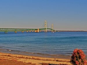
Mackinac Bridge, Mackinaw City, Michigan
Mackinaw City, Straits of Mackinac, Michigan, USA
 11.7°C / 53.1°F
 09:05
09:05 09:05:14
 4.6°C / 40.3°F
 Clear Sky
 74%
74% 19 km/h / 12 mph
 07:53
07:53 18:47
18:47Loading forecast…
Mackinaw City, Straits of Mackinac, Michigan, USA
11.7°C / 53.1°F
09:05



Michigan Technological University, Houghton, Michigan, USA
 9.4°C / 48.9°F
09:05
9.4°C / 48.9°F
09:05

Kollen Park, Lake Macatawa, Holland, Michigan, USA
5.1°C / 41.2°F
09:05

Canada Creek Ranch, Montmorency County, Michigan, USA
5.4°C / 41.7°F
09:05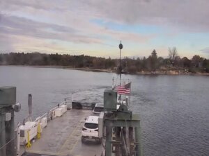
Ironton Ferry, Ferry Road, Charlevoix, MI, USA
9.7°C / 49.5°F
09:05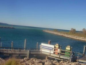
The Saginaw River Webcam looks out from Smith Park in Essexville, Michigan, across one of the last stretches of the Saginaw River before it reaches Saginaw Bay and Lake Huron. The park’s paved riverside overlook fills the foreground, with a railing along the water and a small dock reaching out from the bank. A rock revetment and a low wall carrying the Essexville name sit on the right, and the far shore is a band of trees with houses and lights between them. This is part of the shipping channel that lake freighters follow to docks upriver, so a long hull can slide across the frame at any hour. Between ships the water belongs to fishing boats, summer pleasure craft and, in the coldest weeks, ice. The stream carries a small town label in one top corner and a temperature reading in the other.
The Saginaw River is only 36 kilometers (22.4 miles) long. It begins in the city of Saginaw, where the Tittabawassee and Shiawassee rivers meet, and runs north past Zilwaukee, Bay City and Essexville before entering Saginaw Bay at the line between Bangor and Hampton townships. It is one of the few inland rivers in Michigan that large ships can navigate, and it still carries about 4.6 million tons of commerce a year. Long before the freighters, Indigenous peoples travelled it for millennia, and fur traders followed.
Essexville is a small city of 3,379 people (2020 census) on the east bank, covering just 3.63 square kilometers (1.40 square miles) at an elevation of 178 meters (584 feet). It became a village in 1883 and a city in 1934, and it calls itself the Gateway to the Saginaw Bay. Smith Park, formally Earl C. Smith Park, sits off the end of Burns Street right on the river. The City of Essexville manages the camera, which was set up as a Saginaw Bay Watershed Council project so people could follow passing freighters and river conditions without driving down to the bank.
The river made Bay City, the larger neighbor just upstream, which was incorporated in 1865 and grew quickly on lumbering, milling and shipbuilding in the 19th century. Industry still lines the water today. Closer to the mouth, Consumers Energy runs the Dan E. Karn plant, a multi-fuel power station beside the site of the J.C. Weadock plant, which closed in 2016. The complex’s seawall and freighter dock were rebuilt in 2009. Also near the mouth stands the Saginaw River Rear Range Light, built in 1876 to guide ships into the channel and listed on the National Register of Historic Places in 1984.
Essexville has a humid continental climate with a wide swing between seasons. Averaged over 2011 to 2025, January highs sit near minus 1 C (30 F) and lows near minus 8 C (18 F), and February is barely warmer. Roughly 86 centimeters (34 inches) of snow falls in a typical year, most of it from December to February. In winter the overlook can sit under fresh snow, the far bank turns grey and white, and ice can spread across the water, which is when ship traffic on the river thins out.
Spring arrives slowly because the bay stays cold, with April highs around 12 C (53 F) and May reaching 19 C (67 F). Summer is warm and often humid: July highs average about 27 C (81 F) with nights near 18 C (65 F), and August is only a degree or so cooler. September is still mild at around 22 C (72 F), and by October highs fall to about 16 C (60 F) as the trees on the far shore change color. Snow usually returns in November, with highs back down near 8 C (46 F).
Bay City’s riverfront is the obvious next stop. Four bridges carry traffic over the river there: the Lafayette Avenue Bridge (1938), the Veterans Memorial Bridge (1957), the Independence Bridge (1976) and the Liberty Bridge (1990). Wenonah Park and Veterans Memorial Park sit on the water, and the Saginaw Valley Naval Ship Museum and Appledore Tall Ships both tie the city to its shipping past. For local history, the Bay County Historical Museum tells the county’s story, and the State Theatre is the city’s landmark stage downtown. Studio 23/The Arts Center adds exhibitions and classes.
The Delta College Planetarium and Learning Center is in Bay City too, and the Bay City State Recreation Area sits on the shore of Saginaw Bay for a day outdoors by the water. The city’s calendar includes the Bay City Fireworks Festival, River Roar and St. Stan’s Polish Festival, along with the River of Time living history reenactment. Back in Essexville, Smith Park itself is a good place to wait for a freighter, with a clear view of the channel from the same overlook the camera uses.
More Michigan cams where ships and big water are the main event.
The camera is at Smith Park in Essexville, Bay County, Michigan, on the east bank of the Saginaw River. Bay City lies just upstream, and the river meets Saginaw Bay on Lake Huron a short distance downstream.
The Smith Park overlook and its small dock in the foreground, the river channel across the middle of the frame and a tree-lined far bank. Lake freighters, fishing boats and pleasure craft pass through, and the stream shows a small temperature reading in the corner.
Winters are cold and snowy, with January highs near minus 1 C (30 F) and about 86 centimeters (34 inches) of snow a year. Summers are warm, with July highs around 27 C (81 F).
Yes. The river is one of the few inland navigable rivers in Michigan and carries about 4.6 million tons of commerce a year, so lake freighters regularly move through the channel past Essexville on their way to and from docks upriver.
The City of Essexville manages the camera. It was set up as a Saginaw Bay Watershed Council project to let people watch river traffic and conditions at the mouth of the river.
It is 36 kilometers (22.4 miles) long, running from the meeting of the Tittabawassee and Shiawassee rivers in Saginaw to Saginaw Bay.
Bay City has four: the Lafayette Avenue Bridge, opened in 1938, the Veterans Memorial Bridge from 1957, the Independence Bridge from 1976 and the Liberty Bridge from 1990.
The best new live webcams and site features, once a week.
By subscribing you agree to receive our weekly email. Unsubscribe any time.