English
 简体中文
 Deutsch
 Français
 Español
 Nederlands
 Svenska
 Italiano
 日本語
 Polski
 Português
 Русский
 Ελληνικά
 العربية
 Türkçe

Live
 15:34:01
 7.3°C / 45.1°F
 Overcast Clouds
 68%
 16 km/h / 10 mph
 06:43
 16:10
Loading forecast…
The Stratton Maine Webcam looks across Main Street, the Route 27 stretch through the village of Stratton, from Flagstaff General Store. A painted crosswalk runs through the foreground, School Street branches off beyond it, and a two-story clapboard house with a pale green metal roof stands on the far corner, with a small white cottage further up the street and evergreens behind the rooftops. Local channel EustisME runs it as a road-conditions camera, so it is a quick way to see whether Route 27 is bare, wet or snow-covered before driving up from Sugarloaf or down from the Canadian border. Five more EustisME cameras sit in the tabs.
Stratton is the main village of Eustis, a Franklin County town of 641 people at the 2020 census, spread over 107 square kilometers (41.5 square miles) of western Maine forest, lake and mountain. Charles L. Eustis of Lewiston bought the northern half of the township around 1831 and built a sawmill and gristmill, and the town that carries his name was incorporated on February 18, 1871, with 342 residents. Earlier still, on October 19, 1775, Benedict Arnold’s troops passed through on their way up the North Branch of the Dead River toward the Battle of Quebec.
Flagstaff General Store, at 108 Main Street, hosts the two village cameras; it serves breakfast, lunch and dinner and sells fuel around the clock. Routes 27 and 16 arrive in Stratton together from Carrabassett Valley. Route 16 then forks west toward Rangeley, while Route 27 heads north through Eustis to the Coburn Gore border crossing and continues into Quebec as Route 161.
The western end of Flagstaff Lake reaches the edge of the village. The Long Falls Dam on the Dead River enlarged a smaller natural lake into a reservoir of about 82 square kilometers (20,300 acres) in 1950, submerging the townships of Flagstaff, Bigelow, Dead River and Carrying Place. The lake is no deeper than 15 meters (48 feet). The Bigelow Range overlooks its southern shore, topped by West Peak at 1,263 meters (4,145 feet) and named for Major Timothy Bigelow, one of Arnold’s officers, who climbed it in October 1775 “for the purpose of observation.”
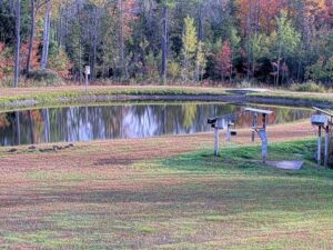
The Tagging Station tab looks over the gravel yard behind the store: picnic tables, two tall posts hung with antlers and a wall of birch and spruce, with two pickups parked in front of the lens when we looked. Hunters register moose, deer and bear here between 7 a.m. and 7 p.m. during the seasons, so EustisME puts a viewer discretion warning on the feed. The same yard is the village trailhead for snowmobiles and ATVs.
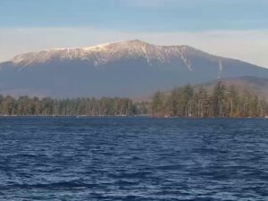
The Flagstaff Lake camera faces northeast from Flagstaff Landing in Eustis, across open water to a low wooded shore, with a mountain flank at the right edge. In mid-November its floating dock sat on bare shore well above the waterline. The Eustis Ridge camera at Caldwell Farm faces mainly south over conifer forest to the Bigelow Range, and EustisME says Sugarloaf shows in the background on the right. Two wildlife cameras come from private land in Eustis: the Deer Cam watches a clearing ringed by evergreens where whitetail deer and moose feed in winter, and the Porch Cam looks over a seed tray and tube feeder, where a blue jay was working the tray during our check.
Winter is long. January averages a high of -6°C (22°F) and a low of -17°C (2°F) at the NOAA station in Eustis, 384 meters (1,260 feet) above sea level, and the record low there is -38°C (-36°F). About 301 centimeters (118.5 inches) of snow falls in an average year, so the Main Street view can show snow-packed pavement and plowed banks for weeks at a time. November averages a high of 4°C (39°F) and a low of -5°C (23°F); on our mid-November look the hardwoods were bare, the road was wet and light snow was drifting past the Deer Cam.
Spring arrives late, with April highs of only 8°C (47°F). Summer is short and mild: July averages a high of 24°C (76°F) and a low of 11°C (53°F), the season for boats on Flagstaff Lake. September highs drop back to 19°C (67°F), and the year brings about 1,060 millimeters (41.7 inches) of precipitation.
The Bigelow Preserve, created by a statewide vote in 1976 to stop a planned ski resort, covers the range across the lake. The Appalachian Trail traverses it, Avery Peak at 1,246 meters (4,088 feet) joins West Peak as a four-thousand footer, and the Maine Appalachian Trail Club keeps seasonal caretakers at the Horns Pond and Bigelow Col campsites. Quill Hill, off Route 16 toward Rangeley, is the easy summit: a 6.4-kilometer (4-mile) dirt road climbs to 868 meters (2,848 feet) and a 360-degree view.
Flagstaff Lake has a public motorboat ramp and a separate canoe and kayak launch, and Eustis Kayak Rentals rents kayaks, canoes and paddleboards. Cathedral Pines Campground has a public beach, and a primitive beach off Route 27 in Eustis allows free carry-in, carry-out camping. Grand Falls on the Dead River, north of Eustis, is a snowmobile ride on ITS trails 86 and 89 in winter. In the village, the Dead River Area Historical Society opens weekends from 11 a.m. to 3 p.m. in July and August.
More cameras from the lakes and mountains of Maine:
In the town of Eustis, Franklin County, western Maine. In a straight line it lies about 25 kilometers (16 miles) northeast of Rangeley and 39 kilometers (24 miles) southeast of the Coburn Gore border crossing into Quebec.
Main Street (Route 27) and the School Street corner, seen from Flagstaff General Store. The tabs add the tagging station, Flagstaff Lake, the Bigelow Range from Eustis Ridge, a deer clearing and a porch feeder.
Cold and snowy in winter, with January lows around -17°C (2°F), and mild in summer, with July highs around 24°C (76°F).
Yes. EustisME runs the Main Street camera as a guide to road conditions through the village.
The Maine game tagging station behind Flagstaff General Store, where hunters register moose, deer and bear. Harvested animals can appear on screen during the seasons.
On private property in Eustis. The host keeps the location undisclosed, and the land is posted against trespassing.
Sugarloaf’s summit is about 16 kilometers (10 miles) southeast of Stratton in a straight line, along Route 27 through Carrabassett Valley.
Source: EustisME
The best new live webcams and site features, once a week.
By subscribing you agree to receive our weekly email. Unsubscribe any time.
 15.4°C / 59.7°F



 16.5°C / 61.7°F