
 English
 简体中文
 Deutsch
 Français
 Español
 Nederlands
 Svenska
 Italiano
 日本語
 Polski
 Português
 Русский
 Ελληνικά
 العربية
 Türkçe

Live
 12:41:47
 12.3°C / 54.1°F
 Overcast Clouds
 86%
 23 km/h / 14 mph
 07:09
 16:51
Loading forecast…
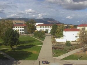
EOU Quad, La Grande, Union County, Oregon, USA
16.2°C / 61.2°F
12:41

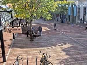
Church Street Marketplace, Burlington, Vermont, USA
2.8°C / 37°F
15:41


Continuum College, Brooklyn Avenue Northeast, Seattle, WA, USA
 12.5°C / 54.5°F
12:41

Eagle County Regional Airport, Gypsum, Colorado, USA
15.8°C / 60.4°F
13:41

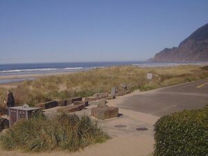
The Yachats Webcam looks southwest across the Pacific from Overleaf Lodge & Spa, on the bluffs at the north end of Yachats on the central Oregon coast. The camera is mounted just above the lodge’s soaking tubs, and its frame runs from a strip of coastal grass in the foreground to dark rock ledges, the white water breaking over them, and a long reach of open ocean out to the horizon. Sky fills the upper half, which makes it a good camera for watching weather roll in off the Pacific. In a winter swell the waves stack up offshore and burst across the ledges in sheets of foam, while the tide changes how much of the rock shows. The lodge streams the view around the clock, winter sunsets included.
Yachats is a small city of 994 people (2020 census) in Lincoln County, built where the Yachats River meets the sea at about 58 meters (190 feet) above sea level. US Route 101 runs straight through it, 13 kilometers (8 miles) south of Waldport and 37 kilometers (23 miles) south of Newport. The town incorporated in 1967. Oregon Geographic Names traces the name to a Siletz word meaning “at the foot of the mountain,” while the linguist William Bright linked it to an Alsea place name.
Overleaf Lodge & Spa sits right on the shoreline path. The Roslund family, who bought the town’s Fireside Motel in 1981, built the lodge and opened it in 1997. The name is a happy accident: Jerry Roslund mistook “overleaf,” a catalogue’s note to turn the page, for the name of an architectural style he liked.
The path outside the rooms is the 804 Trail, which follows the line of old County Road 804. Carriages and buggies used that road until US 101 was built in the 1930s, and today it is a footpath that forms part of the Oregon Coast Trail. Smelt Sands State Recreation Site, on the same trail at the north edge of town, is where large runs of smelt once came ashore every year.
Yachats has mild, very wet winters and cool, dry summers. NOAA’s 1991 to 2020 normals for Yachats give winter highs of 11°C to 12°C (52°F to 54°F) and lows of 5°C to 6°C (41°F to 42°F), with December the wettest month at 335 millimeters (13.2 inches) of rain. About 1,990 millimeters (78 inches) falls in a typical year, the heaviest of it from November to January, when Pacific fronts push rain bands and heavy swell toward the shore. That is when the Yachats Webcam shows the coast at its roughest, with gray curtains of rain over the water and surf running high over the ledges. Snow is rare, averaging just 2.3 centimeters (0.9 inches) a year, and the lodge notes that the temperature seldom drops below 0°C (32°F) or climbs above 32°C (90°F).
Spring warms slowly, with highs of 14°C to 15°C (57°F to 59°F) in April and May. July and August are the driest months, at only 23 millimeters (0.9 inches) each, with highs around 18°C (64°F) and lows near 11°C (52°F). The lodge warns that fog and low cloud are common on summer mornings and evenings, so the horizon can disappear even in August. September stays dry and mild at about 18°C (64°F), and October brings the rain back with 158 millimeters (6.2 inches). In winter the sun sets toward the southwest, into the camera’s line of sight.
Walk north from the lodge on the 804 Trail and the path follows the rocky shore, where the lodge says you can hear sea lions barking, before it reaches the sand of Tillicum Beach farther on. Across the street from Overleaf, the Ya’xaik Trail and Gerdemann Preserve loop covers 3.4 kilometers (2.1 miles) through coastal forest and the Gerdemann Botanical Preserve. In town, the cross-shaped Little Log Church, built in 1926, is now a city-owned museum of local artifacts. Yachats State Recreation Area, at the river mouth, has a viewing deck and tide pools.
Cape Perpetua rises 245 meters (803 feet) about 3.2 kilometers (2 miles) south of town. Captain James Cook named it on March 7, 1778, St. Perpetua’s Day, and the Cape Perpetua Scenic Area now protects about 1,100 hectares (2,700 acres) of old-growth spruce, Douglas fir and western hemlock, with a Forest Service visitor center built in the 1960s. The paved Captain Cook Trail is a 1.6 kilometer (1 mile) loop past an old Civilian Conservation Corps camp and Native American shell middens down to the tide pools, and at high tide Spouting Horn and Thor’s Well can be watched from Cook’s Chasm. Devil’s Churn, nearby, is a sea cave whose roof collapsed, leaving a narrow inlet in the basalt that can throw spray high into the air as the tide comes in. The West Shelter, built by the Civilian Conservation Corps in 1933, is a favorite lookout for migrating gray whales.
More coastline and Oregon views to watch next:
Yachats is on the central Oregon coast in Lincoln County, on US Route 101 at the mouth of the Yachats River. It is 13 kilometers (8 miles) south of Waldport, 37 kilometers (23 miles) south of Newport and 37 kilometers (23 miles) north of Florence. The camera is at Overleaf Lodge & Spa on the bluffs at the north end of town.
The camera faces southwest over a grassy bank, a band of dark rock ledges and the surf breaking across them, with the open Pacific stretching to the horizon. Big swells, passing rain squalls, fog banks and winter sunsets are the things to watch for.
Mild and wet, with winter highs around 11°C to 12°C (52°F to 54°F), summer highs around 18°C (64°F) and about 1,990 millimeters (78 inches) of rain a year.
The heaviest rain falls from November to January. December is the wettest month at 335 millimeters (13.2 inches), while July and August get only 23 millimeters (0.9 inches) each.
Rarely. The town averages about 2.3 centimeters (0.9 inches) of snow a year.
About 3.2 kilometers (2 miles) south along US Route 101, a short drive to Devil’s Churn, Thor’s Well and the visitor center.
A shoreline footpath on the line of old County Road 804, now part of the Oregon Coast Trail. It runs right past Overleaf Lodge and Smelt Sands State Recreation Site.
Yes. A Coastal Safety Marker was put up at Smelt Sands in January 2013 to warn about sneaker waves, after two high school students from Eugene drowned there in February 2011. Stay well back from the low ledges when the surf is up.
Source: Overleaf Lodge & Spa
The best new live webcams and site features, once a week.
By subscribing you agree to receive our weekly email. Unsubscribe any time.
 -2.3°C / 27.9°F
 18.1°C / 64.6°F