Live

 14:22:54
 18.6°C / 65.5°F
 Broken Clouds
 47%
47% 20 km/h / 12 mph
 07:21
07:21 18:17
18:17Loading forecast…
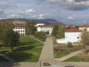
EOU Quad, La Grande, Union County, Oregon, USA
22.2°C / 72°F
14:22
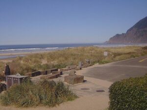

Chinook Winds Casino Resort, Northwest 44th Street, Lincoln City, OR, USA
 16.3°C / 61.3°F
14:22
16.3°C / 61.3°F
14:22


Montana Whitewater - Yellowstone, Gardiner, MT, USA
17°C / 62.6°F
15:22

Attitash Mountain Village, Bartlett, NH, USA
5.6°C / 42.1°F
17:22

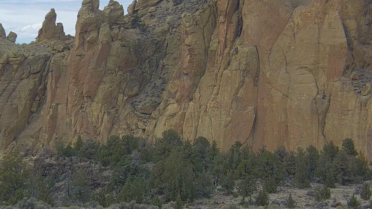
The Smith Rock Webcam is a robotic camera run by Smith Rock Climbing Guides that tours Smith Rock State Park in central Oregon, just outside Terrebonne. It never holds one view for long. Over a few minutes it pans from a wide shot of the ridge and valley floor to close-ups of single walls, where the orange and tan volcanic rock fills the screen and the juniper below shrinks to a dark green band. Between the zooms it swings past the park road and the main parking area, which on a fall Saturday is lined end to end with cars, vans and campers. Midday light flattens the cliffs to a pale tan, and the operator’s own archive of saved frames leans heavily on sunsets over the spires.
Smith Rock State Park covers 641 acres (259 hectares) of Oregon’s high desert, east of the Cascades. The Crooked River has cut a deep bend around the foot of cliffs that stand about 180 meters (600 feet) high. The river runs at roughly 790 meters (2,600 feet), and the ridge above it reaches about 975 meters (3,200 feet). Most of the rock is welded tuff, ash left by a caldera collapse around 30 million years ago, with basalt flows about half a million years old laid over parts of it. The State of Oregon acquired the land between 1960 and 1975.
Climbers know the park as the birthplace of American sport climbing. In 1983 Alan Watts began putting up routes here with sport climbing ethics, relying on fixed bolts rather than gear the climber places and removes, and the first route in the United States graded 5.14 is at Smith Rock. More than 1,800 routes had been recorded by 2010. The best known formation is Monkey Face, a spire 107 meters (350 feet) tall whose top, seen from the south, looks like a monkey’s face, complete with mouth, nose and eyes.
On the Smith Rock Webcam, named walls come and go as the tour moves along the ridge. The operator’s saved captures carry names such as Asterisk Pass, the Christian Brothers, Misery Ridge, Red Wall, the Monument and the Dihedrals, and on clear days the zoom has picked out Mount Washington and South Sister on the Cascade skyline. Deer, geese, slackliners and a climber at night also turn up in that archive. A date and time stamp sits in the top right corner of the stream, with the guide service’s logo in the top left.
The park sits in the dry high desert east of the Cascades, and NOAA’s 1991 to 2020 normals for nearby Redmond show how little falls here: about 215 millimeters (8.5 inches) of precipitation and 38 centimeters (15 inches) of snow in an average year. July averages highs of 31 C (88 F) and lows of 9 C (49 F), so by early afternoon the walls sit under hard, flat light. January highs average 7 C (44 F) with lows near -4 C (25 F), and a winter storm can leave snow on the ledges and ice on the trails.
Spring and fall bring the mild days that draw the biggest crowds. April averages highs of 16 C (60 F) and October 18 C (65 F), but nights in both months drop to around freezing, and the operator warns that conditions change quickly in both seasons. Spring break, Memorial Day and Labor Day are the busiest times, when parking in the lots the camera passes over becomes the main problem. In mid-October the broadleaf trees on the valley floor turn yellow against the gray-green juniper and sage below the cliffs.
The Misery Ridge Trail is the park’s classic climb, gaining about 300 meters (1,000 feet) in under 1.6 kilometers (1 mile). The River Trail follows the Crooked River at the base of the walls, while the Summit Trail, Wolf Tree Trail and Canyon Trail reach farther into the park. A close look at Monkey Face takes a hike of about 3 or 6.4 kilometers (2 or 4 miles). For a view without the walk, the operator suggests leaving the park, turning right on NE Wilcox for about 1 kilometer (0.6 miles), then right on NE 9th Street, where the spire stands about 800 meters (half a mile) away and looks best in afternoon or evening light.
Smith Rock Climbing Guides works from the park itself and runs climbing outings every day for all ages and levels by reservation, plus guided hikes and interpretive walks. Dogs are allowed on a leash. The three main parking areas sit within a 1.6 kilometer (1 mile) stretch of NE Crooked River Drive. Wildlife recorded in the park includes prairie falcons, golden eagles, canyon wrens, white-throated swifts, river otters, beavers and mule deer.
More of Oregon’s volcanic country, and another famous climbing skyline farther east:
Smith Rock State Park is in central Oregon’s high desert, east of the Cascades, just outside the town of Terrebonne in Deschutes County. Terrebonne lies north of Redmond, and the park road is NE Crooked River Drive.
The robotic camera cycles between wide shots of the ridge and valley, the park road and main parking area, and zoomed views of single cliffs and spires such as Misery Ridge, Asterisk Pass, Red Wall and the Christian Brothers.
Dry for most of the year, with big swings between day and night. NOAA normals for nearby Redmond give July highs of 31 C (88 F) and January highs of 7 C (44 F), with about 215 millimeters (8.5 inches) of precipitation a year.
Alan Watts began developing routes here in 1983 with sport climbing ethics and fixed bolts, and the first route in the United States graded 5.14 is at Smith Rock. Just Do It, graded 5.14c, is one of its famous testpieces.
Monkey Face is about 107 meters (350 feet) tall. You can see it from NE 9th Street outside the park, or hike 3 to 6.4 kilometers (2 to 4 miles) for a closer look.
Yes. It is a day-use park open from dawn to dusk all year. The park road has no gate, but rangers often ticket vehicles parked after dark.
Not for personal hiking or climbing. Commercial activities and special events, such as weddings or professional photo shoots, generally need one. Parking passes are sold at pay machines in the lots.
The best new live webcams and site features, once a week.
By subscribing you agree to receive our weekly email. Unsubscribe any time.
 15.3°C / 59.5°F
 8.4°C / 47.1°F
 18.7°C / 65.7°F