Live

 16:50:08
 23.6°C / 74.5°F
 Broken Clouds
 30%
30% 6 km/h / 4 mph
 07:25
07:25 18:26
18:26Loading forecast…
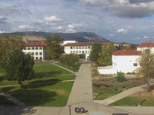
EOU Quad, La Grande, Union County, Oregon, USA
18.2°C / 64.8°F
16:50
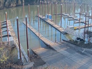
Boones Ferry Marina, Boones Ferry Crossing Northeast, Aurora, OR, USA
 18.3°C / 64.9°F
16:50
18.3°C / 64.9°F
16:50

Montana Whitewater - Yellowstone, Gardiner, MT, USA
17.2°C / 63°F
17:50
Port Everglades, Eller Drive, Fort Lauderdale, FL, USA
 24.6°C / 76.3°F
19:50
24.6°C / 76.3°F
19:50

Ninepipes Lodge, Mission Valley, Montana, USA
19.9°C / 67.8°F
17:50

Planes on the ground and in the air within about 22 km (14 miles) of the airport, updated every 10 seconds. Tap a plane or a flight in the list for its details. Altitudes are above sea level. Positions come from volunteer ADS-B receivers, so some airports show few or no planes on the ground.
The Ashland Municipal Airport Webcam looks out across the asphalt apron at Sumner Parker Field, the single runway general aviation airport on the east side of Ashland, Oregon. Light aircraft sit tied down toward the edges of the frame, grass and a treeline run along the far side of the pavement, and the ridgelines above the Rogue Valley close off the horizon. Most of what happens here is small and unhurried: a single engine airplane taxiing out, somebody pulling a cover off a wing, a helicopter lifting from the ramp. The camera is set low and wide, so the weather moving over the valley takes up as much of the picture as the aircraft do.
The airport is owned by the City of Ashland and carries the FAA identifier S03, under the full name Ashland Municipal Airport, Sumner Parker Field. The field lies at an elevation of 576 meters (1,889 feet), a little below the town it serves, at the southern end of the Rogue Valley in Jackson County. There is one runway, designated 12/30, measuring 1,098 meters (3,603 feet) long and 23 meters (75 feet) wide with an asphalt surface. That is short by airline standards and entirely comfortable for the aircraft that actually work here.
This is a general aviation field with no scheduled airline service. In the year ending 11 May 2021 it recorded 26,050 aircraft operations and had 62 aircraft based on the field, made up of 52 single engine airplanes, 5 helicopters, 1 multi engine airplane, 1 jet and 1 glider. That mix is roughly what passes through the frame over a day, with privately owned light airplanes and training flights accounting for almost all of the movement. Traffic is busiest in the dry months and thins out through the winter.
The setting is what gives the field its character. Ashland itself sits at 594 meters (1,949 feet), and the airport is lower and east of the town on the valley floor. Mount Ashland rises to 2,296 meters (7,533 feet) to the southwest, and the Siskiyou Pass carries Interstate 5 south over that range toward the California state line about 26 kilometers (16 miles) away. The high ground visible beyond the apron on the Ashland Municipal Airport Webcam is the northern edge of the same system, which is why the horizon here is a wall of hills rather than open sky.
The Rogue Valley has a warm summer Mediterranean climate, so the flying year divides cleanly in two. July and August average highs of 31.2 C (88 F) with lows near 10.3 C (50.6 F), and summer days are dry, bright and frequently cloudless, which is why the apron can look bleached through the middle of the afternoon. Heat combined with field elevation thins the air and stretches takeoff runs, and on a hot day that is a genuine planning item on a runway of this length.
January averages 9.4 C (49 F) by day and minus 1.3 C (29.6 F) at night. Snow on the valley floor is unusual, averaging only about 36 millimeters (1.4 inches) across a year, so the apron rarely goes white even though the hills on the horizon hold snow for months. Roughly 510 millimeters (20 inches) of precipitation falls annually, almost all of it in the colder half of the year. Low cloud and valley fog are the conditions most likely to leave the Ashland Municipal Airport Webcam looking at a flat grey wall with the ridgelines gone entirely.
Ashland itself is the reason to land here, a few minutes west of the field. The Oregon Shakespeare Festival, founded in 1935 by Angus Bowmer, runs a repertory season in theaters beside the downtown Plaza and brings most of the town’s visitors. Lithia Park runs south from that same Plaza along Ashland Creek and covers 93 acres (38 hectares), with two duck ponds, a bandshell, tennis courts, a Japanese garden and unpaved trails climbing into the Siskiyou foothills at its upper end. The park was listed on the National Register of Historic Places on 22 November 1982.
Southern Oregon University occupies the south side of Ashland. For higher ground, Mount Ashland at 2,296 meters (7,533 feet) is the peak on the southwest skyline and carries the area’s winter snow. Crater Lake National Park is the long day trip northeast of the valley, and Medford, 19 kilometers (12 miles) northwest, is the largest city in the Rogue Valley. Flying in puts a pilot within a short drive of all of it, which is a large part of why a town of 21,360 people supports a field with this much traffic.
Three more airfield and Oregon cameras in the same spirit:
On the east side of Ashland, Oregon, in Jackson County at the southern end of the Rogue Valley. The field sits at 576 meters (1,889 feet), and Medford lies about 19 kilometers (12 miles) northwest. The California state line is roughly 26 kilometers (16 miles) south over the Siskiyou Pass.
The camera covers the paved apron at Sumner Parker Field, with light aircraft parked toward the edges of the shot, grass and a treeline along the far side, and the ridgelines above the Rogue Valley on the horizon. Movement is mostly single engine airplanes taxiing and the occasional helicopter off the ramp.
The FAA identifier is S03. The airport’s full name is Ashland Municipal Airport, Sumner Parker Field, and it is owned by the City of Ashland.
The single runway is designated 12/30 and measures 1,098 meters (3,603 feet) long by 23 meters (75 feet) wide, with an asphalt surface.
No. S03 is a general aviation field with no scheduled airline service. It handles private, training and helicopter traffic, and commercial passengers in this part of southern Oregon use larger airports elsewhere in the region.
Sixty two, in the year ending 11 May 2021: 52 single engine airplanes, 5 helicopters, 1 multi engine airplane, 1 jet and 1 glider. The same period recorded 26,050 aircraft operations.
Warm summer Mediterranean, so summers are hot and dry and winters are cool and wet. July and August average 31.2 C (88 F) by day, January averages 9.4 C (49 F) and minus 1.3 C (29.6 F) at night, and about 510 millimeters (20 inches) of precipitation falls a year, mostly in winter. Fog and low cloud are the main visibility problem in the cold months.
Source: Ashland Fiber Network
The best new live webcams and site features, once a week.
By subscribing you agree to receive our weekly email. Unsubscribe any time.
 16.2°C / 61.2°F
 10.1°C / 50.2°F