Replay
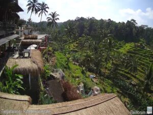
Tegallalang Rice Fields, Bali, Indonesia
Rice field, Jalan Pakudui, Kedisan, Tegallalang, Gianyar Regency, Bali, Indonesia
 22.8°C / 73°F
 08:01
 07:01:21
 23°C / 73.4°F
 Few Clouds
 94%
 7 km/h / 4 mph
 05:41
 17:21
Loading forecast…
Rice field, Jalan Pakudui, Kedisan, Tegallalang, Gianyar Regency, Bali, Indonesia
22.8°C / 73°F
08:01
Carlton Tel Aviv Hotel, Eliezer Peri Street, Tel Aviv-Yafo, Israel
 23.1°C / 73.6°F
03:01

Cih-hu Memorial Statue Park, Section 1, Fuxing Rd, Daxi District, Taoyuan City, Taiwan
 22.7°C / 72.9°F
08:01
Peace Memorial Park, Nakajimachō, Naka Ward, Hiroshima, Japan
15.8°C / 60.4°F
09:01

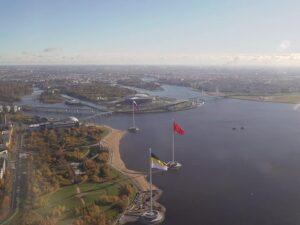
Lakhta Center, Lakhta, Saint Petersburg, Russia
9°C / 48.2°F
03:01


The Da Nang Webcam brings together five street cameras in Hai Chau, the central ward of Da Nang on the coast of central Vietnam. The main view looks along Quang Trung Street outside the gate of Nguyen Hue Secondary School, where scooters, cars and cyclists pass a no-stopping sign and a row of parked cars under shade trees. The tabs above the player add the busy junction at the west end of the Dragon Bridge, seen from high above with the Han River beyond it, two views in the city’s hospital quarter, and a street camera that can pan and zoom. All five come from the local channel Phat Trien Da Nang and run around the clock, each with a date and time stamp in local time.
Da Nang sits on the coast of central Vietnam, 764 kilometers (475 miles) south of Hanoi, with the Han River cutting through the middle of the city. On 1 July 2025 it absorbed the neighboring province of Quang Nam, which stretched it to 11,859 square kilometers (4,579 square miles) and about 3.86 million people, and brought Hoi An’s old town inside the city limits.
Three of the cameras sit within a couple of blocks of each other in Thach Thang, about 900 meters (0.6 miles) west of the river. Nguyen Hue Secondary School is at 134 Quang Trung Street. Da Nang Hospital, the city’s largest, founded before 1945 as the Hopital de Danang, stands about 200 meters (660 feet) away, close to Hospital C on Hai Phong Street. One tab watches a back gate of Hospital C. Another, labeled by the operator as its view of the Da Nang Hospital building works, looks down over a tall modern block with planted terraces and hills on the horizon. The pan-and-zoom camera is mounted at a performance costume shop, and at the time of writing it faced a crowded entrance with a barrier gate.
The Dragon Bridge tab is the one most visitors will recognize. The bridge is 666 meters (2,185 feet) long and 37.5 meters (123 feet) wide, carries six lanes over the Han River and opened on 29 March 2013. The camera looks down on its western approach, with lanes of cars and motorbikes feeding the junction, gardens to the right and the river at the top of the frame. The yellow building in a walled garden at the bottom right is the Museum of Cham Sculpture, founded in 1915 as the Musee Henri Parmentier.
Da Nang has a dry season from January to August and a wet, typhoon-prone season from September to December. January is the coolest month, with average highs of 25 C (77 F) and lows of 19 C (67 F). Spring warms quickly, reaching 31 C (88 F) by April, and February is the driest month with just 24 millimeters (0.9 inches) of rain. June is the hottest, averaging 34.5 C (94 F) by day and 26 C (79 F) at night, and May brings the most sunshine.
October is the wettest month, averaging 628 millimeters (24.7 inches) over about 20 days of rain, with highs near 29.5 C (85 F), and November adds another 448 millimeters (17.6 inches). Most of the city’s 2,205 millimeters (86.8 inches) of annual rain falls in these last four months of the year, and December has the least sunshine. Expect wet asphalt, puddles and grey skies on the feeds in this season, and a hazier view of the river from the Dragon Bridge camera.
The Museum of Cham Sculpture, in view of the Dragon Bridge camera, holds Cham sculptures gathered from Da Nang, Quang Nam and elsewhere; its first building opened in 1919, designed by French architects who worked Cham details into it. The Dragon Bridge is shaped like a dragon and breathes fire and water on Saturday and Sunday nights at 9 pm. About 1.2 kilometers (0.7 miles) north, the Han River Bridge is the only swing bridge operating in Vietnam, turning on its axis late at night to let ships pass. Cross the Dragon Bridge and keep heading east to reach My Khe Beach.
The Marble Mountains rise roughly 8 kilometers (5 miles) south of the Dragon Bridge: five marble and limestone hills named after the five elements, full of caves and Buddhist sanctuaries, with a path to the top of Mount Thuy. Son Tra Mountain, also called Monkey Mountain, has been a nature reserve since 1992 and is home to the endangered red-shanked douc langur. In the hills to the west, the Golden Bridge at Ba Na Hills is a 150-meter (490-foot) footbridge held up by two giant hands. Hoi An Old Town, a UNESCO World Heritage Site since 1999, keeps 1,068 preserved houses and the Japanese Bridge.
For more city streets in Southeast and East Asia, try these cameras.
The cameras are in Hai Chau, the central ward of Da Nang in central Vietnam. The main camera is at Nguyen Hue Secondary School on Quang Trung Street, near Da Nang Hospital and Hospital C. The Dragon Bridge camera is about 1.8 kilometers (1.1 miles) to the southeast, at the bridge’s western end.
The main view shows traffic on Quang Trung Street outside a school gate. The tabs show the Dragon Bridge junction from above with the Han River, a back gate of Hospital C, a high view over the Da Nang Hospital buildings, and a pan-and-zoom street camera whose view changes.
No. All five cameras are on the west side of the Han River and none faces the sea. My Khe Beach is east of the river, beyond the far end of the Dragon Bridge.
No. Da Nang International Airport is about 4 kilometers (2.5 miles) southwest of the main camera, and none of the views takes in the runway or terminals.
No. The Golden Bridge is at Ba Na Hills, about 25 kilometers (16 miles) west of these cameras. The bridge on this page is the Dragon Bridge over the Han River.
Warm all year. The dry season runs from January to August, with highs from 25 C (77 F) in January to 34.5 C (94 F) in June. The wet and typhoon season from September to December brings most of the annual rain.
October is the wettest month, averaging 628 millimeters (24.7 inches) of rain over about 20 days, with highs around 29.5 C (85 F) and lows around 23.5 C (74 F).
Source: Phat Trien Da Nang
The best new live webcams and site features, once a week.
By subscribing you agree to receive our weekly email. Unsubscribe any time.
 10.4°C / 50.7°F