
 English
 简体中文
 Deutsch
 Français
 Español
 Nederlands
 Svenska
 Italiano
 日本語
 Polski
 Português
 Русский
 Ελληνικά
 العربية
 Türkçe
Live
 13:19:29
 11.2°C / 52.2°F
 Clear Sky
 51%
 22 km/h / 14 mph
 06:47
 16:23
Loading forecast…
Brice Prairie, Lake Onalaska, Wisconsin, USA
9.2°C / 48.6°F
13:19
Summerfest Grounds, Milwaukee, Wisconsin, USA
10.3°C / 50.5°F
13:19

Mitchell Airport, Milwaukee, Wisconsin, USA
 9.7°C / 49.5°F
13:19


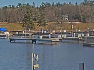
Madeline Island Yacht Club Inc., Fort Road, La Pointe, WI, USA
10.9°C / 51.6°F
13:19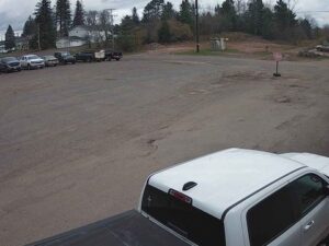

Grant County Clerk of Court, West Maple Street, Lancaster, WI, USA
 8.8°C / 47.8°F
13:19

The Manitowoc Webcam looks out from a dock at Manitowoc Marina, on the Lake Michigan shore of eastern Wisconsin, across the sheltered harbor basin toward downtown Manitowoc. Wooden posts with rope lines strung between them stand in the foreground, and rows of floating docks reach into the water from the right. On the left, tall concrete industrial buildings, a domed roof and a church spire rise beyond a long harbor wall. In the boating season the slips hold cruisers, sailboats and charter boats. By mid-November the docks lie almost empty, the boats lifted out for winter storage. On a clear autumn morning the low sun lays a gold reflection along the edge of the nearest dock.
Manitowoc Marina sits at 425 Maritime Drive on the north side of the harbor, close to where the Manitowoc River enters Lake Michigan and a short walk from downtown. It has about 250 slips, with roughly four dozen set aside for visiting boats, along with a fuel dock, a launch ramp, a ship’s store, kayak and bike rentals, and winter, summer and dry storage. The business behind it, Manitowoc Marina, also sells and services boats and runs yacht sales offices in Chicago, Waukegan, Sandusky and Traverse City. It streams this camera on its own YouTube channel, and the current broadcast began at the end of May 2025, after the marina built the new dock the camera is mounted on.
The view runs across the open water of the marina basin. A long concrete wall crosses the middle distance on the left, with the downtown skyline behind it: big concrete industrial buildings, a domed roof, a church spire and a tall rectangular block. Farther right the shore is lower, with brick buildings, houses, bare trees and a strip of lawn, and a few sailboat masts poke up at the right edge. The stream carries a temperature reading in the top right corner and a hiring notice from the marina in the top left.
Manitowoc is the seat of Manitowoc County and had 34,626 residents at the 2020 census. Shipbuilding here goes back to the 1840s, and during World War II the city’s yards built 28 submarines for the US Navy. The harbor’s north breakwater grew from a 244-meter (800-foot) lakeward section finished in 1895, and the Manitowoc Breakwater Lighthouse, a 15-meter (50-foot) tower from 1918 that still has its original fifth-order Fresnel lens, stands at its end. Boats head out to the open lake through a gap of only about 120 meters (400 feet) between the two converging breakwaters.
Manitowoc has cold winters and mild summers, with Lake Michigan right on its doorstep. Under NOAA’s 1991 to 2020 normals, July averages highs of 25°C (77°F) and lows of 16°C (60°F). Those are the weeks when the docks on camera are usually at their fullest. Spring comes late: April highs average just 10°C (50°F) and May 16°C (62°F). Autumn holds on a little longer, with October still averaging highs of 13°C (56°F).
November highs average 6°C (43°F), with lows just under freezing at -1°C (30°F), and by then most of the slips are bare. January is the coldest month, with average highs of -3°C (27°F) and lows of -10°C (13°F). In the coldest weeks ice can form on the sheltered basin, and snow can settle on the docks and along the harbor wall. The local records run from 41°C (105°F) in July down to -34°C (-29°F) in February.
The Wisconsin Maritime Museum stands at 75 Maritime Drive on the bank of the Manitowoc River, about 700 meters (0.4 miles) from the marina. It began in 1970 as the Manitowoc Submarine Memorial Association, now has more than 5,500 square meters (60,000 square feet) of exhibits and is a Smithsonian affiliate. Moored at the museum is USS Cobia, a Gato-class submarine built in 1943, with 45-minute guided tours through the day. From the marina parking lot, a walk of about 15 minutes leads out along the north breakwater to the lighthouse. The paved Mariners Trail follows the lakeshore for 8.9 kilometers (5.5 miles) north to Two Rivers.
Downtown, the Rahr-West Art Museum fills a 19th-century mansion that the Rahr family donated in 1941, with art from the 15th to the 21st centuries. It also shows a cast of the 9.1-kilogram (20-pound) piece of Sputnik 4 that fell onto North 8th Street on September 5, 1962, an event the city has marked with Sputnikfest since 2008. The Lincoln Park Zoo, run by the city’s parks department, is open all year. From mid-May to early October the SS Badger, the nation’s last coal-fired steamship, carries cars and passengers across Lake Michigan to Ludington, Michigan, a crossing of about 97 kilometers (60 miles) that takes around four hours.
More harbors along the Wisconsin shore, from Milwaukee up to Door County:
The camera is at Manitowoc Marina, 425 Maritime Drive, on the north side of Manitowoc harbor on the Lake Michigan shore of Wisconsin. Manitowoc is the seat of Manitowoc County, about 55 kilometers (34 miles) southeast of Green Bay and about 120 kilometers (74 miles) north of Milwaukee in a straight line.
The marina basin fills most of the frame, with posts and rope lines in the foreground and rows of floating docks on the right. Across the water on the left is the downtown skyline, with tall industrial buildings, a dome and a church spire, while the right side shows the lower shore with houses, trees and lawn. The docks are busiest in summer and mostly empty from late autumn.
Summers are mild, with July highs around 25°C (77°F), and winters are cold, with January lows around -10°C (13°F). Spring warms slowly, with April highs of only 10°C (50°F), while October still averages highs of 13°C (56°F).
Outside the boating season most boats are lifted out of the water and stored ashore, a service the marina offers. In November the slips stand bare, and they fill again once the boats go back in the water in spring.
The ferry did not appear in the frames checked for this page, which look across the marina basin toward downtown. The SS Badger sails between Manitowoc and Ludington, Michigan, from mid-May to early October only, so there are no crossings in winter.
About 250, with roughly four dozen kept for transient boats, plus a fuel dock and a launch ramp.
Park at the marina lot and walk out along the north breakwater, about 15 minutes on foot. The 1918 tower is 15 meters (50 feet) tall and still has its original fifth-order Fresnel lens.
Source: Manitowoc Marina
The best new live webcams and site features, once a week.
By subscribing you agree to receive our weekly email. Unsubscribe any time.