
 English
 简体中文
 Deutsch
 Français
 Español
 Nederlands
 Svenska
 Italiano
 日本語
 Polski
 Português
 Русский
 Ελληνικά
 العربية
 Türkçe

Live
 11:01:51
 16.3°C / 61.3°F
 Clear Sky
 79%
 2 km/h / 1 mph
 06:44
 16:57
Loading forecast…

Old Towne Orange, Orange County, California, USA
17.4°C / 63.3°F
11:01
Oceanside, San Diego County, California, USA
 17.9°C / 64.2°F
11:01




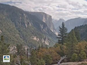
Yosemite Valley, Sierra Nevada, California, USA
1.1°C / 34°F
11:01


Sacramento NWR, Glenn County, California, USA
 13.7°C / 56.7°F
11:01

Goldmine Mountain, Big Bear Lake, California, USA
6.4°C / 43.5°F
11:01The Morgan Hill Webcam looks west across Morgan Hill, a city of about 45,000 people in the southern Santa Clara Valley of California, from a grassy hillside on the valley’s eastern edge. Houses and trees cover the valley floor below the lens, open fields run off toward the south, and El Toro, the steep hill on the city’s seal, rises on the far side of town. Behind it stand the Santa Cruz Mountains, whose highest summit is Loma Prieta. The camera is a pan-tilt-zoom unit that moves between several preset views, from a wide sweep over the whole valley to closer shots of the hills. It is at its best on a showery day, when clouds stack up against the ridgeline and sunlight breaks through in patches over the town.
Morgan Hill lies about 39 kilometers (24 miles) south of downtown San Jose, in the southern part of the Santa Clara Valley between the Santa Cruz Mountains to the west and the Diablo Range to the east. The valley floor sits at roughly 107 meters (350 feet) above sea level. The town grew up around a Southern Pacific railroad stop that passengers called Morgan Hill’s Ranch, after Hiram Morgan Hill and his wife, Diana Murphy, whose ranch it was. The name was later shortened, and the Town of Morgan Hill was incorporated on November 10, 1906. The 2020 census counted 45,483 residents.
The peak at the center of the main view is El Toro, Spanish for “the bull”. It rises to 435 meters (1,427 feet) on the west side of town, appears on the city’s seal and logo, and is known to some locals as Murphy’s Peak. A local legend credits the writer Bret Harte with the name, after he saw two bulls fighting near the summit and was chased back down. Farther back, the Santa Cruz Mountains climb to Loma Prieta at 1,154 meters (3,786 feet), the highest point in the range. PTZtv, which runs the camera, says its views reach beyond Hollister to the south and, on a clear day, to Cupertino in the north.
Winters here are mild and wet. Long-term records put the average January high at about 16°C (61°F), and midwinter nights average close to freezing, around 1°C (34°F), so frost can whiten the fields below the camera on clear mornings. Roughly 550 millimeters (22 inches) of rain falls in an average year, most of it between November and March, with December and January the wettest months. Winter storms can hide Loma Prieta and the upper ridges completely. The rain turns the hillside in front of the lens green by late winter, and spring stays mild, with April highs around 21°C (69°F).
Summer is hot and almost rainless. July highs average 30°C to 32°C (86°F to 90°F), and from June to September the valley usually gets less than 5 millimeters (0.2 inches) of rain a month. By then the grass on the camera’s hillside has dried to gold, and the hills across the valley turn the same tawny color. Autumn stays warm into October, when highs still average about 25°C (77°F), and the rainy season picks up again in November, bringing the green back to the slopes.
The hills on both sides of the valley are the main draw. Behind the camera, in the Diablo Range, lies Henry W. Coe State Park, one of the largest state parks in California. Closer to town, Anderson Lake County Park spreads over 1,730 hectares (4,275 acres) along Coyote Creek. Its reservoir was drained in 2020 for an earthquake retrofit of Anderson Dam, so the water is closed, but the visitor center and the Coyote Creek Parkway trail have stayed open. Across the valley, Uvas Canyon County Park sits in the Santa Cruz Mountains, the range the camera faces.
In town, Villa Mira Monte, an estate from 1884, houses the Morgan Hill Museum and Historical Society. Malaguerra Winery, built in 1869, is listed on the National Register of Historic Places, and Morgan Hill lies within the Santa Clara Valley AVA, the wine appellation of the valley.
More California cameras, from the Bay Area to the Sierra Nevada:
Morgan Hill is in Santa Clara County, California, in the southern Santa Clara Valley. It lies about 39 kilometers (24 miles) south of downtown San Jose, between the Santa Cruz Mountains to the west and the Diablo Range to the east.
The camera looks west over Morgan Hill from a hillside on the east side of the valley. Its main view takes in the town’s rooftops and trees, the fields of the valley floor, El Toro just beyond town and the Santa Cruz Mountains behind it, with Loma Prieta the highest point. It is a pan-tilt-zoom camera, so it also turns to other views of the valley and the nearby hills during the day.
Winters are mild and wet, with January highs around 16°C (61°F) and nights near freezing. Summers are hot and dry, with July highs of 30°C to 32°C (86°F to 90°F) and almost no rain from June to September. About 550 millimeters (22 inches) of rain falls in a year, mostly from November to March.
El Toro rises to 435 meters (1,427 feet) above sea level, roughly 330 meters (1,080 feet) above the valley floor. It is the steep hill on the west side of town that appears on the city’s seal, and it sits in the camera’s main view in front of the Santa Cruz Mountains.
Not to the summit on a public trail. Part of the hill is public land, but the routes to the top cross private property, and public hikes to the summit have not been allowed since 2011. A public trail has been studied and discussed for years, so check with the City of Morgan Hill for any change before you go.
No. It is a scenic camera on a hillside, not a traffic camera. Its views are wide panoramas of the valley, where cars are far too small to follow, so it cannot be used to check on an accident. Caltrans QuickMap carries the state’s highway cameras and incident reports.
Not at present. Anderson Reservoir, the largest in Santa Clara County, was drained in 2020 so that Anderson Dam could be rebuilt for earthquake safety, and the water has been closed to boating, fishing and other recreation since then. Local reporting has put the closure at least through 2030. Parts of Anderson Lake County Park, including the visitor center and the Coyote Creek Parkway, have stayed open during the work.
Source: PTZtv
The best new live webcams and site features, once a week.
By subscribing you agree to receive our weekly email. Unsubscribe any time.
 21.1°C / 70°F
 12.3°C / 54.1°F
 -1.3°C / 29.7°F