Live
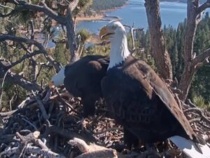
Big Bear Eagle Nest Cam, California
Big Bear Valley Recreation and Park District, Park Avenue, Big Bear Lake, CA, USA
 6.7°C / 44.1°F
 05:23
05:23 05:23:46
 9.7°C / 49.5°F
 Overcast Clouds
 67%
67% 9 km/h / 6 mph
 07:18
07:18 18:19
18:19Loading forecast…
Big Bear Valley Recreation and Park District, Park Avenue, Big Bear Lake, CA, USA
6.7°C / 44.1°F
05:23

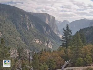
Yosemite Valley, Sierra Nevada, California, USA
 -0.9°C / 30.4°F
05:23
-0.9°C / 30.4°F
05:23

Goldmine Mountain, Big Bear Lake, California, USA
6.7°C / 44.1°F
05:23
Aquarium of the Pacific, Aquarium Way, Long Beach, CA, USA
19.2°C / 66.6°F
05:23



Knott's Berry Farm, Beach Boulevard, Buena Park, CA, USA
18.7°C / 65.7°F
05:23
Monterey Bay Aquarium, Cannery Row, Monterey, CA, USA
11.9°C / 53.4°F
05:23
Mori Point, Bradford Way, Pacifica, California, USA
12.4°C / 54.3°F
05:23

Catalina Island, Los Angeles County, California, USA
17.5°C / 63.5°F
05:23Planes on the ground and in the air within about 22 km (14 miles) of the airport, updated every 10 seconds. Tap a plane or a flight in the list for its details. Altitudes are above sea level. Positions come from volunteer ADS-B receivers, so some airports show few or no planes on the ground.
The Auburn Municipal Airport Webcam looks across the parking ramp at KAUN, a single runway general aviation field in the Sierra Nevada foothills of Placer County, California. Light aircraft sit tied down in the foreground, a long row of hangars closes off the far side of the apron, and oak covered hills rise behind the field. The camera is mounted at the hangar of EAA Chapter 526, the local Experimental Aircraft Association chapter, and it carries the airport’s common traffic advisory frequency as its audio. That makes it one of the few airfield cameras where the radio is part of the view, so an arriving aircraft is often audible before it appears on screen. A current METAR weather line is printed over the picture and refreshes about every five minutes.
The field is owned and run by the City of Auburn and sits about 5 kilometers (3 miles) north of the town center. Its elevation is 468 meters (1,536 feet) above sea level, roughly 94 meters (309 feet) higher than downtown Auburn, which stands at 374 meters (1,227 feet). One paved runway serves the airport, designated 7/25, running 1,128 meters (3,700 feet) long and 23 meters (75 feet) wide. A 2009 count of the parking recorded 81 hangars, 112 permanent tie-downs and 18 transient tie-downs, and it is that tie-down area the camera points at.
There is no control tower here. Pilots coordinate themselves on the common traffic advisory frequency, 122.7 MHz, calling their positions as they join and fly the traffic pattern at 762 meters (2,500 feet) above sea level. An automated weather station broadcasts on 119.375 MHz. Beyond private flying and flight training, the airport supports air ambulance work and law enforcement aviation, including the Placer County Sheriff’s Office and the California Highway Patrol Valley Division Air Operations. Businesses based on the field include TGH Aviation, Mach 5 Aviation and the Sunshine Flyers Flight School.
This part of the foothills has a hot summer Mediterranean climate, which means hot dry summers and cool moist winters. July is the warmest month, averaging a high near 33.7 C (92.7 F), and summer rain is rare, so the apron stays dry for weeks at a time and the grass on the hills behind the field dries off to brown. Conditions in that season are typically settled, and what changes most through the day is the angle of the light rather than the cloud.
Winter reverses it. December averages a high of 13.2 C (55.8 F) and a low of 2.9 C (37.2 F), and most of the year’s 917 millimeters (36.12 inches) of precipitation falls in the cooler months. Wet systems can push low cloud across the foothills and leave standing water on the apron, and the hills turn green again behind the hangars. Spring and autumn sit between the two, with long dry spells on either side of the wet season.
Old Town Auburn, down the hill from the airport in the center of the city, still holds its gold rush era buildings. Gold was found nearby by Claude Chana in May 1848, and miners from Auburn in New York gave the settlement its name in August 1849. By 1850 around 1,500 people were living there, and in 1851 it became the seat of Placer County, which it remains. The Placer County Courthouse and the Auburn Firehouse are the landmarks most people come to photograph, while the Gold Country Museum and the Bernhard Museum Complex cover the mining era and local domestic history.
The other draw is the canyon. Auburn sits on the edge of the Auburn State Recreation Area, where the North Fork and the Middle Fork of the American River meet roughly 240 meters (800 feet) below the town. The recreation area follows both river canyons and is the local ground for hiking, swimming and whitewater boating. It is close enough that a short drive from the airport gets you from the tie-down rows to the rim of the American River canyon.
Other airfield and Sierra Nevada cameras worth a look:
It is in Auburn, the seat of Placer County in northern California, about 5 kilometers (3 miles) north of the town center and in the western foothills of the Sierra Nevada. Auburn had a population of 13,776 at the 2020 census, and Sacramento is the nearest large city.
California. This camera is at KAUN in Placer County, California, and has nothing to do with the city of Auburn in Alabama or with its university airfield. The two places share a name and nothing else.
Parked light aircraft on the ramp, the hangar line across the far side of the apron and the wooded foothills behind the field. Aircraft taxi past through the day, and a METAR weather line and a timestamp are printed over the picture.
Yes. The stream carries the airport’s common traffic advisory frequency, 122.7 MHz, as its audio. Auburn has no control tower, so pilots announce their own positions on that frequency, and those calls are what comes through the feed.
Hot and dry in summer, cool and wet in winter. July highs average about 33.7 C (92.7 F), December runs from about 2.9 C (37.2 F) to 13.2 C (55.8 F), and the year brings around 917 millimeters (36.12 inches) of precipitation, almost none of it in high summer.
The single runway, 7/25, is 1,128 meters (3,700 feet) long and 23 meters (75 feet) wide, at a field elevation of 468 meters (1,536 feet).
The City of Auburn owns and operates it. The camera itself is set up at the hangar of EAA Chapter 526, and businesses on the field include TGH Aviation, Mach 5 Aviation and Sunshine Flyers Flight School.
Source: Andy SixPilot
The best new live webcams and site features, once a week.
By subscribing you agree to receive our weekly email. Unsubscribe any time.