
Live
Kappa Bridge, Kamikochi, Japan
Kappa Bridge, Kamikochi, Kamikochi Azumi, Matsumoto, Nagano, Japan
 11.4°C / 52.5°F
 11:32
11:32 11:32:52
 24.8°C / 76.6°FClear Sky
 54%
54% 15 km/h / 9 mph
 05:42
05:42 17:13
17:13Loading forecast…
Kappa Bridge, Kamikochi, Kamikochi Azumi, Matsumoto, Nagano, Japan
11.4°C / 52.5°F
11:32




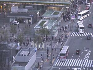
Hakata Station, 中央街-1 博多駅 Hakata Ward, Fukuoka, Japan
 21.1°C / 70°F
11:32
21.1°C / 70°F
11:32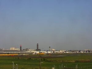
Narita International Airport (NRT), 1-1 Furugome, Narita, Chiba, Japan
24°C / 75.2°F
11:32
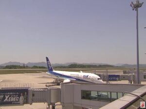
Hiroshima Airport (HIJ) (HIJ), 64-31 本郷町善入寺 Mihara, Hiroshima, Japan
 19°C / 66.2°F
11:32
19°C / 66.2°F
11:32
The Odaiba Webcam looks across the water at Odaiba Beach on Tokyo Bay, where a strip of sand and a belt of trees sit in front of the DECKS Tokyo Beach and Aqua City Odaiba shopping centers. Above them rises the Fuji TV headquarters, a grid of a building with a large sphere held high between its two towers, and through the gaps in its frame you can pick out harbor cranes in the distance. A second tab switches to the Rainbow Bridge, showing its two white towers and the double-deck approach curving toward the camera. The light over the bay shifts from hour to hour, and after dark the waterfront turns into a field of lit windows. Both operators stream around the clock and add a lo-fi music soundtrack, so what you hear is not the beach itself.
Odaiba began as a set of island forts. In 1853, the year Commodore Matthew Perry’s Black Ships arrived, Egawa Hidetatsu started building gun batteries in the bay for the Tokugawa shogunate to protect Edo from attack by sea. Eleven were planned and six were completed. All but two, Nos. 3 and 6, were later removed to clear the shipping lanes or absorbed into the port, and No. 3 became the Metropolitan Daiba Park in 1928. The waterfront in the frame stands on landfill No. 13, finished in 1979 and now shared between Minato, Shinagawa and Koto wards.
In the 1990s the city planned a Tokyo Teleport Town here for more than 100,000 residents. Governor Yukio Aoshima halted the scheme in 1995, after more than 1 trillion yen had been spent. The building that dominates the camera’s view is the Fuji TV headquarters, designed by Kenzo Tange, and its sphere holds an observation deck open to visitors.
Odaiba Beach, inside Odaiba Seaside Park, is an artificial beach about 800 meters (2,625 feet) long and one of only two beaches in urban Tokyo. Swimming and fishing are banned because the water does not meet the national standard for bathing, so the sand is for walking and sitting, with windsurfing and stand-up paddleboarding out on the water. The Rainbow Bridge on the second tab links the Shibaura Pier area to Odaiba. It is a double-deck suspension bridge 798 meters (2,618 feet) long, with a main span of 570 meters (1,870 feet) and towers 126 meters (413 feet) tall, and it opened on August 26, 1993.
Odaiba has the same climate as central Tokyo. January is the coldest month, with average highs around 10 C (50 F) and a daily mean near 5.6 C (42 F). Spring warms quickly, and April highs average about 19 C (67 F). August is the hottest month, with highs near 31 C (88 F) and a mean of about 26.7 C (80 F). Autumn cools again, and October highs average about 22 C (72 F).
On the camera, the seasons show up in the light, the color of the water and the number of people on the sand, which can be thin on a winter morning and much busier on a warm weekend. After dark, the lamps along the Rainbow Bridge’s suspension cables glow red, white and green on the second tab, powered by solar energy collected during the day.
Start on the beach promenade, which runs in front of DECKS Tokyo Beach and Aqua City Odaiba, both in the frame. Daiba Park, built on the surviving No. 3 battery, sits on the same shore. The observation deck in the Fuji TV sphere is open to visitors, and Tokyo Big Sight, Japan’s largest exhibition and convention center, is a few stops away on the Yurikamome. At DiverCity Tokyo Plaza, the large Gundam statue that stood outside until August 2026 is gone, but the Gundam Base Tokyo model shop remains inside.
The Rainbow Bridge can be crossed on foot. Walkways run along both outer sides of the lower deck: the north side looks over the inner harbor toward Tokyo Tower, and the south side looks out over Tokyo Bay and, on clear days, Mount Fuji. Cyclists have to push their bikes. For the trip back, Tokyo Water Bus boats run from Odaiba Seaside Park to Hinode Pier in about 20 minutes, and the Yurikamome links Daiba Station with Shimbashi in about 15 minutes, crossing the bridge on the way.
Three more cameras in and around Tokyo:
The main camera looks across the water at Odaiba Beach, with DECKS Tokyo Beach and Aqua City Odaiba behind the sand and the Fuji TV headquarters above them. The Rainbow Bridge tab shows the bridge’s two towers and its curving double-deck approach, with high-rises across the water.
Odaiba is an artificial island in Tokyo Bay, and the beach is in Minato ward. From Shimbashi Station, the Yurikamome takes about 15 minutes to Daiba Station. The Rinkai Line reaches Tokyo Teleport Station in about 25 minutes from Shinjuku or Shibuya.
No. The main camera faces the beach and the Fuji TV building, and the Rainbow Bridge tab frames the bridge and the towers behind it. For Tokyo Tower, walk the north side of the Rainbow Bridge. For Mount Fuji on a clear day, take the south side.
No. Swimming and fishing are prohibited because the water quality does not meet Japan’s bathing standard. Windsurfing and stand-up paddleboarding are allowed, and windsurfing needs advance registration.
January highs average about 10 C (50 F), April about 19 C (67 F), August about 31 C (88 F) and October about 22 C (72 F). The live picture is the quickest way to check the sky over the bay right now.
Yes. Pedestrian walkways run on both outer sides of the lower deck, with views of the inner harbor to the north and Tokyo Bay to the south. Opening hours are shorter in winter than in summer, and bicycles must be pushed.
It is 798 meters (2,618 feet) long, with a main span of 570 meters (1,870 feet), and the roadway sits 52 meters (171 feet) above the water. Construction ran from 1987 to 1993, and the English name was chosen by public vote.
Yes. Lamps on the suspension cables light up every night in red, white and green, using solar energy collected during the day, and the Rainbow Bridge tab can show them after dark.
Source: Tokyo Views LIVE and ODAIBA TOKYO LIVE
The best new live webcams and site features, once a week.
By subscribing you agree to receive our weekly email. Unsubscribe any time.