Live

 20:10:06
 8.8°C / 47.8°F
 Broken Clouds
 53%
 2 km/h / 1 mph
 06:00
 16:36
Loading forecast…

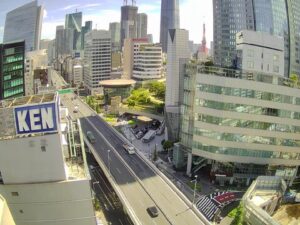
Hiroshima Airport (HIJ) (HIJ), 64-31 本郷町善入寺 Mihara, Hiroshima, Japan
18°C / 64.4°F
20:10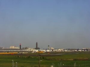
Narita International Airport (NRT), 1-1 Furugome, Narita, Chiba, Japan
 17.9°C / 64.2°F
20:10



Kappa Bridge, Kamikochi, Kamikochi Azumi, Matsumoto, Nagano, Japan
5.6°C / 42.1°F
20:10
Kusasenri Observatory, 1662-9 Nagakusa, Aso, Kumamoto, Japan
 14.2°C / 57.6°F
20:10

Awaji Monkey Center, 289 畑田組 Sumoto, Hyogo, Japan
 19.2°C / 66.6°F
20:10
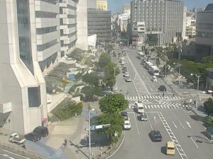
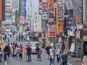
The Sapporo Webcam looks down on a street crossing at the western end of Tanukikoji, the old shopping street in the center of Sapporo, the capital of Hokkaido. A wide road cuts across the frame under a web of overhead wires, with traffic lights, crosswalks and a row of street trees, and the red sign of Goemon Ramen sits on the corner in the bottom right. The operator runs it so people can check snow depth, road conditions and snow removal at any hour, and a snow depth readout sits in the top left corner. Two more cameras from the same operator are in the tabs above the player, one on Mt. Moiwa and one on the streetcar line along Minami 1-jo Street. All three stream around the clock with lofi music playing over the picture.
Sapporo is the capital of Hokkaido and home to about 1.96 million people. It took the name Sapporo City in 1922, and Sapporo Breweries, founded here in 1876, carries the name on its beer. The City of Sapporo says it is the only city in the world with more than a million residents and more than 4 meters (13 feet) of snowfall in a typical year.
Tanukikoji is one of the oldest shopping streets in Hokkaido, and its name dates from 1873. Today about 200 shops line roughly 900 meters (2,950 feet) of roofed arcade from 1-chome to 7-chome. The camera sits just past that roof. According to the operator, the crossing marks the border between Block 8 and Block 9, and Block 8 has never been covered. Its street lamps carry their own plaques reading “Tanukikoji 8-chome Shopping Street”. These western blocks are quieter than the arcade and are used mostly by people who live nearby.
The low building with the rusted tin roof on the corner of Block 9 is Goemon Ramen. It serves soy sauce ramen made with chicken bone broth and sakebushi, flakes of dried salmon that are a Hokkaido ingredient. The operator notes that the shop appears in the 2011 film The Detective Is in the Bar.
The Mt. Moiwa tab looks southwest over the rooftops of central Sapporo to the 531 meter (1,742 foot) mountain, with transmitter masts on the summit and a steel tower on a nearby roof to the right. The streetcar tab looks along Minami 1-jo Street, where trams run on tracks down the middle of the road. This is the Ichijo Line, one of the three lines that opened on the network’s first day in 1918. The operator points out the Sansei Building at the back on the right: built in 1924, it is the oldest surviving reinforced concrete office building in Sapporo.
Winter is what this camera is for. January averages highs of -0.4 C (31 F) and lows of -6.4 C (20 F), and an average year brings 479 centimeters (15.7 feet) of snowfall. January is the heaviest month at 137 centimeters (54 inches), with February close behind at 116 centimeters (46 inches). On the camera, snow banks build along the curbs and snow removal crews work through the night under the street lights. The Sapporo Snow Festival, first held in 1950, brings snow and ice sculptures to Odori Park each February.
April averages highs of 11.7 C (53 F) and lows of 3.4 C (38 F). Summer is warm rather than hot: August is the warmest month, with highs of 26.4 C (80 F) and lows of 19.1 C (66 F), and July runs about a degree cooler at 25.4 C (78 F). In October highs average 16.4 C (62 F) and lows 8.0 C (46 F), and by the middle of the month the street trees at the crossing are turning red and orange.
The crossing is a short walk from most of central Sapporo. The operator puts Odori Park about 3 minutes away on foot, the Nikka whisky sign over the Susukino entertainment district about 10 minutes away, and the Sapporo TV Tower and the Sapporo Clock Tower about 15 minutes away. Walk east from the camera and you reach the arcade roof at 7-chome, with six more covered blocks of shops and restaurants beyond it.
For the view on the second tab, take the Mt. Moiwa Ropeway. It runs 1,200 meters (3,937 feet) from the base station in about five minutes, and the Morris Car, a small cable car, carries visitors on to the summit observatory. The night view of the city from the top is ranked among the New Three Major Night Views of Japan. The Sapporo Streetcar is the simple way to get there. Since December 2015 the line has run as a single 8.9 kilometer (5.5 mile) loop with 24 stops, passing the foot of Mt. Moiwa as well as Nakajima Park and Susukino.
More cameras from Hokkaido and the rest of Japan:
The main camera looks down on the crossing where Tanukikoji Blocks 8 and 9 meet, with a wide road, traffic lights, street trees and Goemon Ramen on the corner. The tabs add Mt. Moiwa over the city rooftops and the streetcar tracks on Minami 1-jo Street. Snow readouts sit in a corner of the picture, and lofi music plays over the streams.
It is in Chuo Ward in central Sapporo, Hokkaido, on the crossing at the western end of Tanukikoji, between Block 8 and Block 9. Odori Park is about 3 minutes away on foot.
No. The roofed arcade covers 1-chome to 7-chome, and the camera watches the crossing just west of it, at the end of Block 8, which has never had a roof. The open sky is what makes it useful for watching snow.
About 479 centimeters (15.7 feet) in an average year, based on Japan Meteorological Agency normals. January is the snowiest month, with 137 centimeters (54 inches).
January is the coldest month, with highs of -0.4 C (31 F) and lows of -6.4 C (20 F). April warms to highs of 11.7 C (53 F), August peaks at 26.4 C (80 F) with lows of 19.1 C (66 F), and October cools to highs of 16.4 C (62 F).
No. All three cameras are in central Sapporo. New Chitose Airport is outside the city in Chitose, and the Sapporo Teine ski area is in Teine Ward in the northwest of the city, so neither is in view. The only mountain on the page is Mt. Moiwa, on the second tab.
No. These cameras are run by the YouTube channel Hokkaido Kurashi no Yomimono, not by the broadcaster STV (Sapporo Television Broadcasting).
Source: Hokkaido Kurashi no Yomimono
The best new live webcams and site features, once a week.
By subscribing you agree to receive our weekly email. Unsubscribe any time.
 26°C / 78.8°F