Live
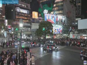
Shibuya Scramble Crossing, Tokyo, Japan
Shibuya Scramble Crossing, 21 Udagawa-cho, Shibuya City, Tokyo, Japan
 21.2°C / 70.2°F
 03:03
 03:03:09
 9.4°C / 48.9°FBroken Clouds
 93%
 15 km/h / 9 mph
 05:54
 16:49
Loading forecast…
Shibuya Scramble Crossing, 21 Udagawa-cho, Shibuya City, Tokyo, Japan
21.2°C / 70.2°F
03:03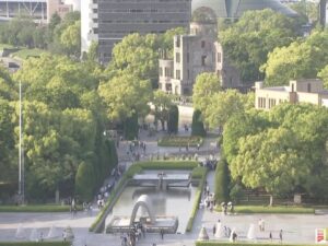
Peace Memorial Park, Nakajimachō, Naka Ward, Hiroshima, Japan
22.2°C / 72°F
03:03

Awaji Monkey Center, 289 畑田組 Sumoto, Hyogo, Japan
 22.5°C / 72.5°F
03:03

Kappa Bridge, Kamikochi, Kamikochi Azumi, Matsumoto, Nagano, Japan
 7.6°C / 45.7°F
03:03

Hakata Station, 中央街-1 博多駅 Hakata Ward, Fukuoka, Japan
24°C / 75.2°F
03:03
Hiroshima Airport (HIJ) (HIJ), 64-31 本郷町善入寺 Mihara, Hiroshima, Japan
20°C / 68°F
03:03
The Hakodate Webcam looks northeast from the summit of Mount Hakodate, 334 meters (1,096 feet) above the southern tip of Hokkaido, straight down the narrow neck of land that holds the city center. Hakodate Bay and its piers fill the left of the frame, the long sandy curve of Omori Beach runs along the Tsugaru Strait on the right, and the city spreads between them to a line of mountains on the horizon. The wooded upper slopes of the mountain take up the foreground. After dark the same scene becomes the night view that the Michelin Green Guide rates at three stars, with dark water on both sides pinching the city lights into a narrow waist. The camera streams 24 hours a day.
Mount Hakodate was once an island. Around 3,000 years ago a sandbar joined it to the Hokkaido mainland, forming a tombolo, and downtown Hakodate is built on that strip of land. That is why the city narrows to a waist in the middle of the frame, then widens again toward the hills. Hakodate Station sits on the bay about 2.5 kilometers (1.5 miles) northeast of the summit, and the rail lines curving along the waterfront into it are easy to follow. A square man-made island with a lawn on top sits in the harbor at the lower left, and at the foot of the slope a white church spire rises above the low rooftops of the Motomachi district.
Hakodate opened fully to foreign trade on 2 June 1859, as one of five ports named in the 1858 Treaty of Amity and Commerce. Ten years later the Naval Battle of Hakodate was fought here from 4 to 10 May 1869, between the remnants of the Tokugawa shogunate’s navy and the new Imperial Japanese Navy, while rebel forces held the European-style Goryokaku fort inland. The city had an estimated 239,813 residents in January 2024.
The camera belongs to Mt. Hakodate Ropeway, the company whose cable car climbs from Motomachi to the summit in about three minutes, and it is broadcast on the YouTube channel of FM Iruka, Hakodate’s community radio station. The Michelin Green Guide Japan gave the view from the top three stars, putting it on a par with the hillside views of Naples and Hong Kong.
Winters are long and snowy. January averages a high of 0.9 C (34 F) and a low of minus 6 C (21 F), and Hakodate collects about 306 centimeters (120 inches) of snow a year, enough to whiten the rooftops below the camera in midwinter. Spring comes slowly, with April highs around 12 C (54 F) and nights near 3 C (37 F).
Summer is mild. July averages 24 C (75 F) by day and August, the warmest month, 26 C (79 F), with nights of 17 to 19 C (63 to 66 F). October cools to highs of 17 C (63 F) and lows of 8 C (46 F), and by early October the first autumn color already shows on the wooded slopes in the foreground. Rain and snow add up to about 1,188 millimeters (46.8 inches) a year. The weather on the summit matters most here: the operator warns that the view can disappear when the mountaintop is in cloud, so a plain gray picture usually means cloud rather than a fault.
The ropeway’s lower station is in Motomachi, a 10-minute walk from the Jujigai tram stop. Walkers can take the wooded trails instead, which reach the summit in roughly an hour. From late April to mid November, direct buses run from Hakodate Station to the top in about 30 minutes, and a toll-free road opens over the same months, though it closes to private cars in the evening. The view is said to be at its best about 30 minutes after sunset.
Down in the city are the Hakodate Morning Market, known as the Asaichi, for fresh fish, and the Kanemori Red Brick Warehouses. Motomachi Catholic Church stands in the streets near the ropeway station. Goryokaku, the European-style fort that rebel forces held in 1869, is about a 20-minute drive from the ropeway.
More of Hokkaido, plus Hong Kong, one of the cities Michelin compares this view with:
The camera looks northeast from the top of Mount Hakodate over central Hakodate. Hakodate Bay, its piers and the rail lines into Hakodate Station are on the left, Omori Beach and the Tsugaru Strait are on the right, and the city fills the isthmus between them before spreading out toward the mountains on the horizon.
On the summit of Mount Hakodate, 334 meters (1,096 feet) high, at the southern end of the city of Hakodate in southern Hokkaido, Japan. It is run by Mt. Hakodate Ropeway.
Yes. The stream runs 24 hours a day, so after sunset it shows the night view that earned three stars in the Michelin Green Guide Japan. Hakodate is nine hours ahead of UTC, so evening there falls in the morning in the UK and in the early hours on the US East Coast.
No. Hakodate Airport lies about 10 kilometers (6.2 miles) east of the summit, near Yunokawa, and the camera is aimed at the city center rather than the runway. Aircraft are too small to follow at that range.
Only from a distance. The station stands on the bay about 2.5 kilometers (1.5 miles) from the summit, and the rail lines curving toward it can be traced in the left half of the frame, but individual trains are small at that range.
Mild summers and snowy winters. August is the warmest month, with average highs of 26 C (79 F), while January averages 0.9 C (34 F) by day and minus 6 C (21 F) at night. Cloud sitting on the summit can hide the view completely.
The quickest way is the Mt. Hakodate Ropeway from Motomachi, about three minutes to the summit. Hiking trails climb through the woods in roughly an hour, and from late April to mid November direct buses run from Hakodate Station in about 30 minutes.
Above all, the night view from Mount Hakodate. The city is also known for its Morning Market, the Kanemori Red Brick Warehouses, its role as one of five ports opened to foreign trade under the 1858 treaty, and Goryokaku, the European-style fort that rebel forces held during the fighting of 1869.
Source: Mt. Hakodate Ropeway and FM Iruka
The best new live webcams and site features, once a week.
By subscribing you agree to receive our weekly email. Unsubscribe any time.
 20.4°C / 68.7°F