English
 简体中文
 Deutsch
 Français
 Español
 Nederlands
 Svenska
 Italiano
 日本語
 Polski
 Português
 Русский
 Ελληνικά
 العربية
 Türkçe
Live
 15:54:59
 21.3°C / 70.3°F
 Clear Sky
 45%
 9 km/h / 6 mph
 06:47
 16:45
Loading forecast…
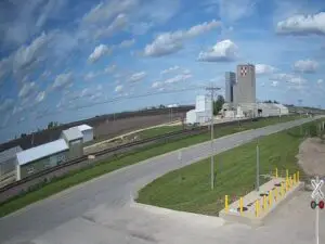
The St. Louis Train Webcam watches three rail lines running side by side on the south edge of downtown St. Louis, Missouri, from the headquarters of St. Louis Trolley Tours. LIVE Trains runs the camera, which looks over the Terminal Railroad Association of St. Louis (TRRA) Merchants Subdivision and MacArthur Subdivision and Union Pacific’s Lesperance Street Lead. TRRA, BNSF, Union Pacific and Amtrak trains all use these tracks. The main view faces west across several tracks and switches, a white signal hut and tall lattice transmission towers to a road bridge spanning the corridor. A second, pan-tilt-zoom camera in the next tab looks the other way, along a curve of track toward a line of steel truss spans on the approach to the MacArthur Bridge over the Mississippi River.
The camera stands at the St. Louis Trolley Tours headquarters on Cerre Street, on the north side of the rail corridor. Busch Stadium, home of the St. Louis Cardinals, is about 400 meters (a quarter mile) to the northeast, and the Purina headquarters on Chouteau Avenue sits just across the tracks to the south. LIVE Trains says it has streamed from here since December 21, 2022. The fixed West Cam looks past equipment cabinets, a pile of old crossties and a heap of gravel to the South Tucker Boulevard bridge, which carries the road over the tracks roughly 250 meters (820 feet) to the west. The power towers stand in front of it, and on the day we checked a line of freight cars waited beneath the bridge deck.
The PTZ camera in the second tab can pan and zoom, so its framing changes. In the view we checked it looked east along tracks curving past a long retaining wall covered in graffiti, with a lawn, trees and a Purina banner above the wall. Far off on the left, a row of steel truss spans carries the MacArthur Subdivision on its raised approach to the main bridge, which begins about 1.1 kilometers (0.7 mile) southeast of the camera. A caption bar with the camera name, date and time runs across the top of both feeds.
The TRRA was formed in 1889 by railroads serving St. Louis and is still owned jointly by Class I railroads, among them BNSF, Union Pacific, CSX, Norfolk Southern and Canadian National. The MacArthur Bridge opened in 1917 as the St. Louis Municipal Bridge, nicknamed the Free Bridge because it charged no toll, and was renamed for Douglas MacArthur in 1942. It closed to road traffic in 1981, and the TRRA took it over in 1989 in exchange for the title to the Eads Bridge. The bridge measures 5,566 meters (18,261 feet) in total, with a longest span of 206 meters (677 feet). The Merchants Subdivision shares its name with the Merchants Bridge, an 1889 river crossing the TRRA rebuilt in a $222 million project completed in 2022.
St. Louis has hot, humid summers and chilly to cold winters, with about 1,060 millimeters (41.7 inches) of precipitation a year. July is the warmest month, with afternoon highs averaging about 31°C (88°F) and nights near 21°C (70°F), and the city records thunderstorms on around 48 days a year. Spring warms quickly: April highs average about 19°C (66°F), with lows near 7°C (45°F).
Autumn is mild, with October highs around 20°C (68°F) and lows near 10°C (50°F). In mid-November the trees behind the iron fence on the left of the West Cam still held orange and yellow leaves. January is the coldest month, with highs of about 5°C (41°F) and lows near -4°C (25°F), and snow is possible from November to April, when the ballast between the rails can turn white. The PTZ view we checked faced into the late-morning sun and looked hazy, while the West Cam, with the sun behind it, showed clear colors.
The Gateway Arch, 192 meters (630 feet) tall, rises on the riverfront about 1.2 kilometers (0.7 mile) east-northeast of the camera. Busch Stadium is a short walk north, home of the St. Louis Cardinals, an 11-time World Series champion. The camera’s host, St. Louis Trolley Tours, runs daily educational tours of the city from the Horseshoe Casino at 999 North 2nd Street.
St. Louis Union Station, about 1.2 kilometers (0.7 mile) northwest, opened in 1894 and no longer sees trains, but it now houses the St. Louis Aquarium. City Museum, a century-old former warehouse turned into part playground and part art project, stands a few blocks north of Union Station. For more trains, Amtrak’s Gateway Transportation Center at 430 South 15th Street is about 700 meters (0.4 mile) west-northwest of the camera, next to the Civic Center MetroLink station on the Red and Blue lines.
More railroad and Missouri cameras on the site:
It is at the St. Louis Trolley Tours headquarters on Cerre Street in downtown St. Louis, Missouri. Busch Stadium is about 400 meters (a quarter mile) northeast and the Gateway Arch about 1.2 kilometers (0.7 mile) east-northeast.
The main West Cam shows several tracks with switches, a white signal hut, transmission towers and the South Tucker Boulevard bridge. The PTZ tab looks east along curving track past a graffiti-covered wall toward the truss spans of the MacArthur Bridge approach. Trains from TRRA, BNSF, Union Pacific and Amtrak can appear in both views.
LIVE Trains lists TRRA, BNSF, Union Pacific and Amtrak. The camera covers the TRRA’s Merchants and MacArthur Subdivisions and Union Pacific’s Lesperance Street Lead, a branch that heads south from this corridor.
It is a terminal railroad formed in 1889 and owned jointly by Class I railroads. It has owned the MacArthur Bridge since 1989.
Yes. It has carried only trains since it closed to road vehicles in 1981. Union Pacific, BNSF and Amtrak use it, and it handled about 40 trains a day in 2012.
At the Gateway Transportation Center, 430 South 15th Street, which opened in November 2008. The Missouri River Runner, Lincoln Service and Texas Eagle call there.
Summers are hot and humid, with July highs near 31°C (88°F), and winters are chilly, with January highs around 5°C (41°F) and lows near -4°C (25°F). Snow is possible from November to April.
Yes. The camera’s YouTube description links two St. Louis Terminal radio streams, on RailroadRadio.net and Broadcastify.
Source: LIVE Trains
The best new live webcams and site features, once a week.
By subscribing you agree to receive our weekly email. Unsubscribe any time.
 25°C / 77°F



 13.4°C / 56.1°F
 11.7°C / 53.1°F