
Live

 13:53:30
 3.7°C / 38.7°F
 Light Rain
 71%
71% 10 km/h / 6 mph
 07:45
07:45 18:42
18:42Loading forecast…





Park Hotel Brasilia, Via Levantina 2° Accesso al Mare, Jesolo, Metropolitan City of Venice, Italy
 18°C / 64.4°F
12:53
18°C / 64.4°F
12:53

Inchydoney Island Lodge & Spa, Inchydoney Island, County Cork, Ireland
13.2°C / 55.8°F
11:53
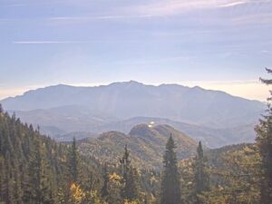
The Vladeasa Webcam stands at Cabana Vladeasa, a mountain hut at about 1,400 meters (4,593 feet) in the Vladeasa Mountains, the northern part of Romania’s Apuseni range. The camera moves through a cycle of preset views. Most of them look across a sloping hay meadow, past small wooden huts, a line of power poles and scattered young spruce, to rows of forested ridges that fade toward flat country on the horizon. One stop turns to the hut’s own grounds, with red-roofed chalets, picnic tables, a swing set and a gravel path between tall spruce. Even under the low overcast of mid-October 2026, the frame reached across several ridges to the distant plain. The stream’s caption carries the names of Electron Grup and the Sacuieu town hall.
Cabana Vladeasa is the main base for walks to Vladeasa Peak (Varful Vladeasa), which at 1,836 meters (6,024 feet) is the highest point of the massif and the second highest summit in the Apuseni Mountains, after Bihor Peak at 1,849 meters (6,066 feet). The hut is open all year and sits at roughly 1,400 to 1,430 meters (4,593 to 4,692 feet), depending on the source. It can be reached by car on a gravel country road from Bologa through Sacuieu and Rogojel, a route suited to vehicles with high ground clearance. Lake Dragan lies about 7.5 kilometers (4.7 miles) to the west as the crow flies.
The summit carries the Vladeasa weather station, run by the regional meteorology center for northern Transylvania. A fire destroyed the station’s cabin in June 2025, and the rebuilt station was presented on 3 December 2025, about five months later, together with work on its access road. Five meteorologists are based there. Strong winds blow along the crest for most of the year, and the scattered junipers below the summit barely hold their ground against them.
From the top, the Dragan basin spreads to the west under wide forests broken by rocky crests and peaks. To the southwest, the central ridge of the Vladeasa Mountains runs toward the Buteasa ridge and its twin peaks. The hut’s own view on the Vladeasa Webcam is lower and closer, a mix of meadow, spruce and wooden buildings in the foreground with the open country beyond.
Ten years of modeled weather data for the hut’s altitude (2015 to 2024) describe a long, cold winter. January averages highs of about -3 C (27 F) and lows near -9 C (17 F), while December and February hover around 0 C (32 F) by day and -6 C (21 F) at night. Average lows stay below freezing from November through April. The ridge trails above the hut are passable in winter only as far as the depth and condition of the snow allow, and the meadow in front of the camera can lie white for much of the season.
Summer is cool at this height. July and August highs average 18 to 19 C (65 to 66 F), with nights around 10 to 11 C (51 to 52 F). June is the wettest month at about 150 millimeters (5.9 inches), and May through July each bring more than 130 millimeters (5.1 inches). Autumn turns quickly: highs average 14 C (58 F) in September, 10 C (50 F) in October and 5 C (40 F) in November. By mid-October 2026 the hay meadow on the Vladeasa Webcam had already faded to straw, and the broadleaf trees around the huts were starting to turn yellow.
The red dot trail, known as the small Vladeasa circuit (13MN06), is the usual way to the summit. It runs 13.3 kilometers (8.3 miles) in 5 to 6 hours with about 600 meters (1,969 feet) of climbing. The route follows a forest road up to the crest, continues about 2 kilometers (1.2 miles) along the crest to the weather station, then drops through dwarf pine and spruce to Pietrele Albe before returning to the hut along the Rogojan road. Markings on the crest are sparse and painted on rocks. Pietrele Albe is a limestone complex full of caves, potholes and vertical walls, popular with climbers, and its highest point, Piatra Graitoare, reaches 1,557 meters (5,108 feet). A 20-minute detour leads to its viewpoint.
The hut is also the starting point for the Varfurasu Cave speleological reserve and for the Stanciului valley, with the Tau waterfall and the Bride’s Veil waterfall (Valul Miresei), both reached on the blue dot trail known as the big Vladeasa circuit or the Rachitele circuit. Bride’s Veil drops about 30 meters (98 feet) in two steps near the village of Rachitele. Other marked trails climb to the hut from Bologa along a blue stripe ridge route, from Valea Draganului on a blue cross and from Rogojel on a red triangle. A less used blue triangle path comes up from Gura Zarnii on Lake Dragan, which Electron Grup also streams from a camera at Dragan Dam.
More Romanian mountain views and high country cams:
Cabana Vladeasa is in Sacuieu commune, Cluj County, in the Vladeasa Mountains of the northern Apuseni in western Romania. It sits at about 1,400 meters (4,593 feet), below Vladeasa Peak, and about 7.5 kilometers (4.7 miles) east of Lake Dragan as the crow flies.
The camera cycles through several views from the hut: a hay meadow with wooden huts, power poles and young spruce, rows of forested ridges reaching to a distant plain, and the hut’s own grounds with chalets, picnic tables and a swing set.
Winters are long and cold, with January highs near -3 C (27 F) and lows near -9 C (17 F). Summers are cool, with July and August highs of 18 to 19 C (65 to 66 F). June is the wettest month.
Vladeasa Peak rises to 1,836 meters (6,024 feet). It is the highest point of the Vladeasa Mountains and the second highest summit in the Apuseni, after Bihor Peak at 1,849 meters (6,066 feet).
The small Vladeasa circuit, marked with a red dot, climbs from the hut to the summit and returns by way of Pietrele Albe. The full loop is 13.3 kilometers (8.3 miles) and takes 5 to 6 hours, with about 600 meters (1,969 feet) of ascent.
Yes. The hut is reachable all year by car on a gravel country road from Bologa through Sacuieu and Rogojel, though the road suits vehicles with high ground clearance.
Average lows stay below freezing from November through April, and the trails above the hut can be walked in winter only as far as the depth and condition of the snow allow.
Source: Electron Grup
The best new live webcams and site features, once a week.
By subscribing you agree to receive our weekly email. Unsubscribe any time.
 13.7°C / 56.7°F
 11.7°C / 53.1°F
 17.5°C / 63.5°F