
Live

 22:31:30
 11.6°C / 52.9°F
 Scattered Clouds
 91%
91% 9 km/h / 6 mph
 07:49
07:49 18:29
18:29Loading forecast…


Aran Islands Hotel, Killeany, Aran Islands, County Galway, Ireland
 10.6°C / 51.1°F
22:31
10.6°C / 51.1°F
22:31
Inchydoney Island Lodge & Spa, Inchydoney Island, County Cork, Ireland
 9.7°C / 49.5°F
22:31
9.7°C / 49.5°F
22:31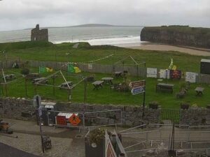

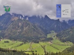
Marveld Recreatie, Elshofweg, Groenlo, Netherlands
 15.5°C / 59.9°F
23:31
15.5°C / 59.9°F
23:31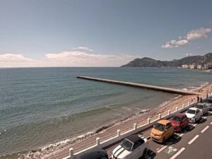

Santa Mónica Suites Hotel, Paseo Costa Canaria, Maspalomas, Spain
27.7°C / 81.9°F
22:31


The Wicklow Webcam looks north over Wicklow town from the top of Ballyguile Hill, on the east coast of Ireland. The camera sits on the Herbst Communications tower near the summit, and Evercam hosts the stream. Rough hilltop grass fills the bottom of the frame, then the ground falls away to rooftops and housing estates running down to the shore. Beyond the town, the narrow water of Broad Lough sits left of center, and the long shingle line of the Murrough curves north along the bay. The harbor piers poke in at the right edge, with the Irish Sea filling the rest of that side and low hills rolling toward the Wicklow Mountains on the left. On a clear day the coast stays sharp a long way north. In a grey spell it fades into haze.
Wicklow is the county town of County Wicklow, 42 kilometers (26 miles) south of Dublin, and counted 12,957 residents at the 2022 census. The town forms a rough semicircle around its harbor, which Vikings used as a base in the mid-9th century, and the English name comes from that period. Ballyguile Hill, where the camera stands, rises to 188 meters (617 feet) on the southwest side of town. Much of Wicklow’s 1970s and 1980s housing went up on its slopes, despite the steep climb from the center.
Broad Lough is a narrow lake that begins about 1 kilometer (0.6 miles) north of Parnell Bridge and stretches to about 4 kilometers (2.5 miles) north of it. It formed when a sand spit grew along the coast and cut the River Vartry off from its old outlet. That spit is the Murrough, and it carries the Dublin to Wicklow coastal railway, built in the 1860s. The lake still drains south through the town into the harbor. The Vartry itself rises in Calary Bog under the Great Sugar Loaf and runs down through Devil’s Glen before it reaches the sea.
The Normans followed the Vikings. Maurice FitzGerald was granted Wicklow after the invasion and built the Black Castle, a land-facing fort whose ruin stands on the coast just south of the harbor. The Franciscan friary at the west end of Main Street was founded in 1252 and dissolved in 1551, and Wicklow Gaol was built in 1702. The harbor took its present shape much later: the East Breakwater went up in the early 1880s and the north groyne was finished by about 1909. Robert Halpin, born in the town in 1836 and later captain of the SS Great Eastern, is remembered with an obelisk in Fitzwilliam Square.
Wicklow has a mild, damp climate set by the Irish Sea. Open-Meteo reanalysis data for the town from 2015 to 2024 gives winter highs of about 8 to 9 C (47 to 48 F) and lows of 4 to 5 C (39 to 41 F). Spring warms slowly, from about 10 C (50 F) in March to 14 C (58 F) in May. July and August are the warmest months, with highs near 18.5 C (65 F) and nights around 13 C (55 F). October still reaches about 14 C (57 F), but autumn is the wet season: October to December each bring roughly 108 to 116 millimeters (4.3 to 4.6 inches) of rain, against 72 to 76 millimeters (2.8 to 3.0 inches) a month from April to July.
Daylight changes more than the temperature does at 53 degrees north. Around the June solstice the sun rises just before 5 am and sets just before 10 pm Irish time, close to 17 hours of light, so the bay stays lit late into the evening. In late December the day shrinks to about seven and a half hours, from around 8:35 am to 4:10 pm. The weather off the sea decides how far the camera sees. A clear spell sharpens the Murrough shoreline far to the north, while a wet front can soften the whole coast into grey.
Wicklow Gaol is the town’s best-known sight, a notoriously harsh 18th century jail that now runs as a heritage attraction open daily for most of the year. Down at the harbor, the Black Castle ruin sits by the East Pier, while the North Pier draws swimmers from June to August. The grassy Murrough leads north from the town beside the sea, on the same sand spit that holds back Broad Lough. About 3 kilometers (1.9 miles) south, Wicklow Head is the most easterly point on the Republic’s mainland and carries two lighthouses, the upper one built in 1781.
Gardens and glens fill the country inland. Mount Usher Gardens at Ashford were laid out in 1868, and Kilmacurragh Botanic Gardens, about 6 kilometers (3.7 miles) southwest of town, were laid out by the Acton family from 1712. Devil’s Glen, about 10 kilometers (6.2 miles) northwest, is a ravine loud with waterfalls where the Vartry drops toward the coast. Avondale Forest Park near Rathdrum adds a treetop walkway and a spiral viewing tower. For sand instead of shingle, Silver Strand, Brittas Bay and Maheramore lie about 15 kilometers (9.3 miles) south, and the monastic site at Glendalough sits inland in the Wicklow Mountains.
These cameras cover more of Ireland and the far side of the Irish Sea.
Wicklow is the county town of County Wicklow on the east coast of Ireland, 42 kilometers (26 miles) south of Dublin. The camera stands on Ballyguile Hill, on the southwest side of the town.
The view runs north from Ballyguile Hill over the rooftops of Wicklow to Broad Lough, the Murrough shoreline and the bay, with the harbor piers at the right edge and hills toward the Wicklow Mountains on the left. A date and time stamp sits in the top left corner of the picture.
Mild and damp. Winter highs sit around 8 to 9 C (47 to 48 F), summer highs around 18.5 C (65 F), and October to December is the wettest part of the year.
Ballyguile Hill reaches 188 meters (617 feet), with 109 meters (358 feet) of prominence above the land around it.
A narrow lake just north of the town, formed when the Murrough sand spit cut the River Vartry off from its old outlet. It drains south to the sea through Wicklow harbor.
The name is Viking. It dates from the 9th century, when Vikings used the natural harbor as a base, and comes from the Old Norse Vikingalo.
Wicklow Head, about 3 kilometers (1.9 miles) south of the town, is the most easterly point on the mainland of the Republic of Ireland.
The camera sits on the Herbst Communications tower at Ballyguile, and Evercam hosts the live view shown on wicklowcam.com.
Source: Herbst Wicklow Cam
The best new live webcams and site features, once a week.
By subscribing you agree to receive our weekly email. Unsubscribe any time.
 -0°C / 32°F