Live

 18:25:05
 11.9°C / 53.4°F
 Broken Clouds
 74%
74% 29 km/h / 18 mph
 07:42
07:42 18:29
18:29Loading forecast…


Pugwash, Cumberland County, Nova Scotia, Canada
 9.7°C / 49.5°F
18:25
9.7°C / 49.5°F
18:25


Val Marie, Grasslands National Park, Saskatchewan, Canada
 16.1°C / 61°F
15:25
16.1°C / 61°F
15:25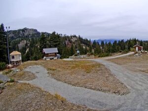
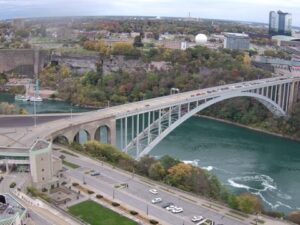
Rainbow Bridge, Niagara Falls, Ontario, Canada
 15.6°C / 60.1°F
17:25
15.6°C / 60.1°F
17:25


The Baccaro Point Lighthouse Webcam streams from the southernmost point of mainland Nova Scotia, where a white wooden tower stands on bare rock at the eastern side of the entrance to Barrington Bay. The camera faces the open Atlantic, with the lighthouse anchoring one side of the frame and the water running out to the horizon on the other. Between them sit a strip of low grass, scattered boulders and the gravel track that leads down to the light. Wind is the constant here. On a rough day the swell breaks white the whole way across the shot, and on a calm one the surface flattens enough to pick out fishing boats working the ground offshore.
A light has burned at this point since January 16, 1851, when the first keeper, James S. Smith, lit a combined tower and dwelling finished the year before. Smith, a cobbler by trade, held the post until 1881. Fire destroyed that original building, and the tower in frame today replaced it in 1934: a square, tapered wooden structure of roughly 13.7 meters (45 feet), set directly on solid rock. Keepers once painted black circles on three of its faces so that mariners could tell it apart from other lights along this coast in daylight.
The station is a Recognized Federal Heritage Building. It was de-staffed in 1984, when Brenton Reynolds, keeper since 1965, retired. His predecessor Victor Crowell had held the job for barely a year before he was killed in a motor vehicle accident. The foghorn that used to sound here was discontinued in 2014, and Reynolds is on record saying the signal interfered with the annual moose rut by calling lovesick animals out of the woods. A volunteer group, Keepers of the Baccaro Light, formed in 2015 and now looks after the tower and its grounds. It repaired and repainted the woodwork in 2016 using a $10,000 grant from the Municipality of Barrington and $3,344 from the National Trust of Canada.
Baccaro is the oldest recorded place name in Nova Scotia. It comes from the Basque word baccalaos, meaning codfish, left behind by crews who worked these banks long before permanent settlement. The point carries the civic address 157 Lighthouse Road, East Baccaro, and marks the eastern side of the entrance to Barrington Bay, the sheltered water between the mainland and Cape Sable Island. The headland is also a recognized bird watching site, which is part of why the ground around the tower stays open and unbuilt.
Shelburne County sits in an oceanic climate, and the water offshore keeps both ends of the year milder than inland Nova Scotia. Typical daily highs run from around 3 C (37 F) in January to about 25 C (77 F) in July. Winter on the Baccaro Point Lighthouse Webcam is usually a matter of grey water, bleached grass and wind rather than deep snow, though a storm tracking up the coast can throw spray across the rocks in front of the tower.
Rain and snow are heavy year round, at roughly 1,362 millimeters (54 inches) annually. December is the wettest month at about 143 millimeters (5.6 inches), and August the driest at about 93 millimeters (3.7 inches). Fog is the condition that most often takes the view away: warm air over cold water in late spring and early summer can close the frame down to the grass in front of the lens for hours at a time. Late summer and early autumn tend to give the cleanest picture, when the drier weather lines up with a sun that still sits high enough to light the water properly.
Barrington, the municipality Baccaro belongs to, calls itself the Lobster Capital of Canada, and the working wharves around its shoreline are the reason. Cape Sable Island lies across Barrington Bay and is reached by causeway. The Hawk Road at its southern end looks out toward Cape Sable Island Lighthouse, a tower of about 30.8 meters (101 feet) that stands at the southernmost tip of Atlantic Canada and can be reached only by boat. West Head Lighthouse, established in 1888 on the island’s western side, is a shorter tower of about 15.5 meters (51 feet) and sits at the end of a road in Clark’s Harbour.
Charlesville Lighthouse at Lower East Harbour is a good vantage point for the Pubnico wind farms and the fishing boats working Pubnico Harbour. Sandhills Provincial Park covers the beach day. The wider municipality falls inside the UNESCO Southwest Nova Biosphere Reserve, and Shag Harbour, a short drive up the coast, is known well beyond the county for the UFO incident that still brings people to the shoreline. The Nova Scotia Marathon runs here each summer, with a half marathon and a 10 kilometer race alongside the full distance.
If the Baccaro Point Lighthouse Webcam has you looking at Atlantic Canada, these cameras cover related ground.
It stands at Baccaro Point in East Baccaro, in the Municipality of the District of Barrington, Shelburne County, on the southwestern shore of Nova Scotia. The point is the southernmost tip of the Nova Scotia mainland, and the light marks the eastern side of the entrance to Barrington Bay.
The square wooden tower fills one side of the frame, with open Atlantic water and the horizon across the rest of it. In front of the tower are cropped grass, boulders and the gravel approach road. Fishing boats pass offshore, and seabirds work the shoreline, which is one of the reasons the point is a known birding spot.
The tower measures roughly 13.7 meters (45 feet). It is square and tapered, built of wood, and set directly on the rock of the point rather than on a raised foundation.
The station first showed a light on January 16, 1851. The building put up in 1850 burned down, and the tower standing today dates from 1934.
Yes. It remains an active navigational aid, though it has been unstaffed since 1984, when the last keeper retired. The station’s foghorn was discontinued in 2014.
Cool and wet, with the ocean flattening the extremes. Daily highs average about 3 C (37 F) in January and about 25 C (77 F) in July, and the area takes roughly 1,362 millimeters (54 inches) of precipitation a year. Sea fog is common in late spring and early summer.
It comes from baccalaos, a Basque word for codfish, and it is the oldest recorded place name in Nova Scotia. Basque crews fished these grounds well before the area was permanently settled.
Source: Nova Scotia Webcams
The best new live webcams and site features, once a week.
By subscribing you agree to receive our weekly email. Unsubscribe any time.
 11.4°C / 52.5°F
 10.9°C / 51.6°F