
 English
 简体中文
 Deutsch
 Français
 Español
 Nederlands
 Svenska
 Italiano
 日本語
 Polski
 Português
 Русский
 Ελληνικά
 العربية
 Türkçe

Live
 16:14:54
 23°C / 73.4°F
 Scattered Clouds
 39%
 20 km/h / 12 mph
 07:04
 17:10
Loading forecast…
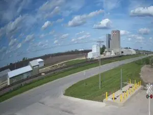
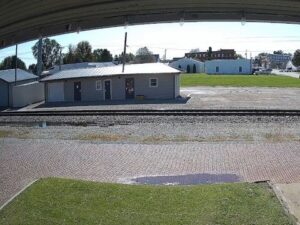
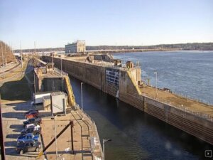
Lock and Dam 19, North Water Street, Keokuk, IA, USA
 20.3°C / 68.5°F
16:14




Goldmine Mountain, Big Bear Lake, California, USA
15.9°C / 60.6°F
14:14


Oregon State University, Corvallis, Oregon, USA
 12.6°C / 54.7°F
14:14
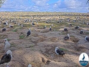
Midway Atoll, United States Minor Outlying Islands
24.9°C / 76.8°F
11:14

The Council Bluffs Webcam looks west across Tom Hanafan River’s Edge Park, on the Iowa bank of the Missouri River, to the downtown towers of Omaha, Nebraska. A wide green lawn runs from below the camera toward the river, framed by curving paths, tall light masts and a few benches. On the left a 10-meter (33-foot) silver figure stands over the grass, and at the far right edge a white mast appears to be the pylon of the Bob Kerrey Pedestrian Bridge. The river shows as a thin band under the skyline, crossed on the left by a highway bridge. The scene changes with the season, from green summer grass to the red and gold trees of autumn, and EarthCam notes that festivals, concerts and outdoor recreation bring people to the park through the year. Because the camera faces Omaha, evening light drops behind the skyline.
Council Bluffs is a city of 62,799 people (2020 census) in Pottawattamie County, facing Omaha across the Missouri at an elevation of about 298 meters (978 feet). In the late 1840s it was Kanesville, the main outfitting point for Latter-day Saints heading to Utah, and it is still recognized as the head of the Mormon Trail. The town took its present name around 1853 and was incorporated on January 19 of that year. The name recalls a bluff about 32 kilometers (20 miles) to the north where Lewis and Clark met Otoe leaders in August 1804. The city later became the eastern end of the first transcontinental railroad, and the Union Pacific’s official Mile 0 sits at 21st Street and 9th Avenue.
Tom Hanafan River’s Edge Park, named for a former mayor, completed its first phase in 2013. The open grass in the middle of the frame is its great lawn, about 2 hectares (5 acres) with built-in amphitheater-style seating for concerts and festivals, and the park is open daily from 5:00 a.m. to 10:00 p.m. The silver figure on the left is Looking Up, a site-specific piece by the artist Tom Friedman. It was placed by the Iowa entrance of the pedestrian bridge on April 13, 2021, commissioned by an anonymous donor with matching money from the Iowa West Foundation. The red-orange steel shape near the riverbank, left of center, appears to be Mark di Suvero’s Big Mo, installed in 2014 and listed by the foundation at 23 meters (75 feet 8 inches) high.
The Bob Kerrey Pedestrian Bridge opened on September 28, 2008, and carries walkers and cyclists between Council Bluffs and Omaha. It is a cable-stayed bridge about 910 meters (3,000 feet) long, with a longest span of 154 meters (506 feet), and it is named for the former Nebraska senator who secured federal money to build it.
The nearest long-term weather station is Omaha’s Eppley Airfield, a few kilometers north of the park. NOAA’s 1991 to 2020 normals there put January highs near 1°C (34°F) and lows near -9°C (15°F), and the airport averages 69 centimeters (27.1 inches) of snow a year. After a snowfall the great lawn can turn white, and the rows of trees between the lawn and the river stand bare until spring. April highs average about 18°C (64°F), with lows near 5°C (41°F), and the lawn greens up again.
Summers are hot, with July highs averaging 31°C (88°F) and lows of 20°C (68°F). July brings about 90 millimeters (3.55 inches) of rain, out of roughly 809 millimeters (31.9 inches) a year. October is mild, with highs near 19°C (66°F) and lows near 6°C (43°F), and in early November the trees on the right of the frame were still showing red and gold leaves against the grass.
The easiest outing is a walk over the Bob Kerrey Pedestrian Bridge into Omaha. Belles’ Play Garden, a river-themed playground with water features beside the River’s Edge Pavilion, sits at the edge of the park. In downtown Council Bluffs, the Union Pacific Railroad Museum fills the former Carnegie library, and the Pottawattamie County Squirrel Cage Jail, a three-story rotary jail used from 1885 to 1969, is listed on the National Register of Historic Places. Bayliss Park, also downtown, has the Wellspring fountain and the Oculus performance pavilion.
Rail history runs deep here. The Golden Spike Monument, dedicated in 1939, marks milepost 0 of the transcontinental railroad, and the RailsWest Railroad Museum occupies an 1899 passenger depot with train cars on display outside. The Lincoln Monument, put up in 1911 by the local Daughters of the American Revolution, looks out over the Missouri River Valley, and the Western Historic Trails Center tells the story of the emigrant trails. At the southern edge of the city, Lake Manawa State Park is known for bald eagle sightings in winter and early spring.
These cameras cover the other side of the river, Iowa’s capital and another river crossing on the state’s eastern border.
Council Bluffs is in Pottawattamie County in western Iowa, on the east bank of the Missouri River directly across from Omaha, Nebraska. The camera sits in Tom Hanafan River’s Edge Park on the riverfront, beside the Iowa end of the Bob Kerrey Pedestrian Bridge.
The camera looks west over the park’s great lawn and curving paths to the Missouri River and the Omaha skyline. The Looking Up statue stands on the left, a highway bridge crosses the river behind it, and a white mast at the right edge appears to belong to the Bob Kerrey Pedestrian Bridge.
It is Looking Up, a 10-meter (33-foot) figure by the artist Tom Friedman. An anonymous donor commissioned it for the park, the Iowa West Foundation matched the gift, and it was installed near the Iowa entrance of the pedestrian bridge on April 13, 2021.
Yes. The Bob Kerrey Pedestrian Bridge, about 910 meters (3,000 feet) long, has carried walkers and cyclists across the Missouri between the two cities since September 28, 2008.
Winters are cold, with January highs near 1°C (34°F) and lows near -9°C (15°F), and about 69 centimeters (27.1 inches) of snow a year. Summers are hot, with July highs near 31°C (88°F), according to NOAA normals for nearby Eppley Airfield.
West, from the Iowa riverfront toward downtown Omaha. That puts the evening sky behind the skyline, and EarthCam points to the sunsets along the Missouri as one of the highlights of the Council Bluffs Webcam.
Its pioneer and railroad history. As Kanesville it was the head of the Mormon Trail in the late 1840s, and it became the eastern end of the first transcontinental railroad, with the Union Pacific’s Mile 0 marked by the Golden Spike Monument.
Source: EarthCam
The best new live webcams and site features, once a week.
By subscribing you agree to receive our weekly email. Unsubscribe any time.
 17°C / 62.6°F
 20°C / 68°F