Live

 17:12:53
 7.5°C / 45.5°F
 Overcast Clouds
 86%
86% 6 km/h / 4 mph
 07:07
07:07 18:13
18:13Loading forecast…

Sunset Beach, Brunswick County, North Carolina, USA
 26.9°C / 80.4°F
19:12
26.9°C / 80.4°F
19:12
EOU Quad, La Grande, Union County, Oregon, USA
 19.1°C / 66.4°F
16:12
19.1°C / 66.4°F
16:12

Continuum College, Brooklyn Avenue Northeast, Seattle, WA, USA
 19°C / 66.2°F
16:12
19°C / 66.2°F
16:12
Lake Itasca, Itasca State Park, Minnesota, USA
8.7°C / 47.7°F
18:12
Strasburg, Lancaster County, Pennsylvania, USA
24.7°C / 76.5°F
19:12

Lower Florida Keys, Monroe County, Florida, USA
30°C / 86°F
19:12

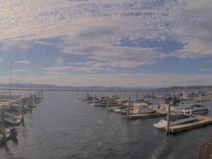
Ferry Dock Marina, King Street Dock, Burlington, VT, USA
12.2°C / 54°F
19:12

The Custer Webcam looks out over downtown Custer, South Dakota, and splits the screen into four separate views, one facing each point of the compass. Mount Rushmore Road runs east and west through the middle of the frame, wide and lined with angled parking, storefront awnings and the low brick buildings that make up the town center. The north and south views cover the cross street, the sidewalks and a parking lot backed by ponderosa pine ridges. Traffic is the thing that moves here: pickups, motorcycles and camper vans heading out toward Mount Rushmore or Custer State Park. Through the summer the intersection rarely empties. In winter it can sit quiet for minutes at a time, with snow banked along the curb.
Custer is the oldest town established by European Americans in the Black Hills. It dates to 1875, a year after the Black Hills Expedition led by Lieutenant Colonel George Armstrong Custer came through the area and found gold east of the present townsite. That discovery set off the Black Hills Gold Rush, and prospectors who put up the first cabins called their camp Stonewall before the name was changed to Custer.
The town sits at 1,620 meters (5,315 feet), high enough that the surrounding country is pine forest rather than prairie, and the 2020 census counted 1,919 residents. Mount Rushmore Road is the main street and carries most of that population past the camera at some point in the day. The 1881 Custer County Courthouse stands at 411 Mount Rushmore Road, a few doors along from the intersection the cameras watch, and it is one of the older buildings still in use on the street.
What the camera really records is a town working as a gateway. Custer is small, but it sits between four of the best known attractions in South Dakota, so the traffic through the middle of it is out of all proportion to the number of people who live there. Rental RVs, motorcycle groups in August and school buses in May all funnel through the same set of lights.
Winters are long and cold at this elevation. January averages a high near 3 C (37 F) and a low near minus 9 C (16 F), and the record low for the town is minus 42 C (minus 43 F), set on January 19, 1963. Around 147 centimeters (58 inches) of snow falls in an average year, so the camera often shows plowed windrows along the curb line and a road surface that is wet and dark rather than white, since the highway through town is kept clear. Spring arrives slowly, and heavy wet snow in March and April is normal here rather than remarkable.
Summer is mild by Great Plains standards, again because of the altitude. July averages a high around 27 C (80 F) with nights dropping back to about 13 C (56 F), and the all time record high is 38 C (100 F) from 1954. Those cool nights mean the early morning views can start out hazy before the light gets flat and bright by late morning. Fall brings the clearest air of the year, and the aspen stands mixed into the pine on the ridges behind town turn yellow through late September and early October, which shows up in the north and south views.
Crazy Horse Memorial is the closest of the big attractions, roughly 6 kilometers (4 miles) from downtown, and the mountain carving is visible from the highway well before the entrance. Custer State Park begins about 10 kilometers (6 miles) east, and Sylvan Lake sits inside it, below the granite spires at the western end of the park. Mount Rushmore National Memorial is about 31 kilometers (19 miles) northeast, which is why so many of the vehicles in frame are pointed that way in the morning and back again in the late afternoon.
West of town, Jewel Cave National Monument is about 16 kilometers (10 miles) out along US Highway 16, and Wind Cave National Park lies to the south. For anyone on foot or on a bike, the George S. Mickelson Trail runs 175 kilometers (109 miles) from Edgemont to Deadwood on a converted rail grade, with 15 trailheads along the way and one of them at Custer. The stretch of Mount Rushmore Road in the camera view is the town’s own shopping and eating street, with restaurants and outfitters at street numbers in the 100s and 500s, so most visits to any of the above start or end within a block of where the cameras are mounted.
Other cameras in the Black Hills and on comparable American main streets:
Custer is in Custer County in the southern Black Hills of western South Dakota, at an elevation of 1,620 meters (5,315 feet). It is about 31 kilometers (19 miles) southwest of Mount Rushmore National Memorial and around an hour’s drive from Rapid City.
Four views of the same downtown intersection on Mount Rushmore Road, looking north, south, east and west at once. The east and west views run along the main street past storefronts and angled parking, while the north and south views take in the cross street, sidewalks, a parking lot and the pine covered ridges behind town.
Cold winters and mild summers. January averages about 3 C (37 F) by day and minus 9 C (16 F) overnight, with roughly 147 centimeters (58 inches) of snow in a typical year. July averages about 27 C (80 F) by day and 13 C (56 F) at night.
Four separate cameras are mounted at the same downtown location, one pointing in each direction, and the stream combines them into a single picture. It means traffic can be followed through the intersection from one panel to the next rather than disappearing at the edge of a single frame.
Yes. Custer was established in 1875 and is the oldest town founded by European Americans anywhere in the Black Hills, which makes it older than Deadwood and Rapid City.
About 6 kilometers (4 miles) from downtown Custer, just north of the town along US Highway 16 and 385.
The park begins roughly 10 kilometers (6 miles) east of town. Sylvan Lake and the granite formations at the park’s western end are the closest well known features to Custer itself.
The 2020 census recorded 1,919 residents, which makes the volume of traffic crossing the intersection in summer the clearest sign on camera of how many visitors the town handles.
Source: Custer Chamber of Commerce
The best new live webcams and site features, once a week.
By subscribing you agree to receive our weekly email. Unsubscribe any time.

 25.1°C / 77.2°F