English
 简体中文
 Deutsch
 Français
 Español
 Nederlands
 Svenska
 Italiano
 日本語
 Polski
 Português
 Русский
 Ελληνικά
 العربية
 Türkçe

Live
South Dakota Mines, South Dakota
South Dakota Mines, Rapid City, South Dakota, USA
 12.5°C / 54.5°F
 12:5913:59:41
 8.3°C / 46.9°F
 Overcast Clouds
 82%
 20 km/h / 12 mph
 07:16
 17:18
Loading forecast…
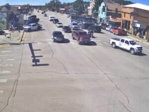
The Redfield Webcam looks across the 500 block of Main Street in Redfield, South Dakota, the county seat of Spink County in the eastern half of the state. In frame is a short row of storefronts: a blue-and-tan insurance office, an antiques shop with an orange front, and a two-story brick building whose stone entrance sits under green awnings. Angle parking lines the curb, and the top of a grain elevator shows above the rooftops on the left. The camera is part of KELOLAND’s LiveCam network, which the Sioux Falls station’s meteorologists use to follow changing weather, so this quiet street doubles as a weather gauge. Rain darkens the concrete, snow can bank up along the curb, and the trees behind the block turn orange in autumn.
Redfield sits at 397 meters (1,303 feet) on the flat farmland of Spink County, about 65 kilometers (40 miles) south of Aberdeen, and had 2,214 residents at the 2020 census. The first settlers arrived in 1878. A post office opened in 1880 under the name Stennett Junction, and a year later the town took the name Redfield, after J. B. Redfield, a railroad official. It was incorporated in 1883 and became the county seat in 1886, at the end of a six-year dispute among the towns of Spink County.
Two institutions shaped the town early on. Redfield College taught students from 1887 until 1932, and in 1902 the state opened the Northern Hospital for the Insane here, which continues today as the South Dakota Developmental Center. The city motto calls Redfield “The Pheasant Capital of the World,” and regional tourism material pitches the town to hunters under the same name.
Main Street holds much of the business district, and the block on camera sits in the middle of it. Redfield’s tourism site lists the street’s buildings by address, a record that runs from the Masonic Temple at 503 Main to the Old City Hall at 517 Main in this same block. The insurance office in the middle of the frame is number 513, and the antiques shop beside it is number 511. The cameras on KELOLAND’s network are provided through On Sight 24/7 Security Systems, and the station’s LiveCam map lists 39 of them across South Dakota, Minnesota and Iowa, from Deadwood in the Black Hills to Orange City in northwest Iowa.
Redfield’s weather swings hard between the seasons. January afternoons average about -4°C (25°F), and overnight lows regularly fall below -12°C (10°F). The nearest long-term weather record, at Aberdeen Regional Airport, averages 108 centimeters (42.7 inches) of snow a year, so winter scenes on the camera can show snow plowed into the parking lanes, and a blizzard can blank out the view entirely. The days are short as well: around the December solstice the sun is up for only about 8 hours 47 minutes.
Spring warms quickly. April highs reach about 13°C to 14°C (55°F to 58°F), though nights still hover near freezing. By July, afternoons average about 29°C (85°F) and nights cool to 15°C to 18°C (59°F to 65°F), with the sun up for about 15 hours 36 minutes around the June solstice. Most of the year’s 550 to 590 millimeters (22 to 23 inches) of precipitation falls between May and August, so summer afternoons can bring wet pavement and heavy cloud over the rooftops. October highs drop to about 15°C (59°F), and the trees behind the block, which were turning orange in early November 2026, add color to the frame before the first snow.
The Redfield Carnegie Library stands just off Main Street at 5 East 5th Avenue. Built in 1902 in the Romanesque style with a $10,000 Carnegie grant, it was listed on the National Register of Historic Places in 1978, and the town’s tourism office describes it as the oldest Carnegie library in South Dakota still in continuous use as a library. The Depot Visitor Center occupies the historic 1914 Chicago and North Western depot and keeps a display on the old depot lunchroom alongside its gifts and souvenirs. For an evening out, the Pheasant City Drive-In Theatre is about 1.6 kilometers (1 mile) north of town on Highway 281.
Fisher Grove State Park lies on the James River 13 kilometers (8 miles) east of Redfield. The park has canoeing, kayaking and fishing on the river, biking on the park roads, picnic areas and snowmobiling in winter, and the Fisher Grove Country Club runs a 10-hole golf course next to it. The park also appears on Redfield’s list of historic sites under its older name, Belcher’s Ford. Back in town, Hav-A-Rest Park has a campground, and Legler Park and Centennial Park, with its tennis courts, give the town its green space.
More small-town and prairie views from South Dakota and the northern Plains:
Redfield is in Spink County in eastern South Dakota, about 65 kilometers (40 miles) south of Aberdeen. It is the county seat and sits at 397 meters (1,303 feet) above sea level.
The camera faces the 500 block of Main Street: an insurance office at number 513, an antiques shop at 511, a brick building with a stone entrance and green awnings, angle parking along the curb and a grain elevator on the skyline. The sky and the state of the pavement say a lot about the weather in town at any moment.
Winters are cold, with January highs around -4°C (25°F) and lows that regularly drop below -12°C (10°F). Summers are warm, with July highs near 29°C (85°F). Most precipitation falls from May to August, and Aberdeen, the nearest long-term weather station, records about 108 centimeters (42.7 inches) of snow a year.
It is one of the cameras on KELOLAND’s LiveCam network, provided through On Sight 24/7 Security Systems. KELOLAND’s meteorologists use the network to track changing weather across the area, and the station lists every camera on its LiveCam map.
Its motto is “The Pheasant Capital of the World,” and regional tourism material pitches the town to hunters. It is also home to the South Dakota Developmental Center, which opened in 1902 as the Northern Hospital for the Insane, and to a Carnegie library built the same year.
Fisher Grove State Park is 13 kilometers (8 miles) east of Redfield on the James River. It has canoeing, kayaking, fishing and picnic areas, and the Fisher Grove Country Club runs a 10-hole golf course next door.
Settlers arrived in 1878, a post office called Stennett Junction opened in 1880, and the name Redfield was adopted in 1881 in honor of railroad official J. B. Redfield. The city was incorporated in 1883.
Source: KELOLAND
The best new live webcams and site features, once a week.
By subscribing you agree to receive our weekly email. Unsubscribe any time.



 9°C / 48.2°F

 22.4°C / 72.3°F


 26.7°C / 80.1°F

 24.1°C / 75.4°F