
Live
Hillsboro Inlet Lighthouse, Florida
Hillsboro Beach, Broward County, Florida, USA
 24.6°C / 76.3°F
 04:45
 04:45:19
 24.4°C / 75.9°F
 Clear Sky
 94%
 18 km/h / 11 mph
 07:26
 18:43
Loading forecast…
Hillsboro Beach, Broward County, Florida, USA
24.6°C / 76.3°F
04:45
Las Olas Beach, Las Olas Circle, Fort Lauderdale, FL, USA
24.6°C / 76.3°F
04:45


New River South Fork, Fort Lauderdale, FL, USA
 24.1°C / 75.4°F
04:45



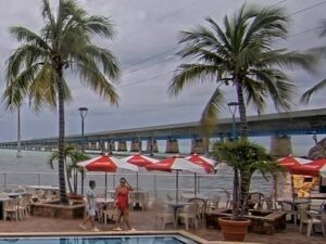
Green Parrot Bar, Whitehead Street, Key West, FL, USA
23.9°C / 75°F
04:45

Fort Myers Beach, Estero Island, Florida, USA
23.1°C / 73.6°F
04:45The Jewfish Creek Bridge Webcam looks out over the mangrove-lined creek at the north end of Key Largo, where U.S. 1 crosses from the Florida mainland into the Florida Keys. Palm crowns, wooden docks and boat slips fill the bottom of the frame. Past them, a row of moored boats can stretch along the edge of the mangroves toward open water, and a flat green shoreline runs along the horizon under a sky that takes up nearly half the picture. The operator calls this the spot where the Everglades meet the Keys, with cars crossing overhead and boats passing below. Depending on the tide, the wind and the season, the water can lie glassy and silver at midday or turn gray and choppy as a front moves through.
Jewfish Creek is a short tidal channel, roughly 1.6 kilometers (1 mile) of mangrove-lined water, that carries the Intracoastal Waterway between Barnes Sound and Blackwater Sound. U.S. Route 1, the Overseas Highway, crosses it on the Jewfish Creek Bridge, linking the Florida mainland with the Keys. The bridge sits within Key Largo, a community of 12,447 people at the 2020 census with an official elevation of just 2.1 meters (7 feet).
The current bridge opened on May 22, 2008, and rises 20 meters (65 feet) above the water. It replaced a small drawbridge that had served the highway since 1944, and unlike that bridge it never has to open, so cars and boats no longer take turns. The new span also crosses Lake Surprise. Building it allowed the removal of the Lake Surprise Causeway, an embankment dating back to the railroad era, which restored the natural flow of water into Florida Bay. The work was part of a $300 million project to rebuild U.S. 1 between Florida City and Key Largo.
The Jewfish Creek Bridge Webcam is run by the Monroe County Tourist Development Council, which lists it among its Key Largo live views, and the current broadcast has been on air since May 2025. The council’s own listing promises cars overhead, boats below and Florida Bay stretching wide beyond them.
Key Largo is warm all year, and winter here is mild. January, the coolest month, averages highs of about 24°C (76°F) and lows near 17°C (63°F). By April the highs reach about 28°C (82°F), with lows around 21°C (71°F). Winter cold fronts can bring a day or two of wind, gray skies and choppy water across the sound before the blue returns.
Summer is hot and humid. July averages highs near 32°C (90°F) and lows of about 26°C (79°F), and October still reaches about 30°C (86°F). Rain totals about 1,447 millimeters (57 inches) a year. September is the wettest month at about 208 millimeters (8.2 inches), with June and October close behind at roughly 200 millimeters (7.9 inches) each. Afternoon storm clouds can build over the bay in the wet months, and the Atlantic hurricane season runs from June 1 to November 30, so late summer and early fall are when the camera is most likely to catch heavy weather rolling in.
A short drive south on U.S. 1 brings you to John Pennekamp Coral Reef State Park, founded in 1963 as the first undersea park in the United States. The park runs glass-bottom boat tours, snorkel and dive trips to the reef and kayak routes through the mangroves, and its visitor center has an aquarium. Snorkelers and divers head out to Dry Rocks for the Christ of the Abyss statue, which stands on the seabed.
Closer to the bridge, in north Key Largo, Dagny Johnson Key Largo Hammock Botanical State Park protects a tropical hardwood hammock named for a local environmental activist, with the Port Bougainville Trail running through it. Crocodile Lake National Wildlife Refuge, set up in 1980, covers 2,706 hectares (6,686 acres) and shelters the American crocodile, the Key Largo woodrat, the Key Largo cotton mouse and the Schaus swallowtail butterfly. Its natural areas are closed to the public, but the refuge office hands out information and keeps a butterfly garden of about 232 square meters (2,500 square feet) beside it. Boaters can run the creek itself on the inside route between Barnes Sound and Blackwater Sound.
For more of the Florida Keys and the water around them, try these cameras.
The bridge carries U.S. 1, the Overseas Highway, over Jewfish Creek and Lake Surprise at the north end of Key Largo in Monroe County, Florida. It is where the highway from the mainland reaches the Keys, with Barnes Sound on one side of the creek and Blackwater Sound on the other.
The camera looks over palms and private docks onto the creek, with moored boats along the mangrove shore and open water stretching to a low horizon. Boats come and go along the channel, and the sky fills a large part of the picture, so passing clouds and storms are easy to follow.
Warm all year. January averages highs of about 24°C (76°F), while July reaches about 32°C (90°F) with lows near 26°C (79°F). Around 1,447 millimeters (57 inches) of rain falls each year, and June, September and October are the wettest months.
The bridge rises 20 meters (65 feet), which is also its listed clearance for boats. As a fixed span it never opens, unlike the drawbridge that stood here from 1944 until 2008.
It opened on May 22, 2008, as part of a $300 million rebuild of U.S. 1 between Florida City and Key Largo. Its construction also let the old Lake Surprise Causeway be removed, which restored the natural water flow into Florida Bay.
Yes. Crocodile Lake National Wildlife Refuge in north Key Largo was set up in 1980 partly to protect the American crocodile, which was moved from endangered to threatened in 2007. The refuge’s natural areas are closed to the public.
The Atlantic hurricane season runs from June 1 to November 30. September falls at the height of the season and is also Key Largo’s wettest month, averaging about 208 millimeters (8.2 inches) of rain.
The best new live webcams and site features, once a week.
By subscribing you agree to receive our weekly email. Unsubscribe any time.