
Live

 08:46:19
 25°C / 77°F
 Clear Sky
 82%
 13 km/h / 8 mph
 07:25
 18:54
Loading forecast…

Castillo de San Marcos, St. Augustine, Florida, USA
 15.7°C / 60.3°F
08:46




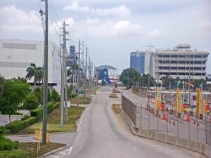
Port Everglades, Eller Drive, Fort Lauderdale, FL, USA
 23.3°C / 73.9°F
08:46

Hillsboro Beach, Broward County, Florida, USA
22.9°C / 73.2°F
08:46The Lower Florida Keys Underwater Webcam sits on the bottom beside a private dock in the Lower Keys, looking out at a piling thick with marine growth, pale sand and scattered limestone rubble. The camera pans and zooms, so one minute a Goliath grouper fills the screen with its face at the dome, and the next the view drifts out across open water. Gray snapper and grunts hang around the piling in loose schools, tarpon and barracuda cruise through, and nurse sharks turn up often enough that the regular watchers keep count. The water shifts from clear blue-green to a milky haze, which decides how far the camera can see.
Viva The Keys runs the camera and streams it on YouTube, with a clock and the words “Lower Florida Keys” in the top right corner. The operator keeps the exact site private: its channel description says questions about the camera’s location are automatically hidden in the chat, and that no site information is available. The setting is clear enough, though. The Lower Keys are the islands of Monroe County west of the Seven Mile Bridge, ending at Key West.
Hurricane Irma made landfall on Cudjoe Key on September 10, 2017, and the Lower Keys took the worst of its damage. According to notes kept with the camera’s species log, the limestone blocks on the bottom here were washed into the water by that storm and gathered about a year later to build a habitat. Before that, the notes say, far fewer fish lived at the site.
The camera has been running since at least June 3, 2021, the date of the first entries in that log. Volunteers post the day’s best moments in a shared timestamp document linked from the channel.
The species list is kept by regular watchers who describe themselves as volunteers rather than experts, and it had reached 133 species by June 30, 2026. Several are marked as daily visitors: Goliath grouper, gray (mangrove) snapper, bluestriped and sailors choice grunts, pinfish, sea bream, great barracuda and Atlantic tarpon. Slender sharksuckers ride along on the nurse sharks and groupers.
The Goliath groupers are the main attraction. NOAA Fisheries gives the species a maximum size of about 2.4 meters (8 feet) and 363 kilograms (800 pounds), with a lifespan of more than 30 years, and harvest has been closed in the federal waters of the southeastern United States since 1990. The regulars at this dock have names in the chat, among them George Goliath Foreman, Gracie and Gigi.
Rarer visits fill the rest of the log. Nurse sharks are frequent, once five at the same time in August 2021, and lemon, bull and bonnethead sharks have all been recorded. Green and loggerhead sea turtles pass through, a West Indian manatee showed up several times between February 2024 and June 2025, and a common octopus and a lined seahorse are on the list too. The oddest entry is an American alligator, logged on October 26, 2021.
Key West, at the western end of the chain, keeps the long-term weather record for the Lower Keys. NOAA’s 1991 to 2020 normals give January highs of 24 C (76 F) and lows of 19 C (66 F). By April, days reach 28 C (83 F) and nights 23 C (73 F). July peaks at 32 C (90 F) with nights around 27 C (81 F), and October still averages 30 C (86 F) by day.
For this camera the sea matters more than the air. The water averages 21.8 C (71.2 F) in January and 30.5 C (86.9 F) in August. May to October is the wet season, with September the wettest month at 184 millimeters (7.24 inches), and the year totals about 1,027 millimeters (40.44 inches). Wind and heavy rain can stir up the sand and cloud the picture, most of all during the June to November hurricane season.
Looe Key is the best-known reef in the Lower Keys, about 10 kilometers (6 miles) off Big Pine Key and Ramrod Key, with depths from about 2 to 9 meters (7 to 30 feet). It takes its name from HMS Looe, a British warship that ran aground there in 1744, and it became a national marine sanctuary in 1981. It now lies within the Florida Keys National Marine Sanctuary.
On land, Big Pine Key holds the National Key Deer Refuge, home of the endangered Key deer, a small white-tailed deer. The refuge also takes in the Blue Hole, an old quarry where fresh and salt water mix, and the Jack C. Watson Wildlife Trail. Bahia Honda State Park sits on Bahia Honda Key near the eastern end of the Lower Keys, and Key West waits at the end of the Overseas Highway.
More water and wildlife cameras from Florida and beyond:
At a private dock in the Lower Keys of Monroe County, Florida, the islands between the Seven Mile Bridge and Key West. Viva The Keys does not publish the exact spot and hides location questions in the stream’s chat, so the map on this page shows the Lower Keys rather than an address.
A dock piling covered in marine growth, sand and limestone rubble, and the fish around them. Goliath grouper, gray snapper, grunts, tarpon and barracuda appear most days, and the camera pans between close-ups at the dome and open water.
The southwestern end of the Florida Keys, west of the Seven Mile Bridge: Bahia Honda Key, Big Pine Key, the Torch Keys, Ramrod, Summerland, Cudjoe and Sugarloaf Keys, Boca Chica Key, Stock Island and Key West.
Yes. Nurse sharks are the most frequent, sometimes several at once, and lemon, bull and bonnethead sharks have also been logged. No visit is guaranteed, so the volunteers’ timestamp document is the quickest way to find recent ones.
No. It looks at a shallow dock site, not living coral. The best-known reef in the Lower Keys, Looe Key, lies about 10 kilometers (6 miles) offshore of Big Pine Key and Ramrod Key.
Yes, on YouTube. The operator says the stream rewinds up to 12 hours, and the clock in the top right corner lets you match a posted time to the right moment.
Warm all year. Key West averages highs of 24 C (76 F) in January and 32 C (90 F) in July, and the sea warms from 21.8 C (71.2 F) in January to 30.5 C (86.9 F) in August. May to October is the wet season.
Source: Viva The Keys
The best new live webcams and site features, once a week.
By subscribing you agree to receive our weekly email. Unsubscribe any time.
 23.3°C / 73.9°F