 English
 简体中文
 Deutsch
 Français
 Español
 Nederlands
 Svenska
 Italiano
 日本語
 Polski
 Português
 Русский
 Ελληνικά
 العربية
 Türkçe

Live
 12:23:28
 6.5°C / 43.7°F
 Clear Sky
 53%
 07:52
 18:13
Loading forecast…
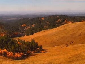
The DuNoir Pass Webcam looks across a road junction and a wide stretch of open valley in Fremont County, Wyoming, west of the town of Dubois. Two paved roads curve together in the foreground, with a red stop sign at the fork and tall grass on either side. Past them the ground runs flat by stands of dark conifers and a few buildings, then lifts to a rounded bare hill on the left and a long tan ridge on the right. Between those two, a line of pale, jagged peaks closes off the view. The sky takes up nearly half the frame, so cloud and light do much of the work here. The peaks can carry fresh snow while the valley floor stays dry, and the pavement gives a quick read on conditions along this stretch of road.
DuNoir Pass is the name Range gives this camera on its webcam page, where it appears as “DuNoir Pass (Fremont County), WY.” Range does not publish an exact position. OpenStreetMap lists DuNoir as a hamlet in the valley west of Dubois, and the fork in the frame appears to be the place where Dunoir Road and Union Pass Road meet US Route 26 and 287, at about 2,221 meters (7,287 feet). Treat the map pin as a close estimate rather than a surveyed camera position.
Range is a telecom and internet provider headquartered in Forsyth, Montana, with offices in Dubois, Sheridan and Worland, Wyoming. Its webcam network covers towns, intersections and mountain passes across both states, and this feed is one of about a dozen on its YouTube channel. Dubois itself sits lower, at 2,117 meters (6,946 feet), and the 2020 census counted 911 residents there.
The valley has a long history as a route and a place to stay. A historical marker for Union Pass stands on US 26/287 at DuNoir, since the road south from this junction climbs toward that old Continental Divide crossing. Fur trappers used the pass from the early 1800s, and Captain William F. Raynolds gave it its name in 1860. In 1907 Charles Moore built Ramshorn Ranch and Camp Yellowstone at the mouth of DuNoir Creek, the first of the many dude ranches that followed in this valley. The operator does not name the peaks on the skyline. They are most likely part of the Absaroka Range, whose summits include The Ramshorn at 3,625 meters (11,893 feet), about 19 kilometers (12 miles) north of the junction.
Modeled 2015 to 2024 figures for this elevation put January at -11°C to -2°C (11°F to 28°F), with December and February about the same. Snow can whiten the grass and the hills in those months, and the sky is often the only color left in the picture. Spring is slow to arrive. April runs from -6°C to 5°C (22°F to 42°F), and April and May bring the most precipitation in that record, so a snowy morning in the frame is still possible well into the season.
Summer is short and mild, with July at 8°C to 25°C (47°F to 76°F) and the driest weather of the year. The grass in the foreground can turn green by then, and it fades back to the straw color seen in late fall. October cools to -3°C to 10°C (27°F to 49°F). That is when the first snow can show up on the distant peaks while the junction stays bare, a contrast that was on screen at the end of October 2026.
Union Pass Road is the obvious trip from here. The route runs between US 287 near Dubois and US 189 in Pinedale, about 117 kilometers (73 miles), and most of the road to the summit is unpaved. The pass reaches 2,808 meters (9,212 feet) on the Continental Divide between the Gros Ventre Range and the Wind River Range, and water nearby can drain to the Mississippi, Columbia or Colorado river systems. The Dubois Museum has run driving tours up the pass. Fish Lake lies about 13 kilometers (8 miles) west of DuNoir.
Heading northwest on the highway leads to Togwotee Pass, a Continental Divide crossing at 2,944 meters (9,658 feet), and the Continental Divide Snowmobile Trail passes through that area. Near the pass, Brooks Lake sits between Sublette Peak and the Pinnacle Buttes, whose main summit reaches 3,510 meters (11,516 feet), and Pinnacles Campground has 21 sites at about 2,804 meters (9,200 feet). Back toward Dubois, the National Bighorn Sheep Center covers wild sheep conservation, and the National Museum of Military Vehicles holds more than 500 vehicles. Bighorn sheep winter in Whiskey Basin on Whiskey Mountain, and the 4.3 meter (14 foot) Tie Hack Historical Monument, built in 1946, marks the logging era northwest of town.
These cameras stay on the same road through Wyoming or look at another mountain pass.
The camera is in Fremont County in northwest Wyoming, in the valley west of Dubois. Range gives no exact position, but the view appears to match the junction of Dunoir Road, Union Pass Road and US 26/287.
A forked road and a stop sign in the foreground, then grassland, conifers and a few buildings, with bare hills on both sides and pale, jagged peaks on the horizon.
Winters are long and cold, with January at -11°C to -2°C (11°F to 28°F). July reaches 8°C to 25°C (47°F to 76°F). These are modeled figures for this elevation from 2015 to 2024.
The junction that appears in the frame sits at about 2,221 meters (7,287 feet), roughly 104 meters (341 feet) above Dubois.
Togwotee Pass is about 29 kilometers (18 miles) northwest of DuNoir, and the highway carries on from there toward Jackson Hole.
It runs from US 287 near Dubois to US 189 in Pinedale, crossing the Continental Divide at 2,808 meters (9,212 feet). Most of the climb to the summit is on unpaved road.
Range says all of its webcams stream free 24 hours a day, every day of the year, so there is no daily off-air period to wait out.
Source: Range
The best new live webcams and site features, once a week.
By subscribing you agree to receive our weekly email. Unsubscribe any time.
 7.7°C / 45.9°F

 9.6°C / 49.3°F