
 English
 简体中文
 Deutsch
 Français
 Español
 Nederlands
 Svenska
 Italiano
 日本語
 Polski
 Português
 Русский
 Ελληνικά
 العربية
 Türkçe

Live
 15:53:11
 16.4°C / 61.5°F
 Clear Sky
 45%
 11 km/h / 7 mph
 06:47
 16:48
Loading forecast…


Kent Island, Queen Anne's County, Maryland, USA
15.6°C / 60.1°F
15:53
Mitchell Airport, Milwaukee, Wisconsin, USA
 15.1°C / 59.2°F
14:53
La Plata, MO Virtual Railfan Webcam, North Owensby Street, La Plata, Missouri, USA
16.2°C / 61.2°F
14:53
Gulfport, Boca Ciega Bay, Florida, USA
25.1°C / 77.2°F
15:53

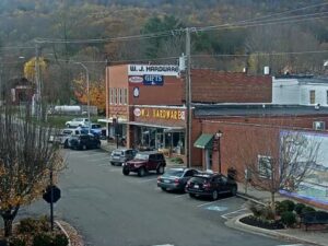

Save the Manatee Club, Wekiva Springs Road, Longwood, FL, USA
 20.7°C / 69.3°F
15:53
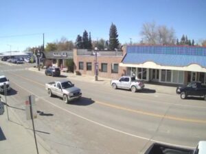

Noyo Headlands Park, Fort Bragg, California, USA
13°C / 55.4°F
12:53
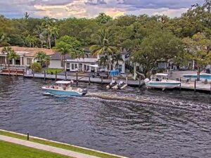
New River South Fork, Fort Lauderdale, FL, USA
 23.4°C / 74.1°F
15:53
The Downtown Salisbury Webcam looks north from the TidalHealth Peninsula Regional campus, over a band of treetops, to the skyline of downtown Salisbury, Maryland. The 14-story Ross tower, white with a brick crown, stands at the right of the frame. On the left rise older brick blocks, one with a fire escape down its side and a tall radio mast on its roof. Between them a white steeple with a clock face shows above the rooftops, and a parking deck trimmed in bright blue and green panels fills the middle distance. A curving street with a crosswalk and green-painted bike lane markings cuts across the lower right corner beside a one-story brick building. Early morning sun can turn the face of the tower orange, and after dark the street lamps and lit windows take over the picture.
Salisbury was established in 1732 and incorporated as a city in 1854, and many historians think it was named after Salisbury in England, the old cathedral city. It had 33,050 residents at the 2020 census, and the city sits between 5.2 and 13.7 meters (17 and 45 feet) above sea level. Fires in 1860 and 1886 burned through two-thirds of the town. US Route 50 once ran along Main Street, the spine of the downtown blocks in this view. The Wicomico River, just out of frame to the west, made Salisbury a shipping town, and the Port of Salisbury is the second-largest and second-busiest commercial port in Maryland.
The tallest building in the picture is also the newest. The Ross, at 132 East Main Street, is a 14-story apartment tower with a reinforced concrete frame, completed in 2023 together with a seven-story partner building. The structural engineers on the project describe the pair as the tallest structures in Salisbury. From the hospital campus the tower is roughly 400 meters (a quarter mile) away, close enough to count its rows of windows on a clear day.
TidalHealth Peninsula Regional, which runs the stream, stands at 100 East Carroll Street on the south side of downtown. It traces its start to 1897, when Dr. George W. Todd opened it with six beds in an old home, and it was later known as Peninsula General Hospital. Today it is a Level III trauma center with its own helipad. Its parent system joined Nanticoke Health Services of Seaford, Delaware, in January 2020, and the combined group took the TidalHealth name on September 1, 2020. That name appears in the sponsor panel in the top right corner of the stream.
NOAA’s 1991 to 2020 normals at the Salisbury regional airport put July highs around 31°C (88°F). August is the wettest month, with about 134 millimeters (5.3 inches) of rain, out of roughly 1,206 millimeters (47.5 inches) in a normal year. In full summer leaf, the treetops in front of the camera can hide more of the lower buildings, leaving the upper floors of the Ross and the brick blocks to carry the skyline.
Winters are cool rather than harsh. January highs average about 8°C (46°F), with lows near -2°C (28°F). Snow is light, about 20 centimeters (8 inches) in a normal season, and February is the snowiest month at about 8.6 centimeters (3.4 inches), so white rooftops are an occasional sight. Spring and autumn are mild: April highs reach about 19°C (66°F) with lows near 7°C (44°F), and October highs about 21°C (69°F) with lows near 9°C (48°F). Late autumn is the most colorful season on this camera, when the trees in front of downtown turn red, orange and brown before the branches go bare.
The Museum of Eastern Shore Culture opened in November 2024 on the first floor of the Powell Building at 218 West Main Street, about 250 meters (820 feet) west of the Ross. Salisbury University runs it, the displays include pieces from the former Ward Museum’s wildfowl art collection, and admission is free. Poplar Hill Mansion, a Federal-style house museum at 117 Elizabeth Street, is about 800 meters (half a mile) north of the downtown blocks in the frame. Salisbury Zoo sits inside City Park, about 1.6 kilometers (1 mile) east-southeast of downtown.
The Salisbury Marina is in the Marina District near downtown, on the Wicomico River, and the Naylor Mill Forest Trail is a city-listed woodland walk for a longer outing. Salisbury hosted the National Folk Festival in 2018, 2019, 2021 and 2022 and has kept the event going as the Maryland Folk Festival since 2023. The Salisbury Marathon was first run in 2018, and the Sea Gull Century bike ride has brought thousands of cyclists to the city in October.
More town views from Maryland, the Eastern Shore and other downtowns:
The camera is on the TidalHealth Peninsula Regional hospital campus at 100 East Carroll Street in Salisbury, on Maryland’s Eastern Shore. It looks north across the treetops to the downtown blocks along East Main Street, roughly 300 to 500 meters (0.2 to 0.3 miles) away.
The skyline of downtown Salisbury above a band of trees. The white 14-story Ross tower stands on the right, older brick buildings with a rooftop radio mast rise on the left, a white clock steeple shows between them, and a parking deck with blue and green panels sits in the middle. A curving street with a crosswalk crosses the lower right corner.
Not at the moment. Until mid-November 2026 the camera pointed west along Carroll Street at the South Prong of the Wicomico River. It has since been turned north toward the downtown skyline, and the river is now out of frame to the west.
The Ross on East Main Street, a 14-story apartment tower completed in 2023. Its structural engineers describe it and its seven-story companion building as the tallest structures in Salisbury, and the tower is the white high-rise on the right side of this camera’s view.
Summers are hot, with July highs around 31°C (88°F), and winters are cool, with January highs near 8°C (46°F) and lows around -2°C (28°F). Rain falls through the year, about 1,206 millimeters (47.5 inches) annually at the regional airport, and snow averages only about 20 centimeters (8 inches) a season.
Ocean City is about 45 kilometers (28 miles) east of downtown Salisbury in a straight line, on the Atlantic coast of Maryland.
TidalHealth Peninsula Regional, the hospital at 100 East Carroll Street, streams it on its YouTube channel, and the sponsor panel in the top right corner of the picture carries its name. The stream has been running since July 2022.
Source: TidalHealth Peninsula Regional
The best new live webcams and site features, once a week.
By subscribing you agree to receive our weekly email. Unsubscribe any time.
 -4.2°C / 24.4°F