
 English
 简体中文
 Deutsch
 Français
 Español
 Nederlands
 Svenska
 Italiano
 日本語
 Polski
 Português
 Русский
 Ελληνικά
 العربية
 Türkçe

Live
 08:53:49
 1.4°C / 34.5°F
 Overcast Clouds
 94%
 5 km/h / 3 mph
 07:54
 18:12
Loading forecast…
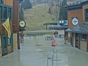
Grand Targhee Resort, Alta, Wyoming, USA
1.9°C / 35.4°F
08:53

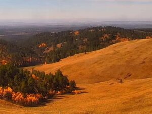
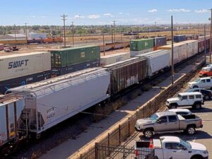

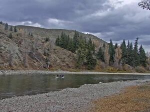
Snake River Cabins, Hoback Junction, Wyoming, USA
5.5°C / 41.9°F
08:53
Big Bear Valley Recreation and Park District, Park Avenue, Big Bear Lake, CA, USA
2.3°C / 36.1°F
07:53

Harry Reid International Airport, Paradise, Nevada, USA
14°C / 57.2°F
07:53

Amherst, Du Bois Library, Massachusetts, USA
 2.5°C / 36.5°F
10:53

Vineyard Haven, Tisbury, Massachusetts, USA
8.5°C / 47.3°F
10:53The Lava Mountain Webcam looks across a small fuel island on US Route 26 and 287 in northwestern Wyoming. Two pumps stand on a concrete apron beside a dark steel frame, and a blue snowmobile sits high on a post above a wooden sign. An American flag flies on the left and the Wyoming flag on the right, so the wind is easy to read. Behind them the highway crosses the frame, then a bank of tan grass climbs to dark conifers and a steep forested slope. Pickups pull in by day and after dark, when their headlights sweep the apron. This is a working roadside view rather than a summit panorama, and it gives a quick read on the pavement before the drive up toward Togwotee Pass.
Range, the telecom and internet provider behind this feed, titles the stream “Range Lava Mountain, WY” and does not publish an exact position. The lettering on the pumps appears to read Lava Mountain, and Lava Mountain Lodge has a gas station on site, so the map pin sits at the lodge. Treat it as a close estimate. That spot is about 30 kilometers (18 miles) northwest of Dubois in a straight line, at about 2,387 meters (7,831 feet) on a terrain model. The lodge has ten rooms in its main building, three cabins, a set of camping cabins, a campground and an RV park with full hook-ups, and it advertises winter snowmobiling straight from the room, which fits the sled on the post.
The mountain itself stands about 6.7 kilometers (4.2 miles) west-northwest of the lodge and rises to 3,176 meters (10,420 feet), roughly 789 meters (2,589 feet) above the pumps. Range does not name the slope behind the highway, so read it as a local hillside and not the summit. The U.S. Geological Survey describes Lava Mountain as about 8 kilometers (5 miles) wide and shaped like a shield volcano, with at least 20 lava flows stacked in a cliff about 230 meters (755 feet) high and a scoria cone on top. It is put at about 400,000 years old, and it erupted mostly andesite rather than basalt.
Fire is part of the recent story here. The Lava Mountain Fire of 2016 burned about 32 kilometers (20 miles) northwest of Dubois, and officials told residents from the lodge to Falls Creek Campground to be ready to leave. Pale dead trunks stand among the green trees on the slope in the frame.
Modeled 2015 to 2024 figures for the lodge’s elevation put January at -12°C to -3°C (10°F to 26°F), with December and February about the same. February is the wettest month in that record, at about 80 millimeters (3.1 inches) of precipitation. Snow can cover the gravel, the apron and the grass bank through these months, leaving the conifers and the highway as the dark shapes in the picture. Spring is slow here. April runs from -6°C to 5°C (21°F to 40°F) with about 76 millimeters (3 inches) of precipitation, so a white frame is still possible well after the calendar says otherwise.
Summer is short and mild. July runs from 7°C to 23°C (45°F to 73°F) and is the driest month, at about 38 millimeters (1.5 inches), and the bank across the road can turn green by then. October drops to -4°C to 8°C (25°F to 46°F). At the end of October 2026 the ground in frame was bare, the grass was the color of straw and one rust-colored tree stood out on the right. Togwotee Pass sits 557 meters (1,827 feet) higher up the same road, so conditions there can be much harsher than this camera shows.
Togwotee Pass is the obvious trip, a Continental Divide crossing at 2,944 meters (9,658 feet) on the highway toward Yellowstone and the Tetons. The Continental Divide Snowmobile Trail passes through the pass area, and the lodge promotes winter riding and pairs with the CD Trail Bar and Grill. Near the pass, Brooks Lake sits between Sublette Peak and the Pinnacle Buttes, whose main summit reaches 3,510 meters (11,516 feet), and Pinnacles Campground has 21 sites at about 2,804 meters (9,200 feet). Closer in, the map shows Brooks Lake Creek Falls Campground about 5 kilometers (3 miles) northwest of the lodge. Hikers can also climb Lava Mountain itself, and one hiking account puts the trailhead at 2,814 meters (9,233 feet).
Down the valley, Dubois has the National Bighorn Sheep Center, which covers wild sheep conservation, and the Dubois Museum on West Ramshorn Street, which deals with Native American history, the tie hack industry and guest ranches. The National Museum of Military Vehicles holds more than 500 vehicles. Bighorn sheep winter in Whiskey Basin on Whiskey Mountain, and the 4.3 meter (14 foot) Tie Hack Historical Monument, built in 1946, marks the logging era northwest of town.
These cameras follow the same highway corridor, over the pass and down the valley.
Lava Mountain is in Fremont County in northwestern Wyoming, about 6.7 kilometers (4.2 miles) west-northwest of Lava Mountain Lodge on US Route 26 and 287. Dubois is the nearest town, about 30 kilometers (18 miles) southeast of the lodge in a straight line.
The frame shows two fuel pumps on a concrete apron, a snowmobile mounted above a wooden sign, American and Wyoming flags, the highway and a forested slope. Vehicles stop at the pumps from time to time.
Probably not. The summit lies several kilometers from the pin at the lodge, and Range does not identify the hillside behind the highway. Treat the camera as a view of the roadside and its conditions.
Modeled figures for the lodge’s elevation put January at -12°C to -3°C (10°F to 26°F) and July at 7°C to 23°C (45°F to 73°F). The summit, about 789 meters (2,589 feet) higher, runs several degrees colder.
Yes. It is shaped like a shield volcano and is capped by a scoria cone, and it is put at about 400,000 years old. It is built from stacked lava flows, mostly andesite.
The summit reaches 3,176 meters (10,420 feet). Lava Mountain Lodge, down on the highway, sits at about 2,387 meters (7,831 feet) on a terrain model.
The Dubois tourism listing says the lodge has a gas station on site, and the pumps in this frame appear to be it. Fuel hours are not published there, so call ahead in the off season.
The lodge advertises riding from the room during its winter season, and the Continental Divide Snowmobile Trail passes through the Togwotee Pass area.
Source: Range
The best new live webcams and site features, once a week.
By subscribing you agree to receive our weekly email. Unsubscribe any time.
 5.9°C / 42.6°F
 6.9°C / 44.4°F
 8°C / 46.4°F