
Live

 17:50:55
 26.7°C / 80.1°F
 Few Clouds
 21%
 28 km/h / 17 mph
 06:58
 17:50
Loading forecast…

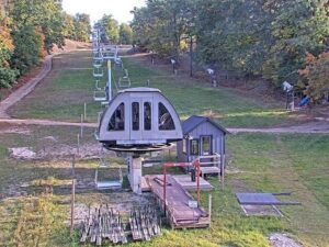
Caberfae Peaks, Caberfae Lane, Cadillac, MI, USA
 11.1°C / 52°F
20:50

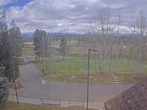
Pole Creek Golf Club, Grand County, Colorado, USA
 12.2°C / 54°F
18:50
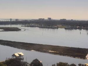

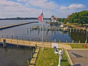


Las Olas Beach, Las Olas Circle, Fort Lauderdale, FL, USA
 23.8°C / 74.8°F
20:50


Planes on the ground and in the air within about 22 km (14 miles) of the airport, updated every 10 seconds. Tap a plane or a flight in the list for its details. Altitudes are above sea level. Positions come from volunteer ADS-B receivers, so some airports show few or no planes on the ground.
The Las Vegas Airport Webcam follows arrivals and departures on runways 26R and 26L at Harry Reid International Airport, with the south end of the Las Vegas Strip standing behind the airfield. The robotic camera locks onto aircraft automatically, so the picture swings from a jet descending out of the desert haze to its touchdown, then across to a departure lifting off in front of the Excalibur castle and the New York-New York roller coaster. A data panel in the top right corner names the aircraft being tracked, with its airline, route, ground speed, altitude and distance from the camera. This video was captured by an automatic tracking camera streaming live to the Flightradar24 YouTube channel.
Harry Reid International (LAS) is the main airport for the Las Vegas Valley, about 8 kilometers (5 miles) south of downtown Las Vegas in the unincorporated town of Paradise. It opened in January 1943 as Alamo Field, sits 665 meters (2,181 feet) above sea level, and is owned by Clark County. The Clark County Commission renamed it in December 2021 for Harry Reid, the former U.S. Senator from Nevada, retiring the old name McCarran International. Southwest Airlines is the dominant carrier, and Allegiant Air and JSX also run bases here. In 2024 a record 58.4 million passengers passed through.
There are four runways. The two on camera run east to west: 26R is 4,522 meters (14,835 feet) of concrete, the longest at the airport, and 26L is 3,208 meters (10,526 feet). Runway numbers follow compass headings, so traffic on these two is landing and taking off toward the west, at about 260 degrees. When the flow reverses, the same strips are called 8L and 8R.
The camera is an AXIS Q6358-LE run by Las Vegas Airport Live. CamStreamer’s PlaneTracker app steers it, and Flightradar24 provides the ADS-B data and the identification overlay. When the tracked aircraft is still far off, the view pulls back to wide shots across the airfield. The JSX and NetJets hangars stand across the runway, with the Luxor pyramid and the gold towers of Mandalay Bay rising behind them.
The climate figures usually quoted for Las Vegas come from the weather station at the airport itself, so the 1991 to 2020 normals describe this airfield. July averages highs of 40.3°C (104.5°F) and lows of 27.8°C (82°F), and the station set its record high of 48.9°C (120°F) on July 7, 2024. In July and August the North American Monsoon sometimes pushes thunderstorms across the valley.
Spring and autumn are the easy months. April averages 25.8°C (78.5°F) by day and 13.8°C (56.9°F) at night, and October 27.3°C (81.2°F) and 15.3°C (59.6°F). January highs reach about 14.7°C (58.5°F), with lows of 4.7°C (40.5°F) and 14 millimeters (0.56 inches) of rain. Snow that settles is rare, though moderate falls come every few years. With only 106 millimeters (4.18 inches) of rain a year and 86 percent of possible sunshine, the camera shows a hard blue sky far more often than not.
Plane spotters have a free viewing area on Sunset Road beside the east-west runways. Aircraft landing from the north on the 1/19 runways pass low over the junction of Tropicana Avenue and Paradise Road. The Welcome to Fabulous Las Vegas sign stands in the median of Las Vegas Boulevard South at the south end of the Strip. Betty Willis designed it in 1959, it is 7.6 meters (25 feet) tall, and it joined the National Register of Historic Places in 2009.
Shark Reef Aquarium at Mandalay Bay holds about 6 million liters (1.6 million gallons) of seawater and more than 2,000 animals, and the Luxor, Excalibur and New York-New York are a short walk north along the Strip from there. Across Interstate 15, Allegiant Stadium, home of the Las Vegas Raiders, runs public tours of about 75 minutes that can include the locker rooms and the field.
Three more cameras for plane spotters and Las Vegas regulars.
For the longer version, our guide to reading the airfield on this camera covers the busy blocks, the flight data overlay and what a webcam can and cannot tell you about the terminals.
Watch the camera above for a few minutes and count. It locks onto one aircraft at a time and moves straight to the next, so the pace of new registrations in the data panel is a fair gauge: back-to-back arrivals and departures mean a busy block, long pauses mean a quiet one.
Runways 26R and 26L, followed aircraft by aircraft. Arrivals appear out of the haze with mountains on the horizon and are tracked to touchdown. Departures roll past the Excalibur castle, the New York-New York roller coaster, the Luxor pyramid and Mandalay Bay, and wide shots show the open airfield.
Runways 26R and 26L, the two east-west runways, in use when aircraft land and take off toward the west. 26R is 4,522 meters (14,835 feet) long and 26L is 3,208 meters (10,526 feet). The north-south pair, 1L/19R and 1R/19L, is not this camera’s focus.
There is no single peak that holds every day, because the schedule moves with the day of the week, conventions and holiday weekends. The Flightradar24 arrivals and departures boards for LAS, linked from the stream’s description, show what is scheduled for a given day, and the camera shows it happening.
Yes. The stream runs 24 hours a day, and its own description warns that flashing aircraft and airfield lights may affect photosensitive viewers during nighttime operations. After dark the picture relies on runway and landing lights, while the data panel keeps naming each tracked aircraft.
No. The camera is mounted outdoors on a rooftop and points at the runways, so it never shows the inside of Terminal 1 or Terminal 3 or the TSA checkpoints. For checkpoint lines, check the airport’s own website before you leave.
The top left panel on the stream shows the current temperature in Fahrenheit and the wind direction and speed in miles per hour. Expect July highs around 40.3°C (104.5°F), January highs near 14.7°C (58.5°F), and sunshine on most days of the year.
Harry Reid International Airport, code LAS. The Clark County Commission renamed it in December 2021 after the former Nevada senator, replacing McCarran International Airport. The code did not change, which is why the stream still labels it LAS/KLAS.
Source: Flightradar24 and Las Vegas Airport Live
The best new live webcams and site features, once a week.
By subscribing you agree to receive our weekly email. Unsubscribe any time.
 16.2°C / 61.2°F
 22.8°C / 73°F