
Live
Las Vegas Airport, Nevada
Harry Reid International Airport, Paradise, Nevada, USA
 23.4°C / 74.1°F
 16:03
16:03 16:03:59
 20°C / 68°FClear Sky
 17%
17% 9 km/h / 6 mph
 07:08
07:08 18:22
18:22Loading forecast…
Harry Reid International Airport, Paradise, Nevada, USA
23.4°C / 74.1°F
16:03


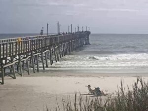
Sunset Beach, Brunswick County, North Carolina, USA
 26.9°C / 80.4°F
19:03
26.9°C / 80.4°F
19:03

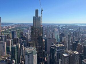
SUMMIT One Vanderbilt, East 42nd Street, New York, NY, USA
 25.4°C / 77.7°F
19:03
25.4°C / 77.7°F
19:03
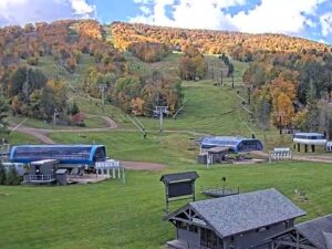
Windham Mountain, Resort Drive, Windham, NY, USA
16.1°C / 61°F
19:03
Midway Atoll, United States Minor Outlying Islands
26.9°C / 80.4°F
12:03


Mauna Kea Summit, Hawaii Island, Hawaii, USA
 2.7°C / 36.9°F
13:03
2.7°C / 36.9°F
13:03
Planes on the ground and in the air within about 22 km (14 miles) of the airport, updated every 10 seconds. Tap a plane or a flight in the list for its details. Altitudes are above sea level. Positions come from volunteer ADS-B receivers, so some airports show few or no planes on the ground.
The Reno Airport Webcam looks across Reno-Tahoe International Airport from high on the Grand Sierra Resort, about 2.9 kilometers (1.8 miles) north of the field. The camera pans, tilts and zooms on its own, locking onto whichever aircraft the tracking software has picked up, so the picture swings between one jet filling the frame and a wide shot of the whole airfield. In the wide shot the two parallel runways run across the middle, with dry brown hills closing the horizon. When the camera turns southwest instead, the antenna-topped summit of Slide Mountain and the cut ski runs of Mount Rose fill the frame. This video was captured by an automatic tracking camera streaming live to the Flightradar24 YouTube channel.
Reno-Tahoe International Airport sits 4.8 kilometers (3 miles) southeast of downtown Reno and covers 590 hectares (1,450 acres). It is high ground, at 1,346 meters (4,415 feet). Two parallel concrete runways do most of the work, 17R/35L at 3,353 meters (11,001 feet) and 17L/35R at 2,743 meters (9,000 feet), with a shorter crosswind runway cutting across them. The control tower between the parallels is 61 meters (200 feet) tall and opened in 2010, replacing one barely a third that height.
The airport opened in 1929 as Hubbard Field, built by Boeing Transport and named after air mail pioneer Eddie Hubbard. Reno bought it in 1953, and the present name arrived in 1994. Military flying shares the field: the Nevada Air National Guard’s 152nd Airlift Wing, the High Rollers, keeps eight C-130H Hercules transports on the west side.
Reno sits in the rain shadow of the Sierra Nevada, and the numbers show it. Reanalysis figures for the airport across 2016 to 2025 put July highs at 33.8 C (93 F) against lows of 17.1 C (63 F), with barely 3 millimeters of rain in the month. January is the mirror image, with highs of 6.2 C (43 F), lows of minus 2.0 C (28 F) and about 80 millimeters of precipitation.
Annual precipitation is only about 450 millimeters (17.7 inches), so most days on the Reno Airport Webcam are clear. Snow averages roughly 28 centimeters (11 inches) in January. Summer sets a different problem for pilots: heat on top of an already high field pushes density altitude well above the real elevation. Late summer can bring smoke from Sierra wildfires, and on those days the hills fade out of the picture.
The Grand Sierra Resort, 2.9 kilometers (1.8 miles) north of the airfield, opened in May 1978 as the MGM Grand Reno and still runs 1,990 rooms beside the lake in the foreground of the wide shot. The National Automobile Museum, 4.6 kilometers (2.9 miles) away, opened in 1989 around William F. Harrah’s collection, and the Nevada Museum of Art on West Liberty Street is the only accredited art museum in the state.
The Truckee River cuts through the middle of town at Wingfield Park, 5 kilometers (3.1 miles) from the airport, where a whitewater course built in 2003 drops kayakers through eleven pools. Two blocks north stands the Reno Arch on Virginia Street, installed in 1987. Mount Rose Ski Tahoe, the mountain in the camera’s other view, is 22 kilometers (13.8 miles) southwest and has the highest base elevation of any Tahoe resort at 2,520 meters (8,260 feet).
Three more to open after this one.
In Reno, Washoe County, Nevada, about 4.8 kilometers (3 miles) southeast of downtown. Incline Village on the north shore of Lake Tahoe is roughly 31 kilometers (19.5 miles) southwest.
Airliners taxiing, landing and taking off, plus the terminal aprons, the control tower and the hills of northern Nevada behind the field.
It runs CamStreamer’s PlaneTracker software on a pan-tilt-zoom camera, using Flightradar24’s ADS-B data to aim at aircraft and label them.
The field sits at 1,346 meters (4,415 feet), high enough that aircraft need extra runway to get airborne on hot afternoons.
The stream runs around the clock. After dark the picture turns into runway and taxiway lighting, strobes and landing lights.
The name was adopted in 1994 to credit both the city and Lake Tahoe. Before that it was Cannon International Airport, and before that Hubbard Field.
It handled 4,912,900 passengers in 2025, plus about 37,900 tonnes (83.6 million pounds) of cargo, second in Nevada behind Las Vegas.
Source: Flightradar24
The best new live webcams and site features, once a week.
By subscribing you agree to receive our weekly email. Unsubscribe any time.
 0.5°C / 32.9°F
 14.4°C / 57.9°F