Live

 01:44:21
 6.9°C / 44.4°F
 Clear Sky
 91%
91% 3 km/h / 2 mph
 07:38
07:38 18:12
18:12Loading forecast…


Plain, Beaver Valley, Washington, USA
2.7°C / 36.9°F
01:44
Mount St. Helens, Skamania County, Washington, USA
 0.4°C / 32.7°F
01:44
0.4°C / 32.7°F
01:44

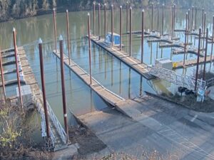
Boones Ferry Marina, Boones Ferry Crossing Northeast, Aurora, OR, USA
 12.5°C / 54.5°F
01:44
12.5°C / 54.5°F
01:44

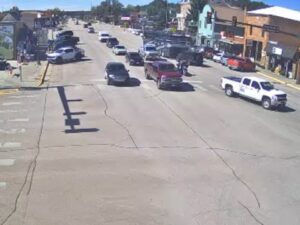


The Mason County Webcam is a network of eleven road condition cameras run by Mason County PUD No. 3 across the southern end of Hood Canal in western Washington. The main feed looks northeast over the Sand Hill Elementary ball fields in Belfair, and the tabs switch to Highway 106 at Trails End, the Tahuya fire station, downtown Shelton, Grapeview, Latimers Landing, Matlock and more. Each view is a plain look at the pavement, the verges and the sky, which is exactly what makes it useful. When a Pacific storm pushes in, the same frames show rain on the lens, standing water, frost on the shoulders or a thin layer of snow, often hours before the county has posted anything.
Mason County PUD No. 3 is the public utility district that supplies electricity across much of Mason County. Its fiber optic network supports many functions of the modern electric grid, and it also carries these camera feeds. During storms, when the PUD opens its Outage Center, staff use the cameras to watch conditions across the county, and the feeds are shared with Mason County Public Works so road crews can decide where to focus their resources. Some of the cameras are provided by Hood Canal Communications and by local fire authorities, all running over the PUD 3 fiber.
Mason County covers 2,722 square kilometers (1,051 square miles) and had 65,726 residents at the 2020 census. It was created on March 13, 1854 as Sawamish County and took its present name in 1864. Shelton is the county seat, and the downtown camera sits at 4th Street and Railroad Avenue in the middle of town. The rest of the network is spread along the rural roads that residents actually drive: Beeville Road and Matlock Brady Road at the Matlock Grange, Grapeview Loop Road at the Grapeview fire station, Mason Lake Road opposite the boat launch, North Shore Road at the Tahuya fire station, and the bridge at Schafer State Park.
The two cameras at the north end sit in Belfair, a community of 4,279 people (2020) at the mouth of the Union River where it meets Hood Canal. Belfair lies on the narrow isthmus that joins the Kitsap and Olympic Peninsulas, at an elevation of only 11 meters (36 feet). The Trails End camera looks south from the junction of Trails End Drive and State Route 106, the 32 kilometer (20 mile) highway that follows the southern shoreline of Hood Canal from US 101 at Skokomish to State Route 3 just south of Belfair. Traffic on that road grew from 2,000 vehicles a day in 1970 to 6,100 by 2007, and a second camera watches another stretch of the same South Shore route.
Mason County sits between the Olympic Mountains and Puget Sound, and it gets a lot of water. Belfair averages around 1,520 millimeters (60 inches) of rain a year, most of it between October and April. Winters are cold, wet and overcast rather than deeply frozen: January lows in Shelton average close to 1 C (34 F), so the cameras spend much of the season showing wet asphalt, low cloud and fog hanging over the tree line. Shelton averages only about 10 centimeters (4 inches) of snow a year, but that small number is the reason the network exists. A single cold night can leave inland roads icy while the waterfront stays wet, and the difference between two tabs can be the difference between an easy drive and a slow one.
Summers are short, warm, dry and partly cloudy, with July highs in Shelton around 26 C (78 F). From June to September the frames brighten and the long evenings keep the cameras in daylight well into the evening. Spring arrives slowly, and the last frost in Belfair typically comes around April 20, with a growing season of about 212 days. Autumn brings the return of the heavy rain, and after a big storm the Highway 106 cameras are worth checking for water or debris along the Hood Canal shore.
The Theler Wetlands in Belfair cover 55 hectares (135 acres) of estuary where the Union River reaches Hood Canal, with boardwalks and trails out over the marsh. Belfair is also the gateway to Tahuya State Forest, reached by State Route 300 along the north shore of Hood Canal toward Tahuya and Dewatto Bay. Heading southwest on State Route 106, the road passes Twanoh State Park and then the waterfront community of Union before curving along the Skokomish River and Annas Bay.
Shelton makes a good base for the south of the county, with Oakland Bay, Hammersley Inlet and Totten Inlet all within a short drive. Further west, part of Olympic National Park and Olympic National Forest lies inside the county, reached by roads that climb toward Lake Cushman above Hoodsport. Mason Lake has a public boat launch right beside one of the cameras, and Case Inlet runs along the east side of the county near Allyn and Grapeview.
For more views of Washington roads, passes and towns, try these next.
Mason County is in western Washington, at the southern end of Hood Canal and the southwest corner of Puget Sound. It borders Kitsap, Pierce, Thurston, Grays Harbor and Jefferson counties, and its county seat is Shelton. Belfair, home of the main camera, sits at the head of Hood Canal on State Route 3.
The main view looks northeast across the Sand Hill Elementary ball fields in Belfair. Ten more tabs cover Highway 106, Tahuya, Mason Lake, Grapeview, Latimers Landing, downtown Shelton, Hillcrest, Matlock and the Schafer State Park bridge.
Mason County PUD No. 3 runs the network over its fiber optic system. Staff watch it during storms from the PUD Outage Center, and the feeds are shared with Mason County Public Works.
Mild, wet winters and short, dry summers. January lows in Shelton are near 1 C (34 F), July highs near 26 C (78 F), and Belfair gets roughly 1,520 millimeters (60 inches) of rain a year.
Not often, but it does. Shelton averages about 10 centimeters (4 inches) of snow a year, usually in a few short events, and frost and ice on higher roads are more common than deep snow.
Open the Trails End and Highway 106 South Shore tabs on the Mason County Webcam. Together they cover the Belfair end of the 32 kilometer (20 mile) route that runs along the south shore of Hood Canal to Skokomish.
Source: PUD 3 Live Road Conditions
The best new live webcams and site features, once a week.
By subscribing you agree to receive our weekly email. Unsubscribe any time.