Live
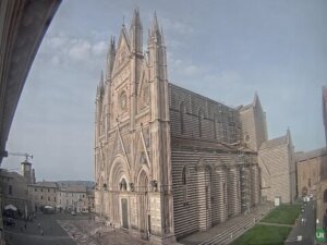
Orvieto, Italy
Orvieto Cathedral, Piazza del Duomo, Orvieto, Province of Terni, Italy
 19.1°C / 66.4°F
 00:39
00:39 00:39:31
 0.3°C / 32.5°F
 Clear Sky
 79%
79% 06:55
06:55 18:44
18:44Loading forecast…
Orvieto Cathedral, Piazza del Duomo, Orvieto, Province of Terni, Italy
19.1°C / 66.4°F
00:39
Val di Luce, Via Val di Luce, Abetone, Province of Pistoia, Italy
11.5°C / 52.7°F
00:39
Hotel Florida Lerici, Via Sebastiano Biaggini, Lerici, SP, Italy
 22.6°C / 72.7°F
00:39
22.6°C / 72.7°F
00:39


Bar Lupo Bianco, Via Brennero, Abetone, Province of Pistoia, Italy
12°C / 53.6°F
00:39
Park Hotel Brasilia, Via Levantina 2° Accesso al Mare, Jesolo, Metropolitan City of Venice, Italy
19°C / 66.2°F
00:39
Castelluccio di Norcia, Province of Perugia, Italy
10.1°C / 50.2°F
00:39



The Mount Etna Webcam looks across the largest active volcano in Europe from the lower eastern slopes, roughly 17 kilometers (10.6 miles) from the summit craters on the Sicilian coast. Snow covers the upper cone for much of the winter, and a steam plume drifts off the crater rim on almost any clear day. When the volcano is restless, the same frame carries ash columns, glowing vents after dark and lava threading into the Valle del Bove. Two feeds run here: a wide panorama of the eastern flank from Nunziata di Mascali, and a rotating multi-camera watch that cuts between closer views of the summit.
Etna rises straight off the Ionian coast in the Metropolitan City of Catania, on the eastern side of Sicily. Its highest point is the rim of the Voragine crater, and that rim keeps moving: the Southeast Crater held the record at 3,357 meters (11,014 feet) in 2021 before six paroxysms in July and August 2024 built the Voragine past it. The mountain covers about 1,190 square kilometers (459 square miles) with a basal circumference near 140 kilometers (87 miles), which is why it fills the horizon across so much of eastern Sicily.
Four craters share the summit area: the Northeast Crater, the Voragine, the Bocca Nuova and the twin cones of the Southeast Crater complex. Below them, on the eastern flank, the Valle del Bove is a vast collapse scar left when that side of the volcano gave way around 8,000 years ago, and it swallows most of what Etna erupts. In the eruption of August 2026, INGV tracked as many as nine vents between just over 3,000 meters and about 1,900 meters, and the furthest lava fronts stopped near 1,315 meters (4,314 feet) inside that uninhabited valley without reaching a village.
UNESCO inscribed Etna on the World Heritage List in June 2013, citing one of the longest documented eruptive records on earth. Sicily treats it less as a hazard than as a neighbor with a routine: towns ring the base, ash falls get swept off the streets the way snow is elsewhere, and vineyards work the black soil high on the flanks.
The camera takes in two climates at once. Down at the coast, Catania sits 7 meters (23 feet) above sea level and runs a dry Mediterranean pattern, where summer is the dry season rather than the wet one: July averages under 10 millimeters of rain, December about 78. Snow there is unheard of, partly because the bulk of Etna shelters the city from northern winds.
The mountain keeps its own winter. Snow typically covers the summit cone from November into May, and those months give the Mount Etna Webcam its sharpest picture: a white upper mountain, a dark ash-stained crater rim, and a plume that reads clearly against the sky. Ski lifts run in that season at Rifugio Sapienza on the southern side and at Piano Provenzana above Linguaglossa on the north. By midsummer the cone is back to black lava and grey ash, and haze off the Ionian Sea softens the outline through the afternoon, so mornings are the clearer watch.
The southern approach, Etna Sud, climbs from Nicolosi to Rifugio Sapienza at 1,910 meters (6,266 feet). From there the Funivia dell’Etna cable car carries visitors to 2,500 meters (8,202 feet), where guided 4×4 vehicles and a final walk continue to roughly 2,920 meters (9,580 feet) below the craters. The Silvestri Craters, cones left by the 1892 eruption, sit at the car park and can be walked without a guide. On the north side, Piano Provenzana above Linguaglossa, 16.5 kilometers (10.2 miles) from the summit, opens the upper trails in summer and a smaller ski area in winter.
Around the base, the Ferrovia Circumetnea runs 110 kilometers (68 miles) of 950 millimeter narrow gauge built between 1895 and 1898, looping almost the whole way around the volcano between Catania and Riposto via Paterno, Bronte and Randazzo. Bronte is the pistachio town, Zafferana Etnea at 12 kilometers (7.4 miles) from the summit is known for its honey, and the northern slope around Randazzo and Passopisciaro carries the Etna DOC vineyards. Taormina gives the postcard angle from the terraces of its ancient theatre, and the Alcantara Gorges cut a narrow basalt canyon through an old lava flow north of the mountain.
More cameras on active volcanoes and the towns beneath them.
On the east coast of Sicily, in the Metropolitan City of Catania, Italy. The summit stands 28 kilometers (17.5 miles) north of Catania and the same distance southwest of Taormina, with Mascali, Giarre and Riposto on the coast below its eastern flank.
The eastern side of the volcano from base to summit, with the crater rim at the top of the frame and wooded slopes and coastal towns in front of it. Steam shows on most clear days. During eruptive episodes the camera catches ash plumes, incandescence at the vents after dark and lava running into the Valle del Bove.
3,403 meters (11,165 feet) at the rim of the Voragine crater, measured by an INGV drone survey on 12 September 2024 and the greatest height ever recorded on the volcano. The figure is revised regularly, because eruptions build and collapse the summit cones year to year.
That changes week to week, which is the reason to open the Mount Etna Webcam rather than read about it. The most recent major phase ran from 6 to 21 August 2026, and INGV confirmed on 23 August that all lava flows had gone cold. Current status is published in the weekly bulletins of INGV’s Osservatorio Etneo in Catania.
Snow usually covers the summit cone from November into May while the coast below stays mild. Catania records around 500 millimeters (20 inches) of rain a year, mostly between October and February, and summer is dry at every elevation.
The cable car from Rifugio Sapienza reaches 2,500 meters, and a guided 4×4 transfer with an authorised volcanological guide continues to about 2,920 meters. How far anyone may go above that depends on the alert level, and the crater rims close outright during eruptive phases.
The summit is about 32 kilometers (20 miles) from Catania Fontanarossa, roughly an hour’s drive to the Rifugio Sapienza base station on the southern side. That proximity is why Etna’s ash clouds disrupt flights into Sicily: restrictions ran from 7 to 18 August 2026.
It was inscribed in June 2013 for its scientific value: Etna’s eruptions have been recorded for roughly 2,700 years, one of the longest continuous accounts of any volcano, and its accessible flanks helped shape volcanology and geophysics.
Source: Weather Italy – WS Cam and afarTV
The best new live webcams and site features, once a week.
By subscribing you agree to receive our weekly email. Unsubscribe any time.
 19.3°C / 66.7°F