Live

 22:31:34
 8.1°C / 46.6°F
 Broken Clouds
 81%
81% 19 km/h / 12 mph
 07:58
07:58 18:22
18:22Loading forecast…
The Portree Webcam looks south from the Isle of Skye Estate Agency’s office on Bridge Road, across Bayfield to the inner waters of Portree Bay. A road and a small car park fill the foreground. Beyond them, motorhomes line up on the grass beside tidal flats where the River Leasgeary meets the bay, a tall tree stands near the shore, and wooded slopes dotted with white houses rise on the far side of the water. The scene shifts with the tide: at low water the flats open out into channels of mud and weed, while a high tide covers much of them. Skye’s weather does the rest, with low cloud, showers and sudden breaks of light that can cross the hills in the space of an hour.
Portree is the main town on the Isle of Skye, in the Highland council area of Scotland, and had 2,281 residents at the 2022 census. Its name is usually read as “king’s port” and tied to a visit by King James V in 1540, though that story is disputed. Thomas Telford designed the pier, and the painted houses along the harbour front are the town’s best known view, although they sit out of shot to the east of this camera.
The camera is run by the Isle of Skye Estate Agency, which has offices in Portree and Kyle of Lochalsh and streams the picture from Ferguson House, its Portree base. The ground below is Bayfield, a low strip between the town centre and the shore where the River Leasgeary reaches the bay through a patch of wetland. Bayfield has designated overnight spaces for motorhomes and campervans, which is why vans so often fill the middle of the frame.
Just southeast of the camera, The Lump forms a headland on the south side of the town centre. The Apothecary’s Tower on it stands about 430 meters (1,410 feet) from the camera as the crow flies. A local doctor, Alexander Macleod, built it in the 1830s, and it was rebuilt after a storm in 1978.
Portree has a mild, wet climate shaped by the sea. Winter highs sit around 7 C (45 F) and nights stay near 3 C (37 F), while October through January are usually the wettest months of the year. In December the sun climbs only about 9 degrees above the horizon at midday and is up for roughly six and a half hours, so the flats spend the short days in low, slanting light and an afternoon visit can find the view already dark. On a showery day the far shore can disappear behind rain and come back a few minutes later.
Spring is the drier stretch, with April and May the least rainy months and highs rising from about 11 C (52 F) in April to 14 C (57 F) in May. July and August peak at around 16 to 17 C (61 to 63 F), with mild nights near 12 C (54 F). Around the June solstice the sun is up for close to 18 hours and the sky never turns fully dark, so the bay stays light late into the evening. Autumn brings the rain back and highs fall to about 12 C (54 F) in October, when the tall tree in the middle of the frame has already lost most of its leaves.
The Lump is the obvious first stop. This natural amphitheatre has hosted the Skye Highland Games since 1877, with heavy events, athletics, piping and Highland dancing each August, and steps inside the Apothecary’s Tower lead up to views south to the Cuillin and north to the Old Man of Storr. From the harbour, boat trips head out for wildlife watching, fishing and the island of Rona. The Scorrybreac path, a walk of about 3.2 kilometers (2 miles), follows the shore of Portree Bay before climbing through woodland, and passes Battery Point, where a gun emplacement guarded Loch Portree during the Napoleonic Wars.
North of town, The Storr rises to 719 meters (2,359 feet), and its pinnacle, the Old Man of Storr, stands about 50 meters (164 feet) tall. The path up starts from the A855 just north of Loch Leathan and runs about 5 kilometers (3 miles) there and back, which takes around three hours. Bride’s Veil Falls, a cascade beside the same road between Loch Fada and Loch Leathan, makes an easy stop on the way. On a wet day, the Isle of Skye Candle Co. Visitor Centre fills the former Aros Centre, and Isle of Skye Distillers makes gin and vodka in the town.
More cameras from the Hebrides and the Highlands:
Portree is on the Isle of Skye in the Highland council area of Scotland, United Kingdom. The camera sits on Bridge Road, a couple of minutes’ walk from Somerled Square in the town centre.
The camera faces roughly south over Bayfield: a road and car park in the foreground, motorhomes on the grass beyond, then the tidal flats where the River Leasgeary enters the bay, and wooded slopes with houses across the water.
Mild and wet for most of the year. Highs run from about 7 C (45 F) in winter to 16 to 17 C (61 to 63 F) in July and August, and October through January bring the most rain. April and May tend to be the driest months.
The live player on the estate agency’s site pauses itself after ten minutes, and also when you switch to another browser tab. Press the play button in the middle of the picture to pick up the live view again. If the button stops responding, reloading the page starts a fresh session.
No. The painted houses and Telford’s pier are on the harbour front east of Bayfield, out of the camera’s view. For a look over the whole bay, climb the steps of the Apothecary’s Tower on The Lump.
Each August, on The Lump, a short walk from the camera. The games have been held there since 1877 and include heavy events, athletics, piping and Highland dancing.
By road, cross the toll-free Skye Bridge and follow the A87. Bus 917 runs from Inverness in about three and a half hours, and Citylink coaches from Glasgow take around eight hours.
It is usually translated as “king’s port”, after the 1540 visit of King James V, but that origin is disputed. An older form of the name, Port Ruighe, means “slope harbour”, and before the 16th century the settlement was called Kiltaraglen.
Source: The Isle of Skye Estate Agency
The best new live webcams and site features, once a week.
By subscribing you agree to receive our weekly email. Unsubscribe any time.
 9.5°C / 49.1°F
 9.1°C / 48.4°F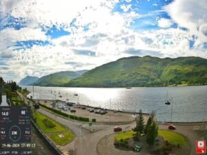
 9.7°C / 49.5°F
 9.7°C / 49.5°F