Live

 23:19:02
 3.3°C / 37.9°F
 Clear Sky
 90%
90% 2 km/h / 1 mph
 07:48
07:48 18:09
18:09Loading forecast…
The Port Edgar Webcam looks out from the marina at South Queensferry, on the south shore of the Firth of Forth, across rows of yachts and motor cruisers to the Queensferry Crossing. The bridge’s cable-stayed towers rise through the upper half of the frame, its approach viaduct runs off to the left above a stone breakwater, and a long timber pier lines the right side of the basin. On a calm day the water between the pontoons holds sharp reflections of masts and clouds. On summer weekends dinghies and yachts can be seen heading out past the pier, while short winter days bring low, raking light across the moorings and the bridge deck.
Port Edgar sits immediately west of the Forth Road Bridge and the town of South Queensferry, about 14 kilometers (9 miles) west-northwest of Edinburgh city centre and inside the City of Edinburgh council area. A pier was built here in 1810, and the harbour worked as a fishing and ferry port. The name is said to come from Edgar Aetheling, who is supposed to have landed here in 1068 while fleeing the Normans. A railhead followed in 1869 to serve a rail and ferry crossing, which the opening of the Forth Bridge in 1890 made redundant.
The Royal Navy shaped most of what the camera shows. The Admiralty acquired the harbour in 1916, the year wounded sailors from the Battle of Jutland were landed at its pier, and in 1917 it was named HMS Columbine, a destroyer base. It reopened in 1939 as HMS Lochinvar, training crews in minesweeping, and from 1943 it served as a Combined Operations training centre preparing landing craft crews for D-Day. The Navy left in 1975 and moved its work across the Forth to Rosyth. In 1978 Lothian Regional Council turned the site into a marina and sailing school, Edinburgh Leisure ran it until 2014, and Port Edgar Holdings Ltd has owned it since. The marina now holds around 300 berths.
The bridge in the Port Edgar Webcam frame is the Queensferry Crossing, opened on 30 August 2017. It is a three-tower cable-stayed bridge 2.7 kilometers (1.7 miles) long, and its towers stand 207 meters (679 feet) high, which makes it the tallest bridge in the UK. With the Forth Road Bridge of 1964 and the Forth Bridge of 1890 beside it, this is the only place in the world where three bridges built in three different centuries carry traffic over the same stretch of water.
Port Edgar shares Edinburgh’s mild, damp maritime climate. At the Met Office station at Gogarbank, on the western edge of the city, January averages a high of 6.9 C (44 F) and a low of 1.5 C (35 F), so frost on the pontoons is possible on clear winter mornings. Around the December solstice the sun is up for only about 7 hours. April highs average 12.0 C (54 F) as the sailing season gets going, and by October they are back to 13.2 C (56 F).
Summer is cool by most standards. July averages a high of 19.4 C (67 F) and a low of 11.0 C (52 F), and close to 17.6 hours of daylight around midsummer means the towers of the Queensferry Crossing stay lit well into the evening. Rain falls in every season, adding up to about 784 millimeters (30.9 inches) a year, against roughly 1,363 hours of sunshine.
The marina is a working watersports base. Edinburgh Watersports, an RYA recognised training centre, runs dinghy sailing, keelboat sailing, sea kayaking and stand up paddleboarding, and Port Edgar Yacht Club organises racing and cruising for yachts and dinghies. Edinburgh Boat Charters offers skippered sailing trips on the Firth of Forth. For food, the Forth Bridges trail lists Down the Hatch, Scotts and Outboard inside the marina, and it marks the Forth Bridges Viewpoint close by and The Binks in South Queensferry, about 0.8 kilometers (0.5 miles) away along Shore Road.
South Queensferry, home to 10,216 people at the 2022 census, starts just east of the marina. St Mary’s Episcopal Church, known as the Priory Church, was built in the 1450s for Carmelite friars and is the only medieval Carmelite church still in use in the British Isles. Under the south end of the Forth Bridge, the 17th century Hawes Inn appears in Robert Louis Stevenson’s 1886 novel Kidnapped, and the old ferry pier opposite is now used by tourist boats, including the ferry to Inchcolm. Two stately homes sit about 3 kilometers (2 miles) either side of the town: Hopetoun House to the west, home of the Earls of Hopetoun since 1699, and Dalmeny House to the east, built in 1817 for the Earls of Rosebery. The town’s Ferry Fair also brings out the Burry Man, a figure covered in burdock burrs, in a procession more than three hundred years old.
These cameras stay close to Edinburgh or look at harbours and big bridges elsewhere.
Port Edgar is on the south shore of the Firth of Forth at the western end of South Queensferry, in the City of Edinburgh council area of Scotland. It lies about 14 kilometers (9 miles) west-northwest of Edinburgh city centre, immediately west of the Forth Road Bridge.
The camera looks over the marina’s pontoons and moored yachts and motor boats toward the Queensferry Crossing, with the bridge’s towers and approach viaduct across the top of the frame, a timber pier on the right and the Fife shore in the distance. A date and time stamp sits in the top left corner.
It is the Queensferry Crossing, the three-tower cable-stayed road bridge that opened in August 2017. Its towers are 207 meters (679 feet) high, the tallest of any bridge in the UK.
Yes. The Queensferry Crossing, the Forth Road Bridge of 1964 beside the harbour and the Forth Bridge of 1890 further east are all visible from the marina, though the webcam points at the Queensferry Crossing.
Mild and changeable. January highs average 6.9 C (44 F) and July highs 19.4 C (67 F), with about 784 millimeters (30.9 inches) of rain a year spread across every season.
Yes. Edinburgh Watersports runs dinghy and keelboat sailing, sea kayaking and stand up paddleboarding at the marina as an RYA recognised training centre, and Port Edgar Yacht Club holds racing and cruising events for members.
Bus 43 runs between Edinburgh and Queensferry by way of Craigleith, Blackhall and Dalmeny. By train, ScotRail’s Fife Circle services stop at Dalmeny station on the east side of South Queensferry, a walk through the town from the marina.
Source: Port Edgar Marina
The best new live webcams and site features, once a week.
By subscribing you agree to receive our weekly email. Unsubscribe any time.
 4.2°C / 39.6°F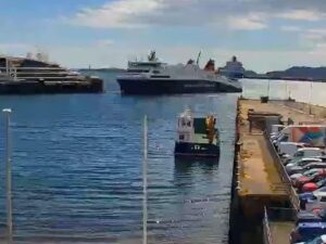
 7.7°C / 45.9°F
 4.1°C / 39.4°F