Live
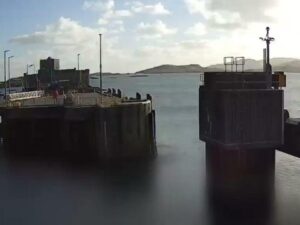
Baleshare Causeway, North Uist, Scotland
Baleshare, North Uist, Outer Hebrides, Scotland
 10°C / 50°F
 19:53
19:53 19:53:33
 7.2°C / 45°F
 Scattered Clouds
 81%
81% 9 km/h / 6 mph
 08:02
08:02 18:18
18:18Loading forecast…
The Braighe Webcam looks east along the narrow isthmus that carries the A866 from the villages east of Stornoway out to Point, on the Isle of Lewis in the Outer Hebrides. From the Branahuie end, the wide camera follows a curving concrete sea wall above a pebble beach, with open water to the right and the houses of Point strung along the far shore. Comhairle nan Eilean Siar, the Western Isles council, runs the camera so the road can be watched in bad weather, and bad weather is when the view earns its place. On a calm day the tide laps quietly at the shingle. When a winter gale lines up with a high tide, waves break against the wall and can throw spray and stones across the only road onto the peninsula.
The Braighe is an isthmus about 1.6 kilometers (1 mile) long and, at its narrowest, barely 100 meters (330 feet) wide. It ties the Eye Peninsula, known locally as Point, to the villages of Branahuie and Melbost and the rest of Lewis. Point runs some 11 kilometers (7 miles) from end to end and holds about 17 villages and hamlets, and the road across the Braighe is the only one linking them to Stornoway, about 5 kilometers (3 miles) to the west.
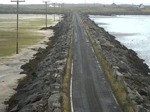
Two beaches line the isthmus. North of the road is a sandy beach, the more sheltered of the pair and the one people use for walks, reached from a small car park about halfway along. South of the road is the pebble beach that fills most of this frame, backed by the long concrete sea wall that protects the carriageway. Stornoway Airport sits beside Melbost, close to the western end of the Braighe.
The live stream puts the council’s two cameras side by side. The wide camera on the left looks east down the length of the isthmus toward Aignish. The close camera on the right frames the sea wall and shingle at short range, with the road and grass verge behind them. The council also posts still images from both cameras every 15 minutes on its road monitoring page.
Storms are what the Braighe is known for on the island. The road is sometimes closed for short periods in winter when a strong gale coincides with high tide, because that combination sends waves over the wall and throws shingle from the beach onto the tarmac. In one storm reported by the Press and Journal, the road was clear at the scheduled high tide, but a surge driven by strong south westerly winds sent breaking waves over cars and buses about an hour later.
The nearest weather station is at Stornoway Airport, just west of the isthmus, and its averages describe a mild, wet climate with small swings between the seasons. January afternoons average 7.5 C (46 F), with nights around 2.7 C (37 F). April warms only to 10.4 C (51 F) by day. July brings an average high of 16.3 C (61 F) and a low of 10.8 C (51 F), and October still manages 12 C (54 F) in the afternoons. Rain falls in every month, about 1,235 millimeters (49 inches) of it a year, against roughly 1,256 hours of sunshine.
Winter is the season to watch. The closures come when a strong gale meets a high tide, and on those days the camera can show white water rolling along the wall while the road behind it empties. Summer brings calmer water and very long evenings: at 58 degrees north the sun is up for close to 18 hours around the June solstice, so the view stays lit late into the night. In late December daylight shrinks to under 7 hours, and the frame spends most of the day in darkness or low, grey light.
The sandy north beach is the easiest walk, starting from the small car park about halfway along the Braighe road. At the east end of that beach stand the ruins of Eaglais na h-Aoidhe, the Eye Church dedicated to St Columba. It was the principal church of medieval Lewis, probably built in the later 14th century by the MacLeods as their religious centre, and 19 MacLeod chiefs of Lewis are buried in its graveyard. Close by is the memorial to the Aignish Riots of 1888, part of the crofters’ long struggle for land. Both can be reached on foot from the beach or from a car park at the north east end of the isthmus.
Beyond the Braighe, the road carries on through the villages of Point to Tiumpan Head at the far eastern tip of the peninsula. The headland has a lighthouse and is widely rated one of the best places in the UK to watch whales from land. In the other direction, Stornoway is about 5 kilometers (3 miles) west, with its harbour, ferry terminal, shops and places to stay.
More cameras from the Outer Hebrides, including the council’s other causeway view:
The Braighe is on the Isle of Lewis in the Outer Hebrides of Scotland, about 5 kilometers (3 miles) east of Stornoway. It is the narrow neck of land between the villages of Branahuie and Melbost and the Point peninsula, crossed by the A866.
The stream shows two council cameras side by side. The wide view looks east along the sea wall and pebble beach toward the houses of Point, and the close view frames the wall, the shingle and the road behind it. In a gale at high tide it can show waves breaking over the wall.
Mild, wet and often windy. Stornoway Airport averages 7.5 C (46 F) on January afternoons and 16.3 C (61 F) in July, with about 1,235 millimeters (49 inches) of rain a year. Winter gales at high tide are the main hazard on the road.
It is sometimes closed for short periods in winter when a strong gale coincides with high tide. Waves then come over the sea wall and throw shingle from the beach onto the carriageway, and the road reopens once the weather eases and it has been cleared.
There are two. A sandy beach runs along the north side of the road, more sheltered and good for walks, with a small car park about halfway along. The pebble beach on the south side is the one in front of the camera.
Comhairle nan Eilean Siar, the council for the Western Isles. It streams both cameras live on YouTube and posts still images from them every 15 minutes on its road monitoring cameras page, alongside cameras at Barvas, Clisham, Castlebay, Baleshare and Drimore.
Source: Comhairle nan Eilean Siar
The best new live webcams and site features, once a week.
By subscribing you agree to receive our weekly email. Unsubscribe any time.
 9.8°C / 49.6°F
 8.2°C / 46.8°F