Live

 13:08:02
 6.2°C / 43.2°F
 Clear Sky
 60%
60% 12 km/h / 7 mph
 07:52
07:52 17:32
17:32Loading forecast…
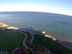
The Angoon Webcam looks out from the Kootz Raven-Beaver Building over the shoreline of Angoon, the only permanent community on Admiralty Island in Southeast Alaska. A gravel and sand beach runs along the left of the frame, a timber pier on pilings stands off to the right, and between them the water of Chatham Strait opens toward a low mountain ridge on the far shore. The tide does most of the work here. The beach widens and narrows through the day, skiffs come and go from the pier, and the strait turns from flat silver to whitecaps when the wind funnels along it. Eagles and ravens work the shoreline year round, and in the warmer months whales and sea lions pass further out.
The village sits on a low isthmus at the mouth of Kootznahoo Inlet, on the eastern shore of Chatham Strait and the west coast of Admiralty Island. It stands about 7 meters (23 feet) above sea level and covers 63.5 square kilometers (24.5 square miles) of land. Juneau lies roughly 97 kilometers (60 miles) to the northeast and Petersburg about 124 kilometers (77 miles) to the southeast, and no road runs to either one. The 2020 census counted 357 residents, down from 459 in 2010.
This is a Tlingit place first and foremost. Admiralty Island is Xootsnoowu in Tlingit, usually translated as fortress of brown bears, and the Kootznoowoo Tlingit take their name from it. The island carries an estimated 1,600 brown bears, the highest density anywhere in North America, and most of its land is protected as the Kootznoowoo Wilderness inside Admiralty Island National Monument, administered by the Tongass National Forest. In October 1882 the village was destroyed in the Angoon Bombardment by United States naval forces, an event the community still marks. Angoon incorporated as a city on May 7, 1963.
The water on screen is worth knowing by name. Chatham Strait runs between 5 and 16 kilometers (3 and 10 miles) wide and separates Admiralty and Kuiu islands from Chichagof and Baranof to the west, which is the ridgeline visible on a clear day. Behind the village, out of shot, Kootznahoo Inlet breaks into narrow passages, lagoons and bays, and the tidal currents through those narrows run hard enough that boaters time their trips to the tide rather than the clock.
Winters are wet and comparatively mild for Alaska. January averages run from about -5 to 0 C (24 to 32 F), so the camera more often shows rain and low cloud sitting on the far ridge than deep snow, though the village receives around 155 centimeters (61 inches) of snow in an average year. Total precipitation reaches roughly 1,100 millimeters (42 inches), which is modest by Southeast Alaska standards because Admiralty Island’s own mountains take some of the weather out of the air before it arrives. Spring arrives slowly, with April running about 1 to 8 C (34 to 47 F) and the light returning fast.
Summer is the season the view is at its best. July averages sit between 10 and 17 C (50 to 62 F), the brush in the foreground greens up, and long northern evenings keep the strait lit well past a southern bedtime. Fog is common on calm mornings and often burns back by midday. October cools to about 4 to 9 C (39 to 48 F) and brings the autumn gales, when the strait acts as a wind tunnel and the water goes short and steep. The Angoon Webcam runs grey through much of the shoulder season, then turns sharp and clear when a high pressure system settles in.
Admiralty Island is the draw. The Cross Admiralty Canoe Route links Angoon with Seymour Canal by about 51 kilometers (32 miles) of lakes, portages and connecting water, and it is the classic multi-day trip out of the village. On the far side of the island, the Pack Creek Bear Viewing Area puts visitors within sight of brown bears fishing the creek during the permit season, reached by floatplane or boat rather than by trail. Charter operators based in town run halibut and salmon trips into the strait, and kayakers use Angoon as the jumping off point for Mitchell Bay and the inlet behind it.
In the village itself, Beavertail Road passes traditional clan houses and totems and gives a sense of how the community is laid out across the isthmus. The floatplane dock is about 400 meters (a quarter mile) from the center of town, and the Alaska Marine Highway ferry terminal sits at Killisnoo Harbor roughly 5 kilometers (3 miles) to the south. Shore watching costs nothing at all: humpback whales, orcas, Steller sea lions, sea otters and harbor porpoises all use Chatham Strait, and bald eagles are a constant along this beach.
Other live views from around Alaska, including the second camera run by the same village corporation.
Angoon is on the west coast of Admiralty Island in Southeast Alaska, on an isthmus at the mouth of Kootznahoo Inlet where it meets Chatham Strait. Juneau is about 97 kilometers (60 miles) to the northeast and Petersburg about 124 kilometers (77 miles) to the southeast. There is no road to either.
The camera frames a beach, a timber pier on pilings and the open water of Chatham Strait, with the mountains of the far shore on the horizon. Boat traffic, tidal range and shoreline birds are the things that change most through the day.
Cool and wet most of the year. January averages about -5 to 0 C (24 to 32 F) and July about 10 to 17 C (50 to 62 F), with roughly 1,100 millimeters (42 inches) of precipitation and 155 centimeters (61 inches) of snow annually.
By air or water only. Floatplanes use a dock about 400 meters (a quarter mile) from the center of town, and Alaska Marine Highway ferries call at a state terminal at Killisnoo Harbor roughly 5 kilometers (3 miles) south of the village.
The 2020 census recorded 357 residents, compared with 459 in 2010. It is the only permanent community on Admiralty Island.
The Tlingit name Xootsnoowu translates roughly as fortress of brown bears. The island supports an estimated 1,600 of them, the highest density in North America, and most of its area is protected as the Kootznoowoo Wilderness within Admiralty Island National Monument.
Chatham Strait is used by humpback whales, orcas, Steller sea lions, sea otters and harbor porpoises, and all of them can pass within sight of the shore. Sightings are a matter of luck and season rather than something the Angoon Webcam can promise on any given day.
Source: Kootznoowoo, Inc.
The best new live webcams and site features, once a week.
By subscribing you agree to receive our weekly email. Unsubscribe any time.
 3.7°C / 38.7°F
 4.4°C / 39.9°F

 27.7°C / 81.9°F