Live

 09:07:55
 0.2°C / 32.4°F
 Overcast Clouds
 65%
65% 3 km/h / 2 mph
 09:08
09:08 18:53
18:53Loading forecast…

Atlantic City, Absecon Island, New Jersey, USA
14.6°C / 58.3°F
13:07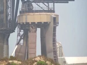
SpaceX Launch Facility, Boca Chica Boulevard, Brownsville, TX, USA
 27.3°C / 81.1°F
12:07
27.3°C / 81.1°F
12:07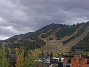
Snow King Mountain, Jackson Hole, Wyoming, USA
5.1°C / 41.2°F
11:07
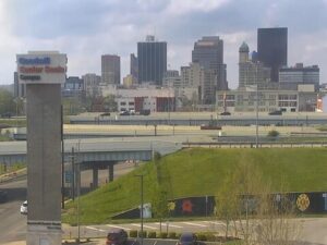
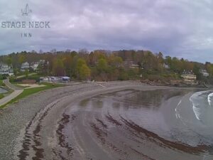



Barnstable Harbor, Cape Cod, Massachusetts, USA
 10.7°C / 51.3°F
13:07
10.7°C / 51.3°F
13:07
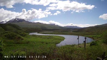
The Frazer Lake Webcam looks across the Dog Salmon River a short way below the outlet of Frazer Lake, deep inside Kodiak National Wildlife Refuge in southwest Alaska. The river fills the middle of the frame, bending through low green tundra and thickets of alder and salmonberry, with rounded hills and a ridge of cloud-capped mountains behind it. A weather mast stands on the near bank, which is the reason the camera is here: it tracks cloud ceiling and visibility for the floatplane pilots who fly into this valley. There is no road in. The city of Kodiak lies 113 kilometers (70 miles) to the northeast, so the light, the cloud base and the water are what change on screen.
Frazer Lake is the second largest lake on Kodiak Island. It runs about 14 kilometers (9 miles) long, reaches roughly 1.6 kilometers (1 mile) across at its widest, and drops to 63 meters (208 feet) at its deepest point. The lake drains southeast through Dog Salmon Creek, which is more commonly called the Dog Salmon River, and empties into Olga Bay on the island’s south coast. The camera sits on refuge land above that outlet, so the water crossing the frame is Frazer Lake on its way to the sea.
For most of its existence the lake held no sea-run fish at all. A waterfall roughly 10 meters (33 feet) high on the outlet river blocked anything trying to swim upstream. In 1951 the Alaska Department of Fish and Game began a stocking project, and in 1962 a fish pass was built around the falls: a diversion weir plus an Alaska steeppass fishway, with a ladder about 61 meters (200 feet) long. Salmon have climbed past the barrier under their own power ever since.
The result is one of the most successful introduced salmon runs anywhere. Sockeye returns to Frazer have exceeded a million fish in recent years, counted through the Dog Salmon Creek weir to set the commercial fishery in the Alitak District and feeding harvests in Olga, Moser and Alitak Bays. The run also handed Kodiak brown bears a reliable summer food source, and bear density around the lake and the fish pass rose with it.
Kodiak Island has a maritime climate governed by the Gulf of Alaska, which keeps the extremes off both ends of the year. Winter temperatures typically sit between -4 and 1 C (25 to 35 F), so the valley spends much of the cold season somewhere between rain and wet snow rather than locked in hard frost. Summer is cool, generally 10 to 15 C (50 to 60 F), and that is when the tundra in the foreground turns the deep green the camera shows through July and August. Precipitation is frequent year round and heaviest through fall and winter, which is what keeps the vegetation this dense at high latitude.
Cloud is the real subject on many days. Ceilings here can drop onto the ridge line and lift again within an hour, and the far mountains often disappear entirely while the river stays clear. Fog, mist and passing rain bands move through the frame regularly, and after heavy rain the river runs higher and browner. Southwest Alaska gets long daylight in June and July and short, dim days around the winter solstice, so the usable picture shrinks to a few hours in midwinter. That volatility is why a weather camera sits here: pilots flying the 50 minute floatplane hop from Kodiak need to know whether the valley is open before they commit to it.
The reason most people come here is the bears. At the Frazer fish pass, brown bears gather at the falls to take sockeye as the fish stack up below the ladder, and the refuge has built a viewing area roughly 46 meters (50 yards) from where they fish. The refuge and the Alaska Department of Fish and Game have laid out trails, food storage lockers and signage marking where public access is allowed, which is what makes an unguided visit workable at a site with this many bears. The published bear viewing season runs June 6 to August 28, and at the height of the run five to ten bears working the falls at once is normal.
Getting there means flying. Permitted air transporters run floatplanes from Kodiak, about 50 minutes each way, with Kingfisher Aviation, Andrew Airways and Island Air Service among the operators serving the site. From the landing it is a walk of about 1.2 kilometers (three quarters of a mile) over uneven ground to reach the river. Zachar Bay Lodge and Kodiak Legends Lodge both use Frazer as a day trip destination for guests. Back in town, the Kodiak National Wildlife Refuge Visitor Center is the place to start, and purchases at its Alaska Geographic store fund refuge projects like this camera.
If this stretch of Alaska holds your attention, these cameras cover comparable ground.
Frazer Lake is in the southwest corner of Kodiak Island, Alaska, inside Kodiak National Wildlife Refuge. It lies about 113 kilometers (70 miles) southwest of the city of Kodiak, and it drains into Olga Bay through Dog Salmon Creek.
The camera looks across the Dog Salmon River below the lake outlet, taking in low tundra and alder thickets, the surrounding hills and the mountain ridge beyond. Cloud, fog and rain moving through the valley are a constant part of the picture.
Cool and wet. Winters average roughly -4 to 1 C (25 to 35 F) and summers 10 to 15 C (50 to 60 F), with frequent rain year round and the heaviest precipitation in fall and winter. The Gulf of Alaska keeps temperatures moderate but the cloud ceiling unpredictable.
Sockeye return through the summer, moving up the Dog Salmon River and through the fish pass into the lake. Recent annual runs have exceeded one million fish.
Kodiak brown bears concentrate at the fish pass falls while salmon are running, and the refuge maintains a viewing area for that. The falls are not in this camera’s frame, so the stream shows the valley and its weather rather than the bears themselves.
By floatplane only. Permitted air transporters fly from Kodiak in about 50 minutes, and from the landing it is roughly 1.2 kilometers (three quarters of a mile) on foot to the river. There is no road access to the site.
The camera is a U.S. Fish and Wildlife Service project at Kodiak National Wildlife Refuge, funded through Alaska Geographic and streamed by HDOnTap. It was installed as a weather camera, tracking cloud ceiling and visibility for pilots flying into the area.
Source: HDOnTap
The best new live webcams and site features, once a week.
By subscribing you agree to receive our weekly email. Unsubscribe any time.