
 English
 简体中文
 Deutsch
 Français
 Español
 Nederlands
 Svenska
 Italiano
 日本語
 Polski
 Português
 Русский
 Ελληνικά
 العربية
 Türkçe

Live
 09:15:29
 6°C / 42.8°F
 Light Rain
 87%
 7 km/h / 4 mph
 07:14
 16:15
Loading forecast…

Raspberry Island, Kodiak Archipelago, Alaska, USA
 5.4°C / 41.7°F
09:15



Boyne Falls, Charlevoix County, Michigan, USA
19.7°C / 67.5°F
13:15
Shenandoah Junction, Jefferson County, West Virginia, USA
 19.1°C / 66.4°F
13:15


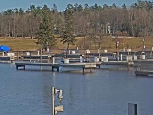
Madeline Island Yacht Club Inc., Fort Road, La Pointe, WI, USA
 12.9°C / 55.2°F
12:15
The Sitka Webcam looks over Crescent Harbor and Crescent Bay from downtown Sitka, a fishing town in southeast Alaska. Harrigan Centennial Hall, the long timber civic building on Harbor Drive, fills the middle of the frame, with its parking lot and flagpoles in front. Fishing boats crowd the harbor floats on the left, behind a rock breakwater. Past the roofline the bay opens out to wooded islands and a row of mountains that often disappear into low cloud. EarthCam runs the stream and pitches it on the fishing, inviting you to look for anyone working the bay.
Sitka sits on the west side of Baranof Island and has no road link to the rest of Alaska, so everything and everyone arrives by boat or plane. The 2020 census counted 8,458 residents, spread across 7,433 square kilometers (2,870 square miles) of land, which makes it the largest city by total area in the United States. Its listed elevation is just 8 meters (26 feet).
The working harbor on the left of the picture is central to the town’s economy. More people here work in the seafood industry than in any other sector, about 18 percent of residents earn at least part of their income from fishing, harvesting or processing, and Sitka ranks as the sixth largest port in the country by value of seafood harvest. Larger vessels can anchor out in Crescent Bay and send passengers ashore by tender.
Harrigan Centennial Hall went up in 1967 for the centennial of the Alaska transfer, and it closed for a major renovation in July 2015. Today the 2,970 square meter (32,000 square foot) building serves as the town’s civic, convention and visitor center, and it houses the Sitka History Museum. In summer it doubles as a cruise shuttle drop-off. The Battle of Sitka took place in October 1804, and the ceremony that transferred Alaska from Russia to the United States was held here on October 18, 1867.
Sitka has a mild, very wet oceanic climate. January runs from 0.2°C to 4.7°C (32.4°F to 40.5°F), and about 82 centimeters (32.3 inches) of snow falls across a typical year. April warms only slowly, from 2.9°C to 8.9°C (37.2°F to 48.1°F). July reaches 11.4°C to 15.8°C (52.5°F to 60.4°F). The airport record high is just 31°C (88°F), and the record low is -18°C (-1°F).
The airport normals show 2,146 millimeters (84.47 inches) of precipitation a year, and October is the wettest month at 299 millimeters (11.78 inches), with temperatures of 5.5°C to 10.4°C (41.9°F to 50.8°F). That is when the picture is most likely to show wet pavement and mountains fading into cloud, while the small trees around the hall can turn orange. Daylight swings widely at this latitude, from roughly 18 hours in late June to under 7 hours in December.
Several of Alaska’s oldest landmarks are a short walk from the hall. The Russian Bishop’s House, a log building from 1841 to 1843 at Lincoln and Monastery Streets, is one of the oldest surviving structures of Russian America and is now run by the National Park Service as part of Sitka National Historical Park. The park commemorates both Tlingit and Russian history. St. Michael’s Cathedral stands on Lincoln Street at Maksoutoff Street, on the site of the earliest Orthodox cathedral in the New World, whose original building burned in 1966. Baranof Castle Hill stands close to the John O’Connell Bridge, the 383 meter (1,255 foot) cable-stayed span that links town to Japonski Island and the airport.
Wildlife is the other big draw. The Alaska Raptor Center is a nonprofit rehabilitation center on a 17 acre (7 hectare) campus beside the Indian River and the Tongass National Forest, with daily tours. Fortress of the Bear, a nonprofit refuge and education center founded in 2003, is at Gary Paxton Industrial Park, the former Sitka Pulp Mill site. Out in Sitka Sound, St. Lazaria Island is a protected seabird nesting colony 32 kilometers (20 miles) west of town, just south of Kruzof Island, where Mount Edgecumbe, a dormant volcano about 980 meters (3,200 feet) high, rises 24 kilometers (15 miles) west of Sitka.
These cams stay with southeast Alaska or with working harbors elsewhere on the coast.
Sitka is on the west side of Baranof Island in southeast Alaska. The camera looks over its downtown waterfront, at Harrigan Centennial Hall on Harbor Drive.
Harrigan Centennial Hall and its parking lot fill the foreground, with Crescent Harbor’s boats and breakwater on the left. Behind them, Crescent Bay runs out to wooded islands and mountains, and a small wooded point with a house closes off the right side.
Cool and wet for most of the year. Average temperatures run from 0.2°C to 4.7°C (32.4°F to 40.5°F) in January and from 11.4°C to 15.8°C (52.5°F to 60.4°F) in July, with 2,146 millimeters (84.47 inches) of precipitation a year.
No. Sitka has no road connection to the rest of Alaska, so visitors reach it by boat or plane. The airport is on Japonski Island, joined to town by the John O’Connell Bridge.
Commercial and recreational fishing, its Russian colonial history and its Tlingit heritage. It ranks sixth among US ports by value of seafood harvest, and it hosted the 1867 ceremony that transferred Alaska to the United States.
That is Harrigan Centennial Hall, built in 1967 at 330 Harbor Drive. It works as the town’s civic, convention and visitor center and also houses the Sitka History Museum.
Roughly 18 hours around the June solstice and under 7 hours around the December solstice. The picture on the Sitka Webcam goes dark overnight and returns with the morning light.
Source: EarthCam
The best new live webcams and site features, once a week.
By subscribing you agree to receive our weekly email. Unsubscribe any time.
 28.6°C / 83.5°F
 23.9°C / 75°F