
Live

 17:21:15
 27.7°C / 81.9°F
 Few Clouds
 55%
55% 14 km/h / 9 mph
 07:34
07:34 18:56
18:56Loading forecast…

Port Everglades, Eller Drive, Fort Lauderdale, FL, USA
 27.3°C / 81.1°F
17:21
27.3°C / 81.1°F
17:21

St. Augustine, Anastasia Island, Florida, USA
 23.8°C / 74.8°F
17:21
23.8°C / 74.8°F
17:21

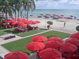

2100 NW 42nd Ave, Miami, FL, United States
28.7°C / 83.7°F
17:21
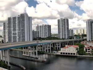


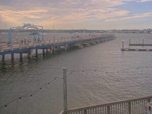

The Bimini Bay Webcam looks out across a sheltered saltwater bay at the north end of Anna Maria Island, on Florida’s Gulf coast. The frame is mostly water. A center console boat sits high on a lift at the left edge, a concrete seawall and a short dock run along the bottom of the picture, and palm fronds lean in from the right. On the far shore, low houses and private docks stand under a line of palms and pines. Small boats idle through the middle of the bay, wading birds work the shallows along the seawall, and the light changes through the day from hard midday glare on the water to a flatter gold in the late afternoon.
Bimini Bay is a protected inlet on the bay side of Anna Maria Island, inside the city of Anna Maria. That city is the northernmost of the three municipalities on the island, with Holmes Beach in the middle and Bradenton Beach to the south, all of them in Manatee County. The island itself runs about 11 kilometers (7 miles) north to south. The Gulf of Mexico is on its west side, Anna Maria Sound on the east, Tampa Bay off the northern tip, and Longboat Pass at the southern end, separating the island from Longboat Key. This camera points away from the Gulf surf and onto the quieter water behind the island.
Anna Maria is small even by barrier island standards. The city covers 2.23 square kilometers (0.86 square miles) in total, of which only 1.92 square kilometers (0.74 square miles) is land, with the remaining 14.53 percent open water. Its population was 968 at the 2020 census, down from 1,503 ten years earlier. The average elevation is roughly 0.9 meters (3 feet) above sea level, which explains the seawall running along the bottom of the frame and the raised lifts that keep the boats clear of the tide.
The northern tip of the island, a short distance from the bay, is Bean Point, named for George Emerson Bean, the first permanent resident of Anna Maria Island. It marks the place where Gulf water meets Tampa Bay. On the bay shore nearby stands the Anna Maria City Pier, which dates back to 1947 and has long been a gathering point for anglers after snook, redfish and snapper. The pier has taken serious damage twice in recent memory, from Hurricane Irma in 2017 and again from Hurricane Milton in 2024, a reminder of how exposed this low strip of sand is.
Anna Maria Island sits in a humid subtropical climate, and the figures from Bradenton, just across Anna Maria Sound on the mainland, give a good sense of the year. January is the coolest month, averaging about 22 C (72 F) by day and 11 C (52 F) at night, and it is the only month whose mean temperature falls below the 18 C (64 F) line that separates this climate from a tropical one. Winter on the Bimini Bay Webcam usually means flat, clear water and sharp light, with the occasional cold front pushing a grey chop across the bay for a day or two.
By April the daily high is around 28 C (83 F) with lows near 17 C (63 F), and the water traffic picks up. July is the peak, averaging 33 C (92 F) by day and staying at 24 C (75 F) overnight, with towering afternoon clouds that often build into a short, heavy thunderstorm and then clear. October settles back to about 30 C (85 F) and 20 C (68 F). Bradenton collects roughly 1,430 millimeters (56 inches) of rain a year, most of it in the summer months, and late summer through autumn is when tropical systems are a genuine risk here, as Irma and Milton both showed.
The Anna Maria City Pier is the obvious walk from the bay, out over the water on the Tampa Bay side, and it stays busy with people fishing rather than sunbathing. A few blocks away, Pine Avenue is the city’s main street, a short run of shops and restaurants in low old island buildings. North of both, Bean Point is a quiet stretch of sand at the very tip of the island, reached on foot rather than by car, where the Gulf and the bay meet and the current runs visibly between them.
Further south, Bradenton Beach has Bridge Street, a compact strip that runs between the Gulf and the bay. From there the Cortez Bridge crosses to Cortez, a working commercial fishing village on the mainland that has kept its fleet and its fish houses. Across Longboat Pass at the southern tip lies Longboat Key, a longer and quieter island again.
If this stretch of the Gulf coast is your kind of view, these cameras cover nearby water and other Florida shores.
Bimini Bay is on the eastern, bay-facing side of Anna Maria Island in the city of Anna Maria, Manatee County, Florida. The island lies off the coast west of Bradenton, at the southern entrance to Tampa Bay.
Calm bay water in the middle of the frame, a boat sitting on a lift at the left, a concrete seawall and dock along the bottom, and palms at the right edge. Houses and private docks line the far shore, and small boats pass through during the day.
Humid subtropical. Highs average about 22 C (72 F) in January and 33 C (92 F) in July, with overnight lows around 11 C (52 F) and 24 C (75 F). Nearby Bradenton records roughly 1,430 millimeters (56 inches) of rain a year, concentrated in summer.
About 11 kilometers (7 miles) from the northern tip to Longboat Pass at the south. Three cities share it: Anna Maria, Holmes Beach and Bradenton Beach.
Two bridges connect it to the mainland. The Anna Maria Island Bridge brings State Road 64 from the Palma Sola part of Bradenton into Holmes Beach, and the Cortez Bridge runs from the village of Cortez into Bridge Street in Bradenton Beach.
The Anna Maria City Pier, built in 1947, has long drawn anglers fishing for snook, redfish and snapper on the Tampa Bay side of the island. The bay water in frame is shallow and sheltered, which is why so many small boats are kept on lifts along it.
Bean Point is the beach at the very northern tip of Anna Maria Island, where Gulf water meets Tampa Bay. It takes its name from George Emerson Bean, the island’s first permanent resident, and is reached on foot.
Source: SeeCam
The best new live webcams and site features, once a week.
By subscribing you agree to receive our weekly email. Unsubscribe any time.
 26.7°C / 80.1°F