
Live
Natchez-Vidalia Bridge Webcam, Natchez, Mississippi
Natchez-Vidalia Bridge, Natchez, MS, USA
 24°C / 75.2°F
 20:16
20:16 20:16:11
 21.7°C / 71.1°FClear Sky
 79%
79% 06:56
06:56 18:26
18:26Loading forecast…
Natchez-Vidalia Bridge, Natchez, MS, USA
24°C / 75.2°F
20:16




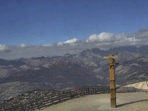
Mammoth Mountain, Mammoth Lakes, Mono County, California, USA
 4.4°C / 39.9°F
18:16
4.4°C / 39.9°F
18:16


EOU Quad, La Grande, Union County, Oregon, USA
14.4°C / 57.9°F
18:16
Marblehead Lighthouse Historical Society, Marblehead, Ohio, USA
24.4°C / 75.9°F
21:16

Big Texan Steak Ranch, Amarillo, Texas
26.5°C / 79.7°F
20:16


Catalina Island, Los Angeles County, California, USA
20°C / 68°F
18:16The D’Iberville Webcam looks out from the Scarlet Pearl Casino Resort over the Back Bay of Biloxi, the stretch of water that separates D’Iberville from Biloxi on the Mississippi Gulf Coast. A long, narrow marsh island runs across the foreground, with a second, curved one further out on the left and a covered pier on pilings at the bottom of the frame. Across the bay, a waterfront lined with moored boats and low buildings follows the far shore, and the skyline of the Biloxi peninsula sits on the horizon with a thin band of the Mississippi Sound beyond it. A long, low bridge crosses the water at the far left. On calm mornings the bay holds clear reflections of the far shore, so the wake of a single passing boat shows up across the whole frame.
D’Iberville sits on the north shore of the Back Bay in Harrison County, directly across the water from Biloxi, and is part of the Gulfport-Biloxi metropolitan area. The city covers 28.1 square kilometers (10.9 square miles), almost all of it land, and lies just 4 meters (13 feet) above sea level. The 2020 census counted 12,721 residents. The name honors Pierre Le Moyne d’Iberville, the French-Canadian explorer who arrived on this stretch of coast in 1699, and it is pronounced dee-EYE-ber-vil.
The community is far older than its charter. People lived here for close to three centuries before D’Iberville became a city on February 23, 1988. Hurricane Katrina struck on August 29, 2005 and left extensive damage across the city, which then drew up urban renewal plans for its rebuilding.
The camera is mounted at the Scarlet Pearl Casino Resort, 9380 Central Avenue, which opened on December 9, 2015 with 300 hotel rooms and a 68,000 square foot (6,300 square meter) gaming floor. From there it faces south over the bay toward the Biloxi peninsula, which keeps the resort itself out of the shot. The stream comes from FOX10 News, whose other live cams watch Mobile and Orange Beach in Alabama, and this broadcast has been running since April 2023.
The NOAA climate normals for neighboring Biloxi give a fair picture of D’Iberville’s weather. January is the coolest month, with average highs of 15 C (60 F) and lows of 6 C (44 F). Spring warms quickly: April averages 24 C (76 F) by day and 16 C (60 F) at night. July brings highs of 32 C (90 F) and average lows of 24 C (75 F), so summer nights stay warm and sticky. October eases back to 26 C (79 F) by day and 17 C (62 F) after dark. Rain falls in every season and adds up to about 1,697 millimeters (66.8 inches) a year.
The Atlantic hurricane season runs from June 1 to November 30, and its peak in late summer and early fall is when storms like Katrina reach this coast. On the camera, humid summer air often softens the far skyline into haze, while a winter cold front can clear the air enough to sharpen the line of the Mississippi Sound on the horizon. The marsh islands tend to look greenest in summer and turn duller and browner through the cooler months.
The quickest diversion is right under the camera: the Scarlet Pearl has its own 36-hole miniature golf course. Across the bay, the Biloxi Lighthouse has stood on Beach Boulevard since May 1848, about 3.5 kilometers (2.2 miles) south-southwest of the resort in a straight line. A short way east along the same road is the Ohr-O’Keefe Museum of Art, designed by Frank Gehry and opened in 2010, roughly 3.9 kilometers (2.4 miles) from the resort.
At Point Cadet, the eastern tip of the Biloxi peninsula, the Maritime and Seafood Industry Museum covers the coast’s fishing and seafood trade. It keeps two replica oyster schooners, the Glenn L. Swetman and the Mike Sekul, modeled on the boats that worked the Gulf Coast from the late 1800s into the early 1900s, and both take walk-on and charter sailings from the museum’s Schooner Pier Complex. West along the beach, Beauvoir preserves the post-war home of Jefferson Davis, the president of the Confederacy.
More live views from the Gulf Coast and elsewhere in Mississippi:
D’Iberville is in Harrison County on the Mississippi Gulf Coast, on the north shore of the Back Bay of Biloxi. Biloxi lies directly across the bay to the south, and the Biloxi Lighthouse is about 3.5 kilometers (2.2 miles) from the Scarlet Pearl in a straight line.
The camera looks south across the Back Bay of Biloxi. A long marsh island fills the foreground, a waterfront with moored boats lines the far shore, and the skyline of the Biloxi peninsula sits on the horizon, with a long bridge at the left edge and a strip of the Mississippi Sound beyond.
It is in D’Iberville, at 9380 Central Avenue on the north side of the Back Bay, facing Biloxi across the water. The camera is mounted on the resort and points out over the bay, so the resort buildings do not appear in the shot.
No. Biloxi’s sand beach runs along Beach Boulevard on the south side of the peninsula, facing the Mississippi Sound, so the trees and buildings of the peninsula hide it from this camera. What the camera does show is the bay side of the peninsula, with its moored boats and waterfront buildings.
Winters are mild and summers are hot and humid. Average highs run from about 15 C (60 F) in January to 32 C (90 F) in July, and about 1,697 millimeters (66.8 inches) of rain falls in a typical year. Hurricane season lasts from June to November.
It is pronounced dee-EYE-ber-vil. The name comes from Pierre Le Moyne d’Iberville, the French-Canadian explorer who reached this part of the coast in 1699.
Yes. Katrina struck the Mississippi coast on August 29, 2005 and caused extensive damage in D’Iberville, which then drew up urban renewal plans for the city. The Scarlet Pearl, where the camera now sits, opened ten years later, in December 2015.
Source: FOX10 News
The best new live webcams and site features, once a week.
By subscribing you agree to receive our weekly email. Unsubscribe any time.
 7.5°C / 45.5°F
 19.8°C / 67.6°F