
Live
Aquarium of the Pacific, Long Beach, California
Aquarium of the Pacific, Aquarium Way, Long Beach, CA, USA
 19.2°C / 66.6°F
 05:35
 05:35:45
 -4.6°C / 23.7°F
 Few Clouds
 69%
 07:09
 18:12
Loading forecast…
Aquarium of the Pacific, Aquarium Way, Long Beach, CA, USA
19.2°C / 66.6°F
05:35
Monterey Bay Aquarium, Cannery Row, Monterey, CA, USA
 11.9°C / 53.4°F
05:35


Mori Point, Bradford Way, Pacifica, California, USA
12.4°C / 54.3°F
05:35

Huntington Beach Pier, Huntington Beach, CA, USA
18.7°C / 65.7°F
05:35


Kitten Rescue Sanctuary, Los Angeles, California
18.5°C / 65.3°F
05:35
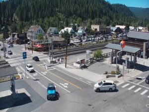

The Mammoth Mountain Webcam puts five live cameras from the ski area’s own network on one page, from the summit of this Eastern Sierra volcano down to the town of Mammoth Lakes, California. The player opens on The Village, a pedestrian plaza in town, and the tabs switch to the summit Top Station, the Main Lodge base, McCoy Station partway up the mountain, and Tamarack near Twin Lakes. The summit tab is the wide one: a flat, fenced lookout with a wooden signpost, a broad valley below and a ragged line of peaks along the horizon. McCoy Station shows lift lines and open runs, the quickest check on snow cover.
The Village camera sits above a paved plaza, and its framing changes from wide to close. Wide shots take in a stone fire pit ringed by wooden chairs, an outdoor stage under a canopy, and a road and parking lot beyond the pines. Closer shots drop onto the plaza itself, including a bronze statue of a skier beside a planter. A gondola links this pedestrian village with the Canyon Lodge base on the mountain.
The Summit tab, labeled Top Station on screen, looks out from the top of the mountain at 3,369 meters (11,053 feet). The Main Lodge tab, which the resort calls its Woolly Cam, looks past a woolly mammoth statue to the base area road, a lodge with a steep chalet roof and the parking lots, with peaks showing above the trees. The McCoy Station camera faces a slope of chairlift towers, scattered pines and a dirt service road, with a long building on the skyline. Tamarack looks down a paved lane through aspens and pines at the foot of a boulder-strewn slope. Every feed carries a title bar and clock in its top corner.
Mammoth Mountain is a lava dome complex of about 12 overlapping domes of rhyodacite and dacite, built between 110,000 and 57,000 years ago in the southwestern corner of the Long Valley Caldera. Its largest recent event was a minor steam eruption about 700 years ago, and the volcano is still active at a low level. Since 1990, carbon dioxide rising through the ground has killed trees across about 69 hectares (170 acres) near Horseshoe Lake on the south flank. The mountain straddles Madera and Mono counties inside Inyo National Forest, and part of it lies within the town of Mammoth Lakes.
Dave McCoy founded the ski area, and its first permanent lift ran in 1955; the mid-mountain McCoy Station carries his surname. The resort covers 1,420 hectares (3,500 acres) served by 25 lifts, with a vertical drop of 940 meters (3,100 feet) from the summit to its lowest base at Eagle Lodge, 2,424 meters (7,953 feet) up. The town sits at 2,461 meters (8,075 feet) and counted 7,191 residents in the 2020 census. The mountain averages about 1,020 centimeters (400 inches) of snow a year, and the season usually runs from November through May, sometimes stretching into summer.
Records from the Mammoth Lakes ranger station in town give the baseline. January averages highs of 5 C (41 F) and lows of -9 C (16 F), and the summit, about 900 meters (2,980 feet) higher, runs colder still. April warms to 11 C (51 F) by day but still falls to -3 C (26 F) at night. The town gets about 431 centimeters (170 inches) of snow a year, well under half of what the upper mountain averages.
Summer is short and mild. July averages 25 C (78 F) by day and 9 C (48 F) at night, and the cameras then look across bare grey slopes and dirt service roads. October brings highs of 16 C (61 F) and nights that average -1 C (30 F), along with the yellow aspens that frame the Tamarack view early in the month. Annual precipitation in town is about 602 millimeters (23.7 inches).
The Panorama Gondola is the direct way to the view on the Summit tab, loading at Main Lodge and stopping at McCoy Station on the way up. Devils Postpile National Monument, which the National Park Service describes as one of the best examples of columnar basalt in the country, and Rainbow Falls are the best-known sights near the mountain, reached by way of State Route 203. The area also has natural hot springs, and the dead trees at Horseshoe Lake show the carbon dioxide seep up close.
The Mammoth Lakes Basin holds a string of alpine lakes. Lake Mary lies south of town, and Tamarack Lodge has taken guests on the shore of Twin Lakes since 1924. Now owned by Mammoth Mountain, the lodge runs a cross-country ski center beside the lakes at 2,621 meters (8,600 feet), with groomed trails that follow the basin’s summer roads.
Three more Sierra Nevada cameras to check alongside this one:
Mammoth Mountain is in the Eastern Sierra of California, in the southwestern corner of the Long Valley Caldera. The ski area sits just west of the town of Mammoth Lakes in Mono County.
Five views from the resort’s own cameras: the Village plaza in Mammoth Lakes, the summit Top Station, the Main Lodge base with its woolly mammoth statue, McCoy Station with its lift lines, and Tamarack near Twin Lakes. Use the tabs on the player to switch between them.
The Summit and McCoy Station tabs answer this fastest, since they show open slopes rather than plazas or roads. Mammoth does not keep snow all year. The season usually runs from November through May, sometimes into summer, and outside it the runs on these cameras are bare grey ground.
The summit stands at 3,369 meters (11,053 feet). The Panorama Gondola starts at Main Lodge, 2,715 meters (8,909 feet), and stops at McCoy Station, 2,935 meters (9,630 feet), on the way up. The lowest base, Eagle Lodge, is at 2,424 meters (7,953 feet).
Winters are cold and snowy. January in town averages highs of 5 C (41 F) and lows of -9 C (16 F), and the summit runs colder. Summers are mild, with July highs around 25 C (78 F) and nights near 9 C (48 F). The mountain averages about 1,020 centimeters (400 inches) of snow a year.
Only the Village camera is in town. It looks over the pedestrian plaza at the Village, with a road and parking lot glimpsed beyond the trees in its wider shots. The other four views are on the mountain or at Tamarack in the Lakes Basin.
The eastern entrance of Yosemite National Park is 51 kilometers (32 miles) north of Mammoth Lakes. For flights, Mammoth Yosemite Airport serves the area with limited scheduled service.
Source: Mammoth Mountain
The best new live webcams and site features, once a week.
By subscribing you agree to receive our weekly email. Unsubscribe any time.