
Live

 14:41:32
 33.6°C / 92.5°F
 Light Rain
 55%
 19 km/h / 12 mph
 06:21
 17:54
Loading forecast…


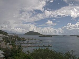
Scrub Island, off Tortola, British Virgin Islands
 31.9°C / 89.4°F
14:41


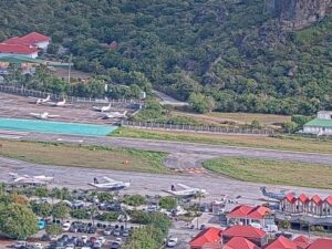
Col de la Tourmente, Saint-Jean, St. Barthelemy
 31.2°C / 88.2°F
14:41


Sorobon Luxury Beach Resort, Kaminda Sorobon, Kralendijk, Caribbean Netherlands
28.6°C / 83.5°F
14:41


Bucuti & Tara Beach Resort, L.G. Smith Boulevard, Oranjestad, Aruba
 30°C / 86°F
14:41

The San Juan Webcam looks out over the Condado Lagoon and the San Antonio Channel in Puerto Rico’s capital, where bridges and expressway ramps tie the islet of Old San Juan to the rest of the city. The lagoon fills the left of the frame, a clear green on sunny days, with a low arched road bridge along its edge. In the middle, more bridges span the channel above a small basin, and on the right a marina full of motor yachts lines the Miramar shore. The high-rises of Miramar and Santurce stand behind, and on a clear day the hills of the interior show on the horizon. Below, palms and planted medians separate the traffic lanes. The stream’s description places the view in the area of Distrito T-Mobile, the entertainment district by the Puerto Rico Convention Center.
San Juan, Puerto Rico’s capital, counted 342,259 residents at the 2020 census. Its oldest districts sit on an islet: Old San Juan at the western end and Puerta de Tierra just east of it. Puerta de Tierra is bounded by the San Antonio Channel on the south and by El Boqueron and Condado on the east, and it reaches the mainland over the Dos Hermanos and San Antonio bridges and a causeway. The crossing is old. The first bridge over the San Antonio Channel was built between 1520 and 1521 by enslaved Taino laborers.
The lagoon on the left of the San Juan Webcam’s frame covers 98.91 acres (40 hectares). It averages 3 meters (10 feet) deep and reaches 11 meters (36 feet) at its deepest point. It connects to the Atlantic through El Boqueron to the north and to San Juan Bay through the San Antonio Channel to the west, with the Condado peninsula on its north and east shores and Miramar on the south. The water is protected as the Laguna del Condado Nature Reserve and Jaime Benitez Rexach State Park and belongs to the San Juan Bay Estuary. West Indian manatees were once common here. Their numbers dropped as the city grew around the shore, but they still visit, alongside herons, terns, brown pelicans and magnificent frigatebirds.
Distrito T-Mobile, the area named in the stream’s description, covers 5 acres (2 hectares) just north of the Puerto Rico Convention Center, about 1.4 kilometers (0.9 miles) west of the middle of the lagoon. The $185 million complex was developed with PRISA Group and ASM Global, opened in phases from February 2020 and held its official grand opening on August 14, 2021.
San Juan stays warm all year, so the seasons on this camera show more in the sky and the rain than in the temperature. The 1991 to 2020 normals for Luis Munoz Marin International Airport give January an average high of 28 C (83 F) and a low of 22 C (72 F). April reaches 30 C (86 F) by day. July averages 32 C (89 F) with nights near 25 C (78 F), and October is barely cooler at 31 C (89 F).
Rain is the better guide to the calendar. The airport records about 1,521 millimeters (59.9 inches) a year. March is the driest month at 55 millimeters (2.2 inches) and November the wettest at 187 millimeters (7.4 inches). The Atlantic hurricane season runs through summer and autumn, and Hurricane Maria made landfall on the island on September 20, 2017. A passing shower can gray out the towers behind the marina and leave the expressway shining under the next patch of sun.
The lagoon itself is the closest outing. Guided snorkeling tours run in its sheltered water, where manatees feed on the seagrass and sea turtles also turn up. A short way west, Distrito T-Mobile gathers the Coca-Cola Music Hall, a concert venue for about 5,000 people, with the Aloft San Juan hotel, a cinema, restaurants and the Toroverde Urban Park. Its central courtyard, Popular Plaza, carries 14,500 square feet (1,350 square meters) of LED screens.
In Puerta de Tierra, Luis Munoz Rivera Park still holds remnants of the fortifications rebuilt at El Boqueron after the British attack of 1797, and the Fortin de San Geronimo de Boqueron is listed on the National Register of Historic Places. Escambron Beach and Third Millennium Park are in the same district, as is the Capitol of Puerto Rico. Farther west lies Old San Juan, where the batteries of Fort San Cristobal were pushed eastward in 1771.
For more harbor towns and waterfront skylines around the Caribbean and Florida, try these cameras.
It covers the Condado Lagoon and the San Antonio Channel in San Juan, the capital of Puerto Rico. The lagoon lies between the Condado peninsula and Miramar, and the channel links it west to San Juan Bay.
The Condado Lagoon on the left, road bridges over the San Antonio Channel in the middle, a marina of motor yachts on the right and the high-rises of Miramar and Santurce behind. The lower half of the frame is a web of expressway lanes, palms and planted medians.
Warm all year. Average highs run from 28 C (83 F) in January to 32 C (89 F) in July, and lows from 22 C (72 F) to 25 C (78 F). About 1,521 millimeters (59.9 inches) of rain falls in a typical year.
November is the wettest month, averaging 187 millimeters (7.4 inches), and March the driest at 55 millimeters (2.2 inches). The Atlantic hurricane season covers the summer and autumn.
Yes. West Indian manatees still come into the lagoon to feed on its seagrass, though in smaller numbers than before the shore was built up. They are far easier to spot up close than on a wide view like this one.
It averages 3 meters (10 feet) and reaches 11 meters (36 feet) at its deepest point, across an area of 98.91 acres (40 hectares).
An entertainment complex of 5 acres (2 hectares) beside the Puerto Rico Convention Center, with the Coca-Cola Music Hall, the Aloft San Juan hotel, a cinema, restaurants and the Toroverde Urban Park. It held its official grand opening on August 14, 2021.
Puerta de Tierra, the district just east of Old San Juan, crosses to the mainland over the Dos Hermanos and San Antonio bridges and a causeway. The first bridge over the San Antonio Channel dates from 1520 to 1521.
Source: Puerto Rico Sky Cam
The best new live webcams and site features, once a week.
By subscribing you agree to receive our weekly email. Unsubscribe any time.
 30.9°C / 87.6°F
 32.1°C / 89.8°F