Live
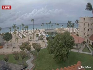
Eagle Beach, Oranjestad, Aruba
Bucuti & Tara Beach Resort, L.G. Smith Boulevard, Oranjestad, Aruba
 29.5°C / 85.1°F
 20:14
 20:14:32
 28.9°C / 84°F
 Light Rain
 79%
 11 km/h / 7 mph
 06:15
 17:48
Loading forecast…
Bucuti & Tara Beach Resort, L.G. Smith Boulevard, Oranjestad, Aruba
29.5°C / 85.1°F
20:14


Villa Renaissance, Ventura Drive, Grace Bay, Turks and Caicos Islands
 26.1°C / 79°F
20:14



Sorobon Luxury Beach Resort, Kaminda Sorobon, Kralendijk, Caribbean Netherlands
 28.9°C / 84°F
20:14



Col de la Tourmente, Saint-Jean, St. Barthelemy
 29.5°C / 85.1°F
20:14
The Scrub Island Webcam looks down from a hillside over the marina village of Scrub Island Resort, Spa and Marina, a private island resort a short boat ride north of Beef Island in the British Virgin Islands. Pale resort buildings with metal roofs and a row of palms fill the left of the frame, and a set of long docks with short finger piers runs out across the basin in the middle, with a handful of boats tied up in the slips. Beyond them the water opens out, with sailboats on moorings, a cone-shaped green island in the middle distance and a low islet at its foot. A steep, wooded headland closes off the right side. The sky does much of the changing here: piles of cumulus build and break over the islands, showers can sweep across the channel, and the water runs from pale turquoise near the docks to deep blue further out.
Scrub Island covers 230 acres (93 hectares) and is really two pieces of land, Big Scrub at 170 acres (69 hectares) and Little Scrub at 60 acres (24 hectares). It is volcanic in origin and runs about 2.6 kilometers (1.6 miles) from end to end, with an eastern peak of 134 meters (438 feet) and a western one of 95 meters (313 feet). The island lies about 2.7 kilometers (1.7 miles) north of Trellis Bay on Beef Island. Great Camanoe sits just across a narrow channel to the west, and the small islet of Marina Cay lies off the south side of its western end.
The resort dates from 2010 and has 52 rooms, suites and villas, most of them on the western end of the island around the marina the camera watches. The marina has 55 slips for lease or transient docking, five of them sized for megayachts. The camera belongs to the resort, which streams it through EarthCam and describes it as a daily view of its marina village.
Guests reach the island on the resort’s launch from the dock at Trellis Bay, a crossing of roughly seven to ten minutes. That dock is a two-minute drive from Terrance B. Lettsome International Airport on Beef Island, the main commercial airport of the British Virgin Islands. Local time is Atlantic Standard Time, UTC minus 4, which the territory keeps all year with no daylight saving.
The climate is warm and tropical, with little swing between seasons. Figures recorded on Virgin Gorda, the next large island to the east, put average highs at 26 C (79 F) in January, 29 C (84 F) in April, 31 C (87 F) in July and 29 C (85 F) in October, with nights between 20 and 23 C (68 and 73 F) through the year. The first months of the year are the coolest, and March is the driest month, with about 55 millimeters (2.2 inches) of rain.
Summer and autumn are hotter and wetter. Annual rainfall comes to about 1,236 millimeters (48.8 inches), and November is the wettest month at around 179 millimeters (7 inches). The Atlantic hurricane season runs from June 1 to November 30, and Hurricane Irma, which struck the territory in 2017, destroyed the buildings on neighboring Marina Cay. On the camera the seasons show mostly in the sky: the drier months tend to bring clear, breezy days, while the wet months bring heavier cloud and passing downpours.
On the island, North Beach and its pool face the opposite shore from the marina, out of the camera’s view, while the Grand Pavilion and the Upper Pool sit on the slope just above the docks. Across the water, Marina Cay is an 8-acre (3.2-hectare) islet roughly 600 meters (2,000 feet) south of the marina. It was uninhabited until 1937, when the writer Robb White and his wife, Rosalie “Rodie” Mason, settled there, a story he told in memoirs including Our Virgin Island (1953). Pusser’s ran a restaurant and villa rentals on the cay until Hurricane Irma wrecked them. Today it has a fuel station and a wooden pier for taxi boats, with a reef off its southern side.
Back on Beef Island, Trellis Bay is where the resort’s launch comes in. It is a small settlement a short walk east of the airport, with a market, a restaurant, a coffee shop, local craft shops and a beach. Long Bay, a beach on the other side of the airport to the west, is the island’s other stretch of sand, and the Queen Elizabeth Bridge carries the road from Beef Island across to Tortola and the rest of the territory.
Three more cams from the Virgin Islands, two in the BVI and one across the water on St. Croix:
Scrub Island is in the British Virgin Islands, about 2.7 kilometers (1.7 miles) north of Trellis Bay on Beef Island, off the eastern end of Tortola. Great Camanoe lies across a narrow channel to the west.
The camera looks over the resort’s marina village: buildings and palms on the left, long docks with boats in the middle, sailboats on moorings beyond, a cone-shaped island with a low islet at its foot, and a wooded headland on the right. It does not show North Beach, the ferry dock at Trellis Bay or the airport.
The camera belongs to Scrub Island Resort, Spa and Marina, part of Mainsail Hotels, and the stream is run by EarthCam.
The marina has 55 slips for lease or transient docking, including five for megayachts. They are the docks in the middle of the camera’s frame.
Warm all year. Average highs run from about 26 C (79 F) in January to 31 C (87 F) in July, and nights stay between 20 and 23 C (68 and 73 F). March is the driest month and November the wettest, and the hurricane season runs from June 1 to November 30.
Fly into Terrance B. Lettsome International Airport on Beef Island, usually on a connecting flight, then take the two-minute drive to the Trellis Bay dock. The resort’s launch crosses to the island in roughly seven to ten minutes.
Marina Cay lies roughly 600 meters (2,000 feet) south of Scrub Island’s marina. Its restaurant and villas were destroyed by Hurricane Irma in 2017, and the islet now has a fuel station and a wooden pier for taxi boats.
No. Anguilla has a separate Scrub Island of its own, farther east in the Leeward Islands. This camera is on Scrub Island in the British Virgin Islands, off Tortola.
Source: Scrub Island Resort and EarthCam
The best new live webcams and site features, once a week.
By subscribing you agree to receive our weekly email. Unsubscribe any time.
 27.8°C / 82°F