Live
Find hotels, flights, car rentals and travel essentials for your visit.

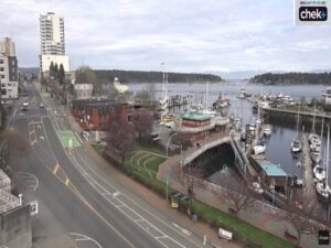
Nanaimo Harbour, Nanaimo, BC, Canada


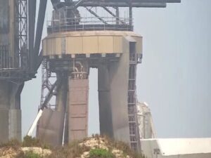
SpaceX Launch Facility, Boca Chica Boulevard, Brownsville, TX, USA


Brownville Deer Pantry, Rips Road, Brownville, ME, USA

Puente Internacional Paso del Norte, Avenida Benito Juárez, Centro, Ciudad Juárez, Chihuahua, Mexico

Everett's 8800, Andesite Ridge Road, Big Sky, MT, USA


The Volcán de Fuego Webcam offers a continuous view of one of Central America’s most active volcanoes. Located in southern Guatemala, Volcán de Fuego rises to approximately 3,763 meters (12,346 feet) above sea level and is famous for its frequent eruptions, glowing lava at night, and towering ash plumes. The live webcam allows viewers from around the world to safely observe this remarkable natural landmark in real time.
Volcán de Fuego forms part of the Central American Volcanic Arc and stands beside its neighboring volcano, Acatenango. The webcam often captures the summit crater, ash emissions, volcanic clouds, and changing weather conditions around the mountain. During periods of increased activity, viewers may witness incandescent material rolling down the slopes after sunset.
The surrounding region is known for its fertile volcanic soils, traditional Guatemalan villages, and spectacular mountain scenery. The volcano lies roughly 16 kilometers (10 miles) southwest of Antigua Guatemala, one of the country’s best-known colonial cities and a UNESCO World Heritage Site. The Volcán de Fuego Webcam provides a fascinating window into one of the most dynamic volcanic landscapes in the Americas.
The volcano experiences a subtropical highland climate with noticeable differences between the dry and rainy seasons. From November through April, skies are often clearer, making this one of the best times to enjoy uninterrupted views from the Volcán de Fuego Webcam. Daytime temperatures at lower elevations generally range between 20°C and 28°C (68°F to 82°F), while the summit remains considerably cooler.
From May through October, the rainy season brings frequent afternoon clouds, heavy showers, and dramatic thunderstorms. These changing weather conditions can create spectacular scenes on the webcam as clouds swirl around the volcanic peak. Even during cloudy periods, occasional clear breaks reveal the summit, while nighttime often offers the best opportunity to observe glowing volcanic activity.
Many visitors come to hike neighboring Acatenango, one of Guatemala’s most popular trekking destinations. From its summit, hikers often enjoy unforgettable views of Volcán de Fuego erupting across the valley. Guided overnight hikes are especially popular because volcanic explosions are frequently visible after dark.
The nearby city of Antigua Guatemala offers beautifully preserved colonial architecture, colorful churches, museums, markets, and excellent local cuisine. Coffee plantations, nature reserves, and cultural tours throughout the region make this area one of Guatemala’s top travel destinations. Even if you are unable to visit in person, the Volcán de Fuego Webcam provides an impressive glimpse into the area’s extraordinary volcanic landscape.
If you enjoy volcano and mountain scenery, you may also like these webcams:
Mount Etna Volcano Webcam
Bromo and Semeru Volcano Webcam
Popocatépetl Volcano Webcam
Volcán de Fuego is located in southern Guatemala on the border of the Sacatepéquez, Escuintla, and Chimaltenango departments. It sits just southwest of Antigua Guatemala.
The webcam typically shows the volcano’s summit, crater area, volcanic ash emissions, weather conditions, and, when activity allows, glowing lava and small eruptions.
Yes. Volcán de Fuego is recognized as one of the most consistently active volcanoes on Earth, producing frequent eruptions throughout the year.
Clear mornings during the dry season often provide the best visibility, while nighttime viewing may reveal glowing lava and incandescent volcanic material.
Access to Volcán de Fuego itself depends on volcanic activity and official safety guidance. Most visitors instead hike nearby Acatenango for safe panoramic views.
The volcano is approximately 16 kilometers (10 miles) southwest of Antigua Guatemala, making it one of the city’s most recognizable natural landmarks.
Volcán de Fuego lies along the Central American Volcanic Arc, where tectonic plate movement continually feeds magma toward the surface, resulting in frequent eruptive activity.
Source: AfarTV