

Live

 16:49:41
 28.5°C / 83.3°F
 Light Rain
 80%
 28 km/h / 17 mph
 05:52
 17:50
Loading forecast…



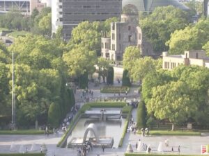
Peace Memorial Park, Nakajimachō, Naka Ward, Hiroshima, Japan
 20.5°C / 68.9°F
20:49



Shibuya Scramble Crossing, 21 Udagawa-cho, Shibuya City, Tokyo, Japan
 17.4°C / 63.3°F
20:49
The Baa Atoll Webcam looks out from a wooden jetty on Amilla Fushi, a resort island on the outer edge of Baa Atoll in the Maldives, across the small harbor that SkylineWebcams labels the island’s port. A motor yacht and a couple of speedboats sit along a low stone quay in the middle distance, a white workboat is moored close on the right, and a wall of coconut palms and dense broadleaf trees closes off the view behind them. The water inside the basin is what holds the eye: pale turquoise over the sandy bottom when the sun is high, deeper teal under cloud, and warmer and softer in low morning light. Small boats come and go from the quay through the day. After dark the frame drops to a handful of lights along the shore. The stream plays on the SkylineWebcams site, which runs the camera.
Baa is the administrative name for Southern Maalhosmadulu, a ring of reef and islands about 125 kilometers (78 miles) north-northwest of Male. It holds 75 islands, 13 of them inhabited, with a population of more than 11,000, and its capital is Eydhafushi. In June 2011 UNESCO named the atoll a Biosphere Reserve, covering roughly 139,700 hectares (about 345,000 acres) of coastal and marine areas.
Amilla Fushi is a small island, less than 1 kilometer (0.6 miles) long, on the outskirts of the atoll. The resort on it now trades as Amilla Maldives Resort and Residences, and guests reach it either by a seaplane flight of about 30 minutes from Male or by a domestic flight to Dharavandhoo Airport and a speedboat transfer of around 10 minutes.
The atoll’s best-known site is Hanifaru Bay, known locally as Vandhumaafaru Adi. Up to a hundred manta rays can crowd into the small inlet when the tide pushes plankton into it, and whale sharks visit too, although research suggests most of them are young males rather than mating adults. Hanifaru was declared a marine protected area on 8 June 2009 and became a core zone of the biosphere reserve in 2011. Thulhaadhoo, one of the inhabited islands, is traditionally known for its lacquerwork handicrafts.
Baa Atoll lies just over 5 degrees north of the equator, so the temperature barely moves through the year. At the Male weather station, the nearest long record, average highs run from 30.5 C (87 F) in October to 31.9 C (89 F) in April, and average lows stay around 26 to 27 C (79 to 81 F) in every month. Rain is what changes. February and March are the drier months, with February the driest at about 38 millimeters (1.5 inches), and the wet season runs from April through January, peaking in October at about 245 millimeters (9.7 inches). The year totals about 1,983 millimeters (78 inches).
Model data for the atoll itself follows the same pattern, with February the driest month and the heaviest falls in May and again from September to November. On camera, the drier months tend to bring glassy water and flat, even light that turns the basin a milky turquoise. In the wet months squalls can roll across quickly, darkening the water to a blue-green and ruffling the surface around the moored boats. Hanifaru’s manta gatherings run from about May to December, at their best from late July to early October.
Hanifaru Bay is the trip most visitors to Baa plan around. Scuba diving is banned in the bay, so the encounter is a snorkel, and the number of visitors and their time in the water are capped. Amilla runs its own Hanifaru snorkeling excursions in season, as do other resorts and dive centers in the atoll. Between trips, the resort’s house reef gives easy snorkeling straight from the island.
For a look at island life beyond the resorts, take a boat to Thulhaadhoo to see the lacquerwork the island has made its name with. Eydhafushi, the atoll capital, is the administrative center, and Dharavandhoo is the island with the domestic airport that links Baa to Male.
More island and lagoon cams from the Indian Ocean and the South Pacific:
Baa Atoll is in the Maldives, in the Indian Ocean, about 125 kilometers (78 miles) north-northwest of the capital, Male. Its geographic name is Southern Maalhosmadulu, and Amilla Fushi, where the camera is, sits on the outskirts of the atoll.
The camera looks from a jetty on Amilla Fushi across the island’s small harbor. A motor yacht and speedboats tie up along a stone quay, a white workboat is moored on the right, and palms and broadleaf trees fill the background. It is a fixed view of the harbor rather than a beach or reef camera.
No. The camera is on Amilla Fushi and faces the resort’s harbor, not Hanifaru Bay. The manta ray and whale shark gatherings happen in a protected inlet elsewhere in the atoll, mostly between May and December, and are seen on snorkel trips rather than on this camera.
Hot and humid all year, with average highs of 30.5 to 31.9 C (87 to 89 F) at the Male weather station and lows around 26 to 27 C (79 to 81 F). February and March are the drier months.
October is the wettest month on the Male record, with about 245 millimeters (9.7 inches) of rain, yet it stays warm, with average highs near 30.5 C (87 F). Expect sunny spells broken by heavy showers, and a choppier surface in the harbor when a squall passes.
UNESCO designated Baa Atoll a Biosphere Reserve in June 2011. It covers about 139,700 hectares (345,000 acres) of coastal and marine areas, and its core zones include Hanifaru Bay, a marine protected area since 2009 because of its manta ray and whale shark gatherings.
Most guests fly in by seaplane from Male, a trip of about 30 minutes. The alternative is a domestic flight to Dharavandhoo Airport in Baa Atoll, followed by a speedboat transfer of around 10 minutes.
The stream keeps running after dark, but the harbor has little lighting, so the picture drops to a few lights along the shore and quay. For a clear view of the water and boats, watch between mid-morning and mid-afternoon Maldives time, which is UTC+5.
Source: SkylineWebcams
The best new live webcams and site features, once a week.
By subscribing you agree to receive our weekly email. Unsubscribe any time.
 33.3°C / 91.9°F
 33.2°C / 91.8°F
 11.8°C / 53.2°F
 19.7°C / 67.5°F