Live

 15:42:58
 17.9°C / 64.2°F
 Light Rain
 63%
63% 15 km/h / 9 mph
 07:10
07:10 20:06
20:06Loading forecast…
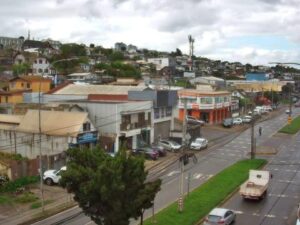




Villa del Palmar Cancun Luxury Beach Resort & Spa, Cancún, Quintana Roo, Mexico
 31.7°C / 89.1°F
13:42
31.7°C / 89.1°F
13:42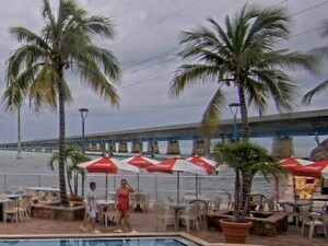





Ninepipes Lodge, Mission Valley, Montana, USA
6.9°C / 44.4°F
12:42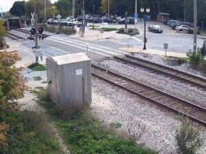
Caberfae Peaks, Caberfae Lane, Cadillac, MI, USA
 17.1°C / 62.8°F
14:42
17.1°C / 62.8°F
14:42The Concepcion Webcam looks out from high on a building beside Avenida Los Carrera, a few blocks northeast of the main square in Concepcion, the capital of Chile’s Biobio Region. The picture runs west-southwest down the avenue, where a line of palms splits the traffic lanes, across corrugated metal roofs, apartment blocks and street-corner shops toward the downtown towers. Wooded hills close the horizon on the left. ConceCam streams it as one very wide picture, so the busy junction below and the far skyline share the screen. Winter rain often leaves the asphalt shining for days at a time, while summer afternoons are long, bright and dry. As the light goes, the street lamps along Los Carrera come on, and because the camera faces roughly west, evening skies over the rooftops can turn orange.
Concepcion sits 12 meters (39 feet) above sea level on the north bank of the Biobio River, about 500 kilometers (311 miles) south of Santiago. The city proper counted 223,574 people in the 2017 census, and Greater Concepcion, which takes in Talcahuano, San Pedro de la Paz, Hualpen and other neighbors, is home to about 971,000. That makes it one of the largest urban areas in the country and the seat of regional government for Biobio.
Pedro de Valdivia founded Concepcion in 1550, but the first city stood on the coast at what is now Penco. After the earthquake of 1751 the settlement was moved inland to the Valle de la Mocha, where it stands today. Earthquakes are still part of local life: the magnitude 8.8 earthquake of 27 February 2010 caused heavy damage across the city. Concepcion is also a university town. The Universidad de Concepcion, founded on 14 May 1919, is the third oldest university in Chile, and its campus is a short trip from the center.
The camera sits less than 1 kilometer (0.6 miles) northeast of Plaza de la Independencia, and Avenida Los Carrera is one of the main avenues crossing downtown. In the frame, the avenue runs away from the camera on the right, through a wide junction with a fast food restaurant and its car park on the far corner. A tall white apartment block fills the left side, a rooftop sports pitch with green turf stands out in the middle distance, and newer residential towers rise on the right. The walls of the building that holds the camera frame both edges of the picture.
Concepcion has mild summers and cool, wet winters. At Carriel Sur airport, the city’s main weather station, January averages highs of 23 C (73 F) and lows of 11 C (52 F), while July averages 13 C (56 F) by day and 6 C (42 F) at night. A typical year brings about 984 millimeters (38.7 inches) of rain. Roughly two thirds of it falls between May and August, with June usually the wettest month, while January and February are close to dry.
Those seasons show plainly on the camera. In winter, low cloud often hangs over the hills, rain bands sweep across the rooftops and the avenue stays wet for days. Summer brings clear skies and long evenings, with about 14 hours 40 minutes of daylight around the December solstice against about 9 hours 40 minutes in late June. Spring and autumn swing between the two, and even in mid October the frame can show a wet Los Carrera under heavy grey cloud, with traffic lights reflected on the road.
Plaza de la Independencia, with the Cathedral of the Most Holy Conception on one side, is about a ten minute walk from the camera’s corner and the natural place to start. On the edge of downtown, Parque Ecuador runs along the foot of Cerro Caracol, and trails climb from the park to the Mirador Aleman, a stone lookout tower built in 1921, for a view across the whole city. The Universidad de Concepcion campus is worth a visit for its gardens and for the Casa del Arte, home to the university’s Pinacoteca collection and to Presencia de America Latina, the large mural by the Mexican painter Jorge Gonzalez Camarena. Down by the water, Parque Bicentenario follows the bank of the Biobio River.
Further out, the Hualpen Peninsula has a nature sanctuary, an old whaling station and Parque Pedro del Rio Zanartu with its house museum, and the fishing village of Lenga, around 15 minutes by car, is known for its seafood. At the naval base in neighboring Talcahuano, the Huascar, a 19th century ironclad, is kept afloat as a museum ship. Nonguen National Park, about 20 minutes away by car, protects native forest. Lota, 40 kilometers (25 miles) south, runs tours of its old coal mines, and the beaches of Tome and Dichato lie up the coast to the north.
For more city views from Chile and the rest of Latin America, try one of these.
Concepcion is in south central Chile. It is the capital of the Biobio Region and lies on the north bank of the Biobio River, a short way upstream from where the river meets the Pacific. Santiago is about 500 kilometers (311 miles) to the north, and the port city of Talcahuano adjoins Concepcion to the northwest.
The camera looks down palm-lined Avenida Los Carrera over a busy junction, low warehouse roofs, apartment blocks and the towers of downtown, with wooded hills on the horizon. Traffic, rain showers, passing cloud and evening light over the rooftops are what change most through the day.
It is mounted high on a building on the northeast side of downtown, beside Avenida Los Carrera and less than 1 kilometer (0.6 miles) from Plaza de la Independencia. It faces roughly west-southwest along the avenue toward the city center.
Summers are mild and mostly dry, with January highs around 23 C (73 F). Winters are cool and wet, with July highs near 13 C (56 F) and lows around 6 C (42 F). The city gets about 984 millimeters (38.7 inches) of rain a year, most of it from May to August.
December to March is the warmest and driest stretch, with long days that suit trips to the beaches at Tome and Dichato or a climb to the Mirador Aleman. June is usually the wettest month, so winter visits call for a good raincoat.
Concepcion is about 500 kilometers (311 miles) south of Santiago. Carriel Sur International Airport serves the metropolitan area, with flights to the capital.
Yes. The magnitude 8.8 earthquake of 27 February 2010 caused heavy damage across Concepcion. The city has a long history with earthquakes: it was moved from its first site at Penco to its present location after the earthquake of 1751.
Source: ConceCam
The best new live webcams and site features, once a week.
By subscribing you agree to receive our weekly email. Unsubscribe any time.
 29.7°C / 85.5°F
 17.7°C / 63.9°F
 34°C / 93.2°F