
Live

 17:01:28
 13.2°C / 55.8°F
 Clear Sky
 68%
68% 32 km/h / 20 mph
 07:44
07:44 18:16
18:16Loading forecast…

Whistler Olympic Plaza, Blackcomb Way, Whistler, BC, Canada
11.8°C / 53.2°F
17:01
Cranbrook, East Kootenay, British Columbia, Canada
14.8°C / 58.6°F
18:01

Apex Mountain Resort, Strayhorse Road, Hedley, BC, Canada
5.4°C / 41.7°F
17:01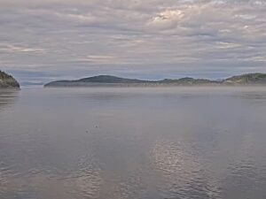




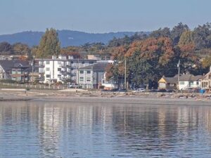
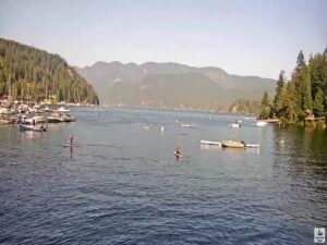
The Departure Bay Webcam looks east across Departure Bay in Nanaimo, British Columbia, on the east coast of Vancouver Island. Open water fills most of the frame, a low island with grassy rock and a crown of trees sits on the left, and a wooded shore closes in on the right, leaving a gap toward the open strait on the horizon. BC Ferries vessels come and go through that gap on the Horseshoe Bay run, and seaplanes, sailboats and fishing boats cross the bay through the day. Mornings are the draw here, since the camera faces the sunrise, and the light and the surface of the water change constantly with the weather. Local pilots, boaters and ferry passengers use it to check conditions before they set out.
Departure Bay is a wide inlet on the north side of Nanaimo, framed by Vancouver Island to the west and Saysutshun, formerly known as Newcastle Island, to the southeast. Jesse Island, about 3.6 hectares (9 acres), and the smaller Brandon Islands lie near the northern shore. The Spanish explorer Francisco de Eliza named the area Bocas de Winthuysen in 1791. Around 1852 the Hudson’s Bay Company called it Departure Harbour, and maps were showing Departure Bay by about 1855.
The shore has an industrial past. The Hamilton Powder Company built an explosives works on the bay in 1892, producing dynamite, black powder and nitroglycerine for the coal mines until it closed in May 1919. On January 14, 1903, two explosions at the plant killed twelve workers. In 1908 the Pacific Biological Station opened on the bay, and it is still run by Fisheries and Oceans Canada as the oldest fisheries research center on the Pacific coast. Departure Bay joined the City of Nanaimo in 1974 and 1975, even though 61 percent of local residents had voted against it.
The BC Ferries terminal on the bay runs Route 2 to Horseshoe Bay near Vancouver. Ferry service began here in 1951 under the Black Ball Line, and BC Ferries took over in November 1961. The terminal handled 1,551,280 passengers in 2024. This camera is separate from the Nanaimo Harbour cam, which watches the downtown harbor on the other side of Saysutshun.
Nanaimo sits at the northern edge of the warm summer Mediterranean climate zone. July averages daily highs of 23.9 C (75 F) and lows of 12.3 C (54 F), and summer on the Departure Bay Webcam usually means sunrise light over the islands, calm early mornings and more boats and paddlers out on the bay.
Winter is cool and wet rather than cold. January highs average 6.9 C (44 F) and lows sit just above freezing at 0.1 C (32 F). Nanaimo gets about 1,165 millimeters (46 inches) of precipitation a year, most of it from late fall through winter, and around 69 centimeters (27 inches) of snow in an average season. On the camera that often means grey days, low cloud across the islands and rain on the water, with the odd snowy morning.
Saysutshun, also called Newcastle Island Marine Provincial Park, closes off the southeast side of the bay. It has about 22 kilometers (14 miles) of trails, including the Coastal Trail around its 7.5 kilometer (4.7 mile) perimeter. A seasonal foot passenger ferry makes the 10 minute trip from Maffeo Sutton Park downtown between late spring and early fall, and the island can be reached by kayak or canoe all year. On the Vancouver Island shore, Departure Bay Beach has an easy walk of about 1.6 kilometers (1 mile) and is popular for birding, paddle sports and running, as well as kayaking, paddleboarding and cold plunges.
North of the bay in the Hammond Bay area, Pipers Lagoon Park wraps around a tidal lagoon with views of Shack Island and the Strait of Georgia. Its main loop is about 1.8 kilometers (1.1 miles) and draws birders for loons, grebes, oystercatchers and great blue herons. Downtown Nanaimo, a city of 99,863 people at the 2021 census, is a short drive south.
More Vancouver Island and ferry cameras to watch:
Departure Bay is on the north side of Nanaimo, British Columbia, on the east coast of Vancouver Island. It lies between Vancouver Island and Saysutshun (Newcastle Island).
Open water across the bay, an island on the left, a wooded shore on the right and the horizon beyond. BC Ferries, seaplanes, boats and wildlife regularly pass through the frame.
Yes. Ferries on Route 2 between Departure Bay and Horseshoe Bay cross the view as they arrive and leave the terminal.
Summer highs average about 24 C (75 F) and winter highs about 7 C (44 F). Most of the year’s 1,165 millimeters (46 inches) of precipitation falls from fall through winter.
The channel owner does not allow the stream to play on other websites, so the live picture opens on YouTube in a new tab.
The Hudson’s Bay Company called it Departure Harbour around 1852, and maps showed the name Departure Bay by about 1855.
The camera operator lists seals, eagles and shorebirds, and the occasional whale passing through the bay.
Source: Departure Bay LIVE
The best new live webcams and site features, once a week.
By subscribing you agree to receive our weekly email. Unsubscribe any time.
 9.8°C / 49.6°F