Replay

 12:39:00
 13.9°C / 57°F
 Scattered Clouds
 68%
68% 11 km/h / 7 mph
 07:39
07:39 18:14
18:14Loading forecast…



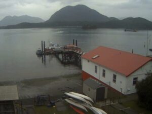

Whistler Olympic Plaza, Blackcomb Way, Whistler, BC, Canada
 4.8°C / 40.6°F
12:39
4.8°C / 40.6°F
12:39

East Beach, White Rock Promenade, White Rock, British Columbia, Canada
11°C / 51.8°F
12:39


Apex Mountain Resort, Strayhorse Road, Hedley, BC, Canada
0.4°C / 32.7°F
12:39
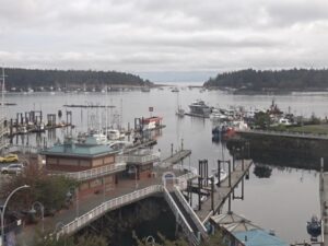
The Vancouver Harbour Webcam looks south from the slopes of North Vancouver across Burrard Inlet to Canada Place and the downtown skyline of Vancouver, British Columbia. Treetops fill the bottom of the frame, the North Vancouver waterfront with its industrial cranes sits just beyond them on the right, and the open water of the harbor runs across the middle. On the far shore, the white sail roofs of Canada Place mark the cruise terminal, and on a busy day one or more cruise ships lie alongside it with the office towers stacked behind. The camera is held on one steady, wide angle, which makes it a good place to watch weather move over the city and to spot ship traffic before it reaches the terminal. The stream can be rewound by up to 12 hours.
Vancouver Harbour is the stretch of Burrard Inlet between downtown Vancouver and the North Shore, and Canada Place is its best known landmark. The building opened as the Canada Pavilion for Expo 86 and hosted more than 5 million visitors before the fair closed on October 13, 1986. Its fabric roofs are shaped like sails, and the structure rises 81.5 meters (267 feet) over 23 floors.
Canada Place is the region’s main cruise ship passenger terminal and the port where cruises to Alaska begin. It was expanded in 2001 to add another cruise berth, and during the 2010 Winter Olympics it served as the Main Press Centre. The same complex holds the Vancouver Convention Centre East Building, the 503-room Pan Pacific Vancouver hotel, the Vancouver World Trade Centre and the FlyOver ride. Every day at noon, ten horns on the hotel roof, five facing north and five facing east, sound the first four notes of O Canada at 115 decibels across the water.
The camera belongs to Vancouver Port Live, which films the harbor from a North Vancouver vantage point. This is its wider, fixed camera. The operator runs a second, actively managed camera from the same area that pans and zooms on individual ship arrivals and departures, so this feed is the one to leave open for the whole scene.
Winters on the harbor are mild and wet. At Vancouver International Airport, January averages a high of 6.8 C (44 F) and a low of 1.4 C (35 F), and the city receives about 1,189 mm (46.8 inches) of precipitation a year. November, December and January are the wettest months at around 174 mm (6.9 inches) each, which on this camera means low cloud over the towers, rain streaking the far shore and days when the skyline all but disappears. Snow is occasional, averaging 36.6 cm (14.4 inches) and about seven snowy days a year.
Summers are dry and bright. July averages a high of 22.4 C (72 F) and a low of 13.9 C (57 F), and in July 2013 the airport recorded no rain for the entire month, a first in its records. On clear summer days the whole skyline sits sharp against the sky, and the operator notes that the wide angle is chosen to show weather developing over the city.
The SeaBus crosses the harbor in about 12 minutes between Waterfront Station downtown and Lonsdale Quay in North Vancouver. On the downtown side, the promenade around Canada Place gives close views of berthed cruise ships and the seaplane traffic that works the inlet, and the Vancouver Lookout at Harbour Centre puts an observation deck 168 meters (551 feet) above the street.
West of Canada Place, the Stanley Park Seawall runs for 9 kilometers (5.6 miles) around the park’s shoreline and is one of the city’s classic walks or bike rides. Back on the North Shore, Lonsdale Quay sits at the SeaBus terminal, and the mountains behind North Vancouver hold Grouse Mountain and Mount Seymour within a short drive.
More harbor and city views, from British Columbia and beyond.
Vancouver Harbour is the part of Burrard Inlet between downtown Vancouver and North Vancouver in British Columbia, Canada. Canada Place stands on the downtown shore, and Lonsdale Quay sits opposite on the North Shore.
The camera shows Burrard Inlet, Canada Place and its cruise berths, and the downtown skyline, with the North Vancouver waterfront and treetops in the foreground. Ship traffic and changing weather are the main events.
From a raised vantage point in North Vancouver looking south across the harbor, according to the operator, Vancouver Port Live.
Yes. The operator keeps up to 12 hours of the stream available, so you can drag the playback bar back to see an earlier arrival or a clearer part of the day.
Mild and wet in winter, with January highs near 6.8 C (44 F) and most rain between November and January, and dry and warm in summer, with July highs near 22.4 C (72 F).
Canada Place is the sail-roofed complex on the downtown waterfront that began as the Canada Pavilion at Expo 86. It is the main cruise ship terminal for the region and also holds a convention centre, the Pan Pacific hotel and the FlyOver attraction.
Ten heritage horns on the roof of the Pan Pacific hotel play the first four notes of O Canada every day at noon, loud enough at 115 decibels to carry across the harbor.
The SeaBus passenger ferry links Waterfront Station and Lonsdale Quay in about 12 minutes, and it is part of the regular TransLink transit network.
Source: Vancouver Port Live
The best new live webcams and site features, once a week.
By subscribing you agree to receive our weekly email. Unsubscribe any time.
 10.8°C / 51.4°F