
Live

 16:28:48
 12.1°C / 53.8°F
 Overcast Clouds
 94%
94% 13 km/h / 8 mph
 07:41
07:41 18:38
18:38Loading forecast…


East Beach, White Rock Promenade, White Rock, British Columbia, Canada
14°C / 57.2°F
16:28
Apex Mountain Resort, Strayhorse Road, Hedley, BC, Canada
5.4°C / 41.7°F
16:28

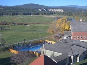
Cranbrook, East Kootenay, British Columbia, Canada
 12.8°C / 55°F
17:28
12.8°C / 55°F
17:28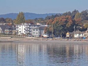

Revelstoke Railway Museum, Track Street West, Revelstoke, BC, Canada
 11.8°C / 53.2°F
16:28
11.8°C / 53.2°F
16:28

Whistler Olympic Plaza, Blackcomb Way, Whistler, BC, Canada
9.8°C / 49.6°F
16:28
The MacKenzie Beach Webcam looks down over the sheltered sandy bay at Crystal Cove Beach Resort, on the west coast of Vancouver Island at the southern edge of Clayoquot Sound. The frame takes in a garden of blue deck chairs, a screen of wind-shaped cedar and spruce, and then the beach itself, a kilometer-long (0.6 miles) curve of sand with rugged tidal rocks closing off the entrance to Crystal Cove. Water does most of the work in this view. At high tide the small islands offshore sit apart from the shore, and a few hours later the sand runs out to meet them and people walk across the flats. Rain, low cloud, bright summer afternoons and long Pacific swell all move through the same piece of coast.
MacKenzie Beach sits about 3 kilometers (1.9 miles) south of Tofino, the district municipality at the western terminus of Highway 4 on the tip of the Esowista Peninsula. Tofino recorded a population of 2,516 in the 2021 census, up 27.9 percent from 1,967 five years earlier, which is a steep rise for a town sitting 10 meters (33 feet) above sea level at the end of a single road. The beach faces into Clayoquot Sound, designated a UNESCO Biosphere Reserve in May 2000 after the environmental campaigns that ran through the 1980s and 1990s.
What separates this bay from the open Pacific strands further south is shelter. Tidal rocks form a gateway into Crystal Cove, and the islands standing just offshore break up the swell before it reaches the sand, so the water arrives with only a light ripple. That geometry is what the camera keeps showing: a beach that changes shape twice a day rather than a fixed line of surf. Crystal Cove Beach Resort, which runs the camera, holds the ground above the sand with 34 log cabins, 60 serviced RV sites and 10 glamping trailers set back among the trees.
Tofino has an oceanic climate with a narrow temperature band and a great deal of rain. August is the warmest month, averaging a high of 19.1 C (66 F) and a low of 10.8 C (51 F), with July just behind at 18.9 C (66 F) and 10.5 C (51 F). Winter does not fall far below that. January averages 8.3 C (47 F) by day and 2.3 C (36 F) at night, and December is almost identical at 8.1 C (47 F). Across the year the mean is 9.5 C (49 F), so the camera rarely shows snow on the sand.
Rain is the real variable. Tofino takes 3,270.7 millimeters (128.8 inches) a year, more than five times what Victoria records 203 kilometers (126 miles) away on the same island. November is the wettest month at 492.1 millimeters (19.4 inches) and January is close behind at 486.6 millimeters (19.2 inches), so winter frames are often grey water under low cloud. July is the dry month at 71.0 millimeters (2.8 inches). Sea fog can sit over the cove on late summer mornings and burn off by midday, and the clearest views typically come in July and August.
The beach itself carries most of the activity. At low tide the flats open a walking route out to the small islands that front the cove, and the rocky southern end is the part worth picking through for sand dollars and shells. Stand up paddleboarding and skimboarding both work in the sheltered water, and the resort office lends out frisbees and bocce sets for the sand. Tofino is a five minute drive north for the harbor, restaurants and galleries.
Pacific Rim National Park Reserve begins just down the highway. Established in 1970 and covering 511 square kilometers (197 square miles) across three separate units, its Long Beach Unit runs 212 square kilometers (82 square miles) along Highway 4 between Tofino and Ucluelet, taking in Long Beach, Combers Beach, Wickaninnish Beach and Florencia Bay. Further south the Broken Group Islands Unit scatters more than a hundred islands across Barkley Sound over 106 square kilometers (41 square miles), reached by sea kayak. The West Coast Trail, the third unit, runs 75 kilometers (47 miles) between Port Renfrew and Bamfield.
Three more cameras along the same stretch of Vancouver Island coast.
MacKenzie Beach is on the west coast of Vancouver Island in British Columbia, Canada, about 3 kilometers (1.9 miles) south of Tofino on the Esowista Peninsula at the southern edge of Clayoquot Sound.
The camera looks from Crystal Cove Beach Resort across its garden and down onto the sand, the tidal rocks at the mouth of Crystal Cove and the small islands lying offshore. Walkers, paddleboarders and the shifting tide line are usually the moving parts.
Mild and wet. August averages 19.1 C (66 F) by day, January 8.3 C (47 F), and the annual mean is 9.5 C (49 F). The town records 3,270.7 millimeters (128.8 inches) of rain a year, with November the wettest month.
About 3 kilometers (1.9 miles), roughly a five minute drive north along Highway 4.
At low tide, yes. The sand flats connect the beach to the small islands fronting the cove, and the route closes again as the tide returns.
Not really. Tidal rocks and the offshore islands shelter the bay and take the power out of the swell, which suits paddleboarding and families more than surfers. The open beaches in Pacific Rim National Park Reserve get the bigger waves.
July and August bring the driest and clearest conditions, with 71.0 millimeters (2.8 inches) of rain falling in July. Winter afternoons are darker and wetter but show the Pacific weather this coast is known for.
Beach walking, paddleboarding and tide pooling on the sand, then Pacific Rim National Park Reserve a short drive down Highway 4, where the Long Beach Unit covers 212 square kilometers (82 square miles) between Tofino and Ucluelet.
Source: Crystal Cove Beach Resort
The best new live webcams and site features, once a week.
By subscribing you agree to receive our weekly email. Unsubscribe any time.
 12.2°C / 54°F