Live

 14:46:08
 23.4°C / 74.1°F
 Scattered Clouds
 60%
60% 3 km/h / 2 mph
 07:27
07:27 18:45
18:45Loading forecast…



Whistler Olympic Plaza, Blackcomb Way, Whistler, BC, Canada
 16.8°C / 62.2°F
14:46
16.8°C / 62.2°F
14:46
Revelstoke Railway Museum, Track Street West, Revelstoke, BC, Canada
 12.8°C / 55°F
14:46
12.8°C / 55°F
14:46
East Beach, White Rock Promenade, White Rock, British Columbia, Canada
15.3°C / 59.5°F
14:46


Apex Mountain Resort, Strayhorse Road, Hedley, BC, Canada
 8.4°C / 47.1°F
14:46
8.4°C / 47.1°F
14:46


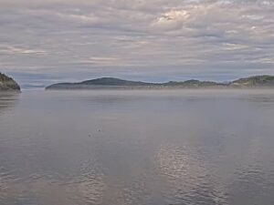
The Port Alberni Webcam looks out from Harbour Quay, the waterfront district of shops and cafes in Port Alberni on Vancouver Island, and down the long Alberni Inlet. A wooden pier deck with blue railings and a flagpole rigged like a ship’s mast fill the lower right of the frame. A lawn, a shoreline path and a few large trees run along the left, and forested hills close in on both sides of the water. Small boats can be seen motoring across the inlet, and people walk out onto the deck through the day. Morning sun lights the slope on the far shore, summer haze can soften the distant ridges, and after dark the picture narrows to the lights along the town shore and the lamps on the pier.
Port Alberni sits at the head of the Alberni Inlet, which at 54.3 kilometers (33.7 miles) is the longest inlet on Vancouver Island and reaches inland from Barkley Sound on the open Pacific. The city counted 18,259 residents at the 2021 census. It is named after Captain Don Pedro de Alberni, a Spanish officer who commanded Fort San Miguel at Nootka Sound from 1790 to 1792. Port Alberni was incorporated in 1912 and merged with the neighboring town of Alberni in 1967.
Harbour Quay groups shops, galleries and eateries around a clock tower on the city’s waterfront. The tower has been renovated and renamed the Wolf Tower, and it gives a wide view over the inlet. Close by stands the Maritime Discovery Centre, a museum of the area’s cultural, environmental and industrial maritime history built from an actual coastal lighthouse on the deep-sea harbour. The inlet also carried the 1964 tsunami into town: the water rose about 30 centimeters (1 foot) in a minute and peaked 3 meters (10 feet) above the high-water mark, damaging about 375 homes and washing away 55, with no injuries or deaths.
The Port Alberni Webcam is run by BigWaveDave.ca, a Vancouver Island wind and webcam site, and streams on its YouTube channel, Port Alberni Live Webcam. The site’s forum calls the quay a good sailing spot with warm water, and windsurfers launch from the boat ramp just left of the frame.
Summers are warm at the head of the inlet. July averages a high of 24.2 C (76 F) and a low of 10.6 C (51 F), and the city set its all-time record of 42.7 C (109 F) on June 28, 2021. On summer mornings the sun picks out the forested hillside across the water, and on hazy days the far ridges fade to grey outlines. Long evenings around the June solstice keep the inlet in daylight until late.
Winters are mild and wet. January averages 5.4 C (42 F) by day and 0.5 C (33 F) at night, and the city receives about 1,907 millimeters (75 inches) of precipitation a year, with snowfall averaging 80 centimeters (31.5 inches). After a snowfall the lawn and the pier deck can turn white, and through the rainy months cloud can hang low over the hills on both shores. After dark in any season, the camera picks up the shore lights on the left and the lamp posts on the pier, while the inlet itself goes black.
Start at the quay itself, with its cafes and shops, the Wolf Tower lookout and the Maritime Discovery Centre, whose lighthouse building holds changing summer exhibits. On Saturdays the Spirit Square Farmers Market runs from 9 a.m. to noon all year, selling locally grown produce and goods made by local artisans. Harbour Quay is also where passengers board the MV Frances Barkley, a passenger and freight vessel that sails down the inlet to Bamfield on the west coast. Windsurfers and other sailors rig at the boat ramp beside the quay when the wind fills in.
The Alberni Pacific Railway, a heritage line founded in 1984, runs steam excursions behind locomotive No. 7, a 1929 Baldwin 2-8-2ST, from the 1912 CPR station on a 40-minute ride through the city and into the forest to the McLean Mill National Historic Site. Check the railway’s schedule before you plan a ride. Further out, Sproat Lake was the base of the Martin Mars water bombers, and Mount Arrowsmith rises above the Alberni Valley.
More harbors and beaches along the coast of Vancouver Island:
Port Alberni is a city of 18,259 people in British Columbia, Canada, on Vancouver Island. It lies in the Alberni Valley at the head of the Alberni Inlet, which runs 54.3 kilometers (33.7 miles) inland from Barkley Sound. Harbour Quay, where the camera stands, is on the city’s waterfront.
The camera looks over Harbour Quay and down the Alberni Inlet. In the foreground are a wooden pier deck with blue railings, two tall wooden carvings, a ship’s mast flagpole and a red post topped by an eagle sculpture. A lawn and shoreline path run along the left, with piers on the town shore beyond, and forested hills rise on both sides of the water.
Summers are warm, with July highs around 24.2 C (76 F), and winters are mild and wet, with January averaging 5.4 C (42 F) by day and 0.5 C (33 F) at night. The city gets about 1,907 millimeters (75 inches) of precipitation and 80 centimeters (31.5 inches) of snow in an average year.
The camera belongs to BigWaveDave.ca, a Vancouver Island wind and webcam site, and its caption at the bottom of the picture carries the date, the time and the bigwavedave.ca address. It streams on the YouTube channel Port Alberni Live Webcam, which links back to the site’s Port Alberni page.
Yes. The BigWaveDave.ca forum lists the boat ramp to the left of the camera as the launch, describes warm water and a good rigging area, and notes that sailors can reach the jetty in view, though most sailing happens to the right and often out of shot. Its tip is to look for a good temperature difference between Bamfield and Port Alberni and to check the Harbour Quay wind readings.
The Alberni Inlet is 54.3 kilometers (33.7 miles) long at its greatest extent, running from Barkley Sound on the Pacific to Port Alberni. It is the longest inlet on Vancouver Island.
Yes. In 1964 the water in Port Alberni rose about 30 centimeters (1 foot) in a minute and reached 3 meters (10 feet) above the high-water mark. About 375 homes were damaged and 55 were washed away, but no one was injured or killed.
Source: BigWaveDave.ca
The best new live webcams and site features, once a week.
By subscribing you agree to receive our weekly email. Unsubscribe any time.