Live

 19:38:46
 9.5°C / 49.1°F
 Few Clouds
 80%
80% 10 km/h / 6 mph
 06:24
06:24 17:42
17:42Loading forecast…

Istanbul Airport (IST), Terminal Caddesi, Arnavutköy/İstanbul, Türkiye
 20.3°C / 68.5°F
19:38
20.3°C / 68.5°F
19:38



Jimbaran Beach, Jimbaran, Badung Regency, Bali, Indonesia
19.3°C / 66.7°F
00:38
Rice field, Jalan Pakudui, Kedisan, Tegallalang, Gianyar Regency, Bali, Indonesia
 20.8°C / 69.4°F
00:38
20.8°C / 69.4°F
00:38
Lotus Pond, Zuoying District, Kaohsiung City, Taiwan
26.9°C / 80.4°F
00:38

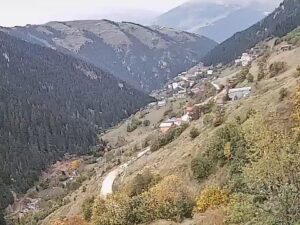
The Golyayla Plateau Webcam looks out over a summer settlement high above the village of Golyayla, in the Ikizdere district of Rize in northeastern Turkey. It is a moving camera that swings between views of the settlement: a gray hut with a red corrugated roof and a low stone wall close to the lens, a dirt track running past wooden houses, a white minaret in the middle distance, and bare grassy slopes rising on both sides toward a valley of layered ridges. In October the grass has turned brown and gold, and cloud often sits on the higher tops. In spring the same scene can still be buried in snow. The plateau lies at about 2,370 meters (7,776 feet), so the light, the snowline and the weather can change within an hour.
The camera stands in the upper settlement that maps label Gol Yaylasi, about 4.7 kilometers (2.9 miles) southeast of Golyayla village and some 1,800 meters (5,900 feet) higher than Ikizdere town. Golyayla was founded in the 1800s under the Greek name Kabaxor and took its present name, roughly “lake plateau”, in 1913. The older name survives as Kabahor, which appears in every one of the project’s stream titles. The village had 151 registered residents in 2020, against 258 in 1985, and lies 24 kilometers (15 miles) from Ikizdere and 76 kilometers (47 miles) from the city of Rize on the Black Sea coast.
It is a remote place, but a well-wired one. The village camera project behind the stream runs 47 active cameras across Golyayla and its pastures, Tiandy and Hikvision units tied together by Ubiquiti radio links over distances of up to about 5.5 kilometers (3.4 miles), with VDSL lines and a 4G backup carrying the feeds. Six Raspberry Pi boards push the pictures to YouTube, and the project puts its traffic at about 30 terabytes a month. After YouTube limited each channel to 10 live streams, the cameras were split across several channels. The Golyayla Plateau Webcam is camera 2, named Yayla Hareketli, which translates as “plateau, moving”.
Because the camera pans, the frame shifts between close views of the huts and wider looks down the valley, where ridge after ridge fades into blue haze. The white minaret belongs to the settlement’s mosque, where the project has mounted three more cameras facing east, north and west. A small date and clock stamp and a GOLYAYLA.NET caption sit in the lower left of the picture. The clock runs on Turkey time, three hours ahead of UTC.
Ten years of modeled weather data for the plateau, 2016 to 2025, describe a long, hard winter. From December to February, daytime highs average -2.5 to -5 C (23 to 28 F), and nights fall to around -10 to -12 C (10 to 14 F). Average highs stay below freezing through March, and snow lingers well into spring: on May 8, 2026 the Golyayla Plateau Webcam showed the settlement deep in snow, with a thick cap on the hut roof and white peaks behind the minaret. April highs average only 4 C (40 F) and May highs under 9 C (47 F), with nights still close to freezing.
Summer is short and cool. July averages highs of 16 C (61 F) and August 18 C (64 F), with nights of 7 to 9 C (45 to 48 F), and June to September are the only months when the average night stays above freezing. By October highs are back to about 8 C (47 F) and nights dip just below zero, which is why the grass on camera turns brown and gold in autumn. Rain or snow falls in every month, roughly 80 to 135 millimeters (3.1 to 5.3 inches), with June the wettest in the record, so low cloud can hide the ridges for hours at a time.
Open, treeless ground surrounds the settlement, and the map shows small lakes close by: Selin Golu about 550 meters (0.3 miles) to the north and Pisik Golu about 1.5 kilometers (0.9 miles) to the south. Golyayla Dagi rises to 3,162 meters (10,374 feet) about 4 kilometers (2.5 miles) to the southeast, with Karagol, Yesil Gol and Tufanin Golu on its flanks, and Palavit Dagi, 3,154 meters (10,348 feet), stands about 3 kilometers (1.9 miles) to the east. In winter the village has held the Kabahor Snow Festival, where people ski on the lazboard, a traditional wooden board, on snowfields at around 2,300 meters (7,546 feet).
Elsewhere in the district, Anzer is Ikizdere’s most famous plateau. It sits at 2,200 meters (7,218 feet), 35 kilometers (22 miles) from Ikizdere town, and its honey, made from a highland flora of about 300 flowers, 40 of them endemic, carries a Turkish geographical indication. The main road through the district climbs to the Ovit Pass, where the Ovit Tunnel opened on February 13, 2018 as the second longest road tunnel in Turkey, on the route linking Rize with Erzurum. Lower down, tea plantations cover the slopes around Ikizdere town, which sits at 570 meters (1,870 feet).
More mountain villages and Black Sea views from Turkey:
The plateau is in the Ikizdere district of Rize province, in Turkey’s eastern Black Sea region. The settlement on camera, mapped as Gol Yaylasi, lies about 4.7 kilometers (2.9 miles) southeast of Golyayla village, which is 24 kilometers (15 miles) from Ikizdere and 76 kilometers (47 miles) from Rize.
A hut with a red roof and a stone wall in the foreground, wooden houses along a dirt track, the white minaret of the mosque, and grassy slopes opening onto a valley of distant ridges. The view changes as the camera pans.
About 2,370 meters (7,776 feet) above sea level, roughly 1,800 meters (5,900 feet) above Ikizdere town.
Cold for most of the year. Winter highs average -2.5 to -5 C (23 to 28 F), summer highs reach only 16 to 18 C (61 to 64 F), and rain or snow falls in every month.
Average highs stay below freezing from December to March, and the snow lasts well into spring. On May 8, 2026 the camera still showed the settlement buried in snow.
The village camera project counts 47 active cameras, 36 of them on its public live list, covering the village, its hamlets and the plateau. This is camera 2 on that list.
The village was founded in the 1800s as Kabaxor, a Greek name, and became Golyayla in 1913. The old name lives on as Kabahor in the stream titles and the village snow festival.
Source: Golyayla.net
The best new live webcams and site features, once a week.
By subscribing you agree to receive our weekly email. Unsubscribe any time.
 10.7°C / 51.3°F
 15.5°C / 59.9°F