
Live

 07:33:34
 17.1°C / 62.8°F
 Clear Sky
 59%
 17 km/h / 11 mph
 07:46
 18:07
Loading forecast…

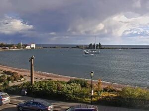


Dog Day Getaway, Felton Court, Apple Valley, Minnesota, USA
15.6°C / 60.1°F
07:33

Hyland Hills Ski Area, Chalet Road, Bloomington, Minnesota, USA
16.4°C / 61.5°F
07:33

Harry Reid International Airport, Paradise, Nevada, USA
 16°C / 60.8°F
05:33
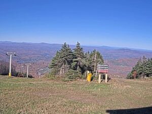

Cedar Point Amusement Park, Cedar Point Drive, Sandusky, Ohio, USA
 10.6°C / 51.1°F
08:33



Hounsfield, Jefferson County, New York, USA
 1.7°C / 35.1°F
08:33


Fallingwater, Mill Run Road, Mill Run, Pennsylvania, USA
4.3°C / 39.7°F
08:33The International Falls Webcam looks out from the sand beach at Camp Idlewood Resort, on the Minnesota shore of Rainy Lake about 10 kilometers (6 miles) east of International Falls. Two tall pine trunks frame the shot. Between them, a wide bay opens toward a small wooded island and a low, tree-lined far shore, with the resort’s wooden docks reaching out on both sides and small fishing boats tied up on the right. On summer days, bright pedal boats sit on the sand and the water often turns deep blue under clear skies. By mid-October the docks are quiet and the hardwoods on the far shore turn orange and gold among the dark pines. Winter changes the scene completely, because the lake freezes and the bay becomes a flat white plain.
The camera is not in town. Camp Idlewood is a small family resort at 3033 County Road 20, with nine cabins, a sand beach, a sauna, and boats and motors for rent. Its beach faces a bay toward the western end of Rainy Lake. The Rainy River leaves the lake’s west side and runs past International Falls and Fort Frances, Ontario, which face each other across the river and are joined by an international bridge.
Rainy Lake covers 932 square kilometers (360 square miles) and stretches 80 kilometers (50 miles) along the border between Minnesota and Ontario. It holds more than 2,500 islands, and its rocky shoreline runs about 1,500 kilometers (930 miles) before the islands are counted. The surface sits at 338 meters (1,109 feet). Walleye, northern pike, smallmouth bass and crappie draw anglers to the lake, and its southeastern corner lies inside Voyageurs National Park.
International Falls itself had 5,802 residents at the 2020 census and sits 345 meters (1,132 feet) above sea level. The town has promoted itself as the “Icebox of the Nation” since 1948. Fraser, Colorado, claimed the same slogan, and after a long dispute the U.S. Patent and Trademark Office registered it to International Falls on January 29, 2008. Paper built the town: industrialist E.W. Backus dammed the Rainy River in the early 1900s to power his mills, and Boise Cascade bought the mill in 1965.
Winters here are long and hard. January averages a high of -9 C (16 F) and a low of -21 C (-6 F), and the town’s record low is -48 C (-55 F), set on January 6, 1909. About 185 centimeters (73 inches) of snow falls in an average year. On camera, the bay turns into a sheet of ice and snow, the far shore becomes a dark line of conifers, and the beach disappears under drifts.
Spring arrives late. April highs average 10 C (50 F), with lows of -3 C (26 F), so the lake can look wintry long after the calendar says otherwise. July brings highs of 25 C (78 F) and lows of 11 C (52 F), the season when the pedal boats and rental boats come out and the docks fill up. October cools to highs of 11 C (51 F) and lows of -1 C (31 F), and the far shore shows its autumn color on camera through the middle of the month. These figures are NOAA’s 1991 to 2020 normals for International Falls.
Voyageurs National Park is the big draw. Its Rainy Lake Visitor Center sits farther east along the shore, and in winter the National Park Service maintains an ice road on the frozen lake. At the resort, canoes, kayaks and rental boats with motors put the bay and its islands within reach, and the beach is right in front of the cabins.
In town, Smokey Bear Park is built around a statue of Smokey about 8 meters (26 feet) tall. The Koochiching County Historical Museum in the park covers some 10,000 years of borderland history, and the Bronko Nagurski Museum beside it honors the NFL star who is the town’s most famous resident. Across the Fort Frances-International Falls International Bridge, Fort Frances, Ontario, makes a short cross-border outing. For travelers flying in, Falls International Airport has Delta Air Lines flights to Minneapolis-Saint Paul.
More northern lakes and Minnesota water to watch:
The camera stands on the beach at Camp Idlewood Resort, 3033 County Road 20, on the Minnesota shore of Rainy Lake. That is about 10 kilometers (6 miles) east of downtown International Falls in Koochiching County, on a lake shared with Ontario, Canada.
A bay of Rainy Lake framed by two pine trunks, with a sand beach in the foreground, the resort’s docks and boat slips on both sides, a small wooded island in the middle distance and a tree-lined far shore. Open water runs to the horizon on the left. The camera is fixed, so the view stays the same while the light, the boats and the seasons change.
No. Downtown, the Rainy River and the bridge to Fort Frances are all about 10 kilometers (6 miles) west of the camera and out of sight. This view is of the open lake east of town, not the river.
Cold for much of the year. January averages -9 C (16 F) by day and -21 C (-6 F) at night, while July reaches about 25 C (78 F) with nights near 11 C (52 F). April and October are close to each other, with highs around 10 to 11 C (50 to 51 F). Snowfall averages 185 centimeters (73 inches) a year.
The cold earns it: January lows average -21 C (-6 F), and the record is -48 C (-55 F). The town has used the slogan since 1948, Fraser, Colorado, contested it for years, and in 2008 the U.S. Patent and Trademark Office registered the trademark to International Falls.
No. International Falls is in Minnesota, in the United States. Fort Frances, Ontario, sits directly across the Rainy River, and the two towns are linked by an international bridge with a border crossing.
Yes. The lake freezes over in winter, and the National Park Service maintains an ice road on it in Voyageurs National Park. On this camera the bay turns white and the beach disappears under snow until the thaw.
Source: Camp Idlewood Live Cam
The best new live webcams and site features, once a week.
By subscribing you agree to receive our weekly email. Unsubscribe any time.
 17.3°C / 63.1°F